Gneisenaustraße is a station on the U7 U-Bahn in Berlin, Germany. The station was opened in 1924 and created by Alfred Grenander. 1945 it was closed for a few months, 1967/68 the platform was elongated. Due to this the station has lost its appearance as it was when Grenander has planned it.
Outtrim was the terminus station on the Outtrim railway line. It closed in 1951 along with Outtrim North. The first sod of soil turned in the construction of the Outtrim railway line was on 6 March 1885. The line was completed by 1896.
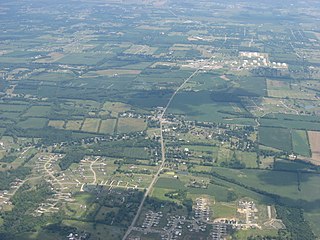
Red Lion is an unincorporated community in southwestern Clearcreek Township, Warren County, Ohio, United States, at the intersection of State Routes 741, 122, and 123. Red Lion is approximately five miles south of Springboro and five miles northwest of Lebanon.
Coppenaxfort is a hamlet in the Nord department in northern France. It is located on the territory of three communes : Brouckerque, Craywick and Bourbourg.
Movses ; also known as Mosesgegh, is a village in the Tavush Province of Armenia.
Gołąb-Kolonia is a village in the administrative district of Gmina Michów, within Lubartów County, Lublin Voivodeship, in eastern Poland.

Ożary Wielkie is a village in the administrative district of Gmina Rutki, within Zambrów County, Podlaskie Voivodeship, in north-eastern Poland. It lies approximately 23 kilometres (14 mi) north-east of Zambrów and 46 km (29 mi) west of the regional capital Białystok.
Brodne-Józefów is a village in the administrative district of Gmina Kiernozia, within Łowicz County, Łódź Voivodeship, in central Poland. It lies approximately 5 kilometres (3 mi) east of Kiernozia, 19 km (12 mi) north of Łowicz, and 62 km (39 mi) north-east of the regional capital Łódź.

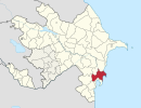
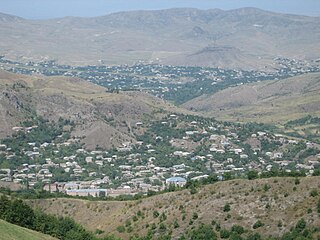
Chalagan-Gyuney is a village in the Lachin Rayon of Azerbaijan. The Battle of Chalagan was fought here in 1412.
Aleksandrów is a village in the administrative district of Gmina Kamieńsk, within Radomsko County, Łódź Voivodeship, in central Poland. It lies approximately 4 km (2 mi) north of Kamieńsk, 19 km (12 mi) north of Radomsko, and 62 km (39 mi) south of the regional capital Łódź.
Smeaton, Saskatchewan is the village at the start of the Hanson Lake Road, which ends at Creighton.
Wólka Wybraniecka is a village in the administrative district of Gmina Stanisławów, within Mińsk County, Masovian Voivodeship, in east-central Poland.
Zaorze is a village in the administrative district of Gmina Goworowo, within Ostrołęka County, Masovian Voivodeship, in east-central Poland. It lies approximately 7 kilometres (4 mi) south-west of Goworowo, 25 km (16 mi) south of Ostrołęka, and 78 km (48 mi) north-east of Warsaw.
Vecpils parish is an administrative unit of the Durbe Municipality, Latvia. The parish has a population of 529 and covers an area of 80.2 km2.

Bloomer is a former settlement in Butte County, California, United States. It was located 5.5 miles (8.9 km) north-northwest from Bidwell's Bar on the Western Pacific Railroad, at an elevation of 902 feet, and was inundated by Lake Oroville.
Ouled Chamekh is a town and commune in the Mahdia Governorate, Tunisia. As of 2004 it had a population of 5,093.

Špionica Donja is a village in Bosnia and Herzegovina. According to the 1991 census, the village is located in the municipality of Srebrenik.
Troitsky Administrative Okrug is one of the twelve administrative okrugs of Moscow. The okrug was founded on July 1, 2012.
Reading is an extinct town in Pike County, in the U.S. state of Missouri. The GNIS classifies it as a populated place.

Landersdale is an unincorporated community in Madison Township, Morgan County, in the U.S. state of Indiana.