Qazaxbərəsi

Last updated

Qazaxbərəsi is a village in the municipality of Qaçaqkənd in the Neftchala Rayon of Azerbaijan. [1]

Qaçaqkənd Municipality in Neftchala, Azerbaijan

Qaçaqkənd is a village and municipality in the Neftchala Rayon of Azerbaijan. It has a population of 2,110. The municipality consists of the villages of Qaçaqkənd, Qazaxbərəsi, Ramazanlı, and Xanməmmədli.

Azerbaijan Country in the South Caucasus

Azerbaijan, officially the Republic of Azerbaijan, is a country in the South Caucasus region of Eurasia at the crossroads of Eastern Europe and Western Asia. It is bounded by the Caspian Sea to the east, Russia to the north, Georgia to the northwest, Armenia to the west and Iran to the south. The exclave of Nakhchivan is bounded by Armenia to the north and east, Iran to the south and west, and has an 11 km long border with Turkey in the northwest.

Related Research Articles

Abbasbeyli Place in Saatly, Azerbaijan

Abbasbeyli is a village in the Saatly Rayon of Azerbaijan.

Çinarlar Place in Davachi, Azerbaijan

Çinarlar is a village in the Davachi Rayon of Azerbaijan. The village forms part of the municipality of Düz Bilici.

Güyüm Place in Ismailli, Azerbaijan

Güyüm is a village in the Ismailli Rayon of Azerbaijan. The village forms part of the municipality of Diyallı.

Qərsələ Place in Ismailli, Azerbaijan

Qərsələ is a village in the Ismailli Rayon of Azerbaijan. The village forms part of the municipality of Birinci Yeniyol.

Tusova Place in Lerik, Azerbaijan

Tusova is a village in the Lerik Rayon of Azerbaijan.

Kolanı, Salyan Place in Salyan, Azerbaijan

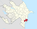
Kolanı is a village in the Salyan Rayon of Azerbaijan. The village forms part of the municipality of Qarabağlı.

Şıxhapıt Place in Khachmaz, Azerbaijan

Şıxhapıt is a village in the Khachmaz Rayon of Azerbaijan. The village forms part of the municipality of Qaraçaycek.

Novaya Teklya Place in Jalilabad, Azerbaijan

Novaya Teklya is a village in the Jalilabad Rayon of Azerbaijan.

Kazakhbarasi Place in Jalilabad, Azerbaijan

Kazakhbarasi is a village in the Jalilabad Rayon of Azerbaijan.

Khush Place in Lerik, Azerbaijan

Khush is a village in the Lerik Rayon of Azerbaijan.

Soruşçay is a village in the municipality of Nüravud in the Lerik Rayon of Azerbaijan.

Sərinbulaq is a village in the municipality of Xanbulan in the Lankaran Rayon of Azerbaijan.

Mikolan is a village in the municipality of Yuxarı Nüvədi in the Lankaran Rayon of Azerbaijan.

Talışlı is a village in the municipality of Haftoni in the Lankaran Rayon of Azerbaijan.

Ballabur is a village in the municipality of Şağlakücə in the Lankaran Rayon of Azerbaijan.

Sədiyan is a village in the municipality of Diyallı in the Ismailli Rayon of Azerbaijan.

Giləşə is a village in the municipality of Siyaku in the Astara Rayon of Azerbaijan.

Siyakeş is a village in the municipality of Şağlazüzə in the Astara Rayon of Azerbaijan.

Həsin is a village in the municipality of Şağlazüzə in the Astara Rayon of Azerbaijan.

Vəznəş is a village in the municipality of Siyətük in the Astara Rayon of Azerbaijan.

References

  1. "Belediyye Informasiya Sistemi" (in Azerbaijani). Archived from the original on September 24, 2008.

Coordinates: 39°22′N48°47′E / 39.367°N 48.783°E / 39.367; 48.783

Geographic coordinate system Coordinate system

A geographic coordinate system is a coordinate system that enables every location on Earth to be specified by a set of numbers, letters or symbols. The coordinates are often chosen such that one of the numbers represents a vertical position and two or three of the numbers represent a horizontal position; alternatively, a geographic position may be expressed in a combined three-dimensional Cartesian vector. A common choice of coordinates is latitude, longitude and elevation. To specify a location on a plane requires a map projection.