
U.S. Route 160 (US 160) is a 1,465-mile-long (2,358 km) east–west United States Numbered Highway in the Midwestern and Western United States. The western terminus of the route is at US 89 five miles (8.0 km) west of Tuba City, Arizona. The eastern terminus is at US 67 and Missouri 158 southwest of Poplar Bluff, Missouri. Its route, if not its number, was made famous in song in 1975, as the road from Wolf Creek Pass to Pagosa Springs, Colorado in C.W. McCall's country music song "Wolf Creek Pass".

U.S. Route 54 is an east–west United States Highway that runs northeast–southwest for 1,197 miles (1,926 km) from El Paso, Texas, to Griggsville, Illinois. The Union Pacific Railroad's Tucumcari Line runs parallel to US 54 from El Paso to Pratt, Kansas, which comprises about two-thirds of the route.

Route 14 is a state highway traveling through the southern part of the U.S. state of Missouri. Its western terminus is at U.S. Route 60 (US 60) in Marionville, and its eastern terminus is at US 63 on the northern edge of West Plains. Route 14 is a two-lane highway for its entire length, however, there are plans to widen Route 14 in some spots.

Missouri Route 5 is the longest state highway in Missouri and the only Missouri state highway to traverse the entire state. To the north, it continues into Iowa as Iowa Highway 5 and to the south it enters Arkansas as Arkansas Highway 5 as part of a three state 650 mile highway 5. With only a few exceptions, it is mostly a two-lane for its entire length.
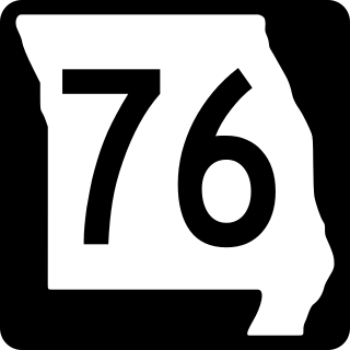
Route 76 is a highway in the west half of southern Missouri running between U.S. Route 60 and U.S. Route 63 at Willow Springs and the Oklahoma state line near Tiff City where it continues as a county road. It bypasses Branson on the Ozark Mountain High Road and is the namesake of the Branson strip, 76 Country Blvd. The road runs for its entirety through the Missouri Ozarks, and is at times very hilly and curvy.

Route 95 is a highway in southern Missouri. Its northern terminus is at Route 32 at Lynchburg in Laclede County. Its southern terminus is at U.S. Route 160 at Lutie about 2.5 miles west of the Theodosia arm of Bull Shoals Lake in Ozark County.

Route 99 is a short highway in southern Missouri. Its northern terminus is at U.S. Route 60 just north of Birch Tree in Shannon County; its southern terminus is at U.S. Route 160 south of Thomasville in Oregon County 18.3 miles (29.5 km) to the SSE. It crosses the Eleven Point River at Thomasville. Just south of Thomasville Route 99 provides access to the west end of the Eleven Point Wild and Scenic River portion of the Mark Twain National Forest.

Zanoni is an unincorporated community located in Ozark County, Missouri, United States on Route 181, approximately ten miles northeast of Gainesville. A watermill and a post office are all that remain of the community. The community was founded in 1898 and was named for the novel Zanoni by Edward Bulwer-Lytton. The mill was built in 1905 as an overshot wheel mill by "Doc" Morrison and restored by his grandson.
Thornfield is an unincorporated community in Ozark County, Missouri, United States. It is located 15 miles (24 km) northwest of Gainesville, on Route 95 at the Little North Fork of the White River on the edge of the Mark Twain National Forest between Wasola to the northeast and Longrun to the southwest. Hammond, the site of the historic Hammond Mill, lies on the Little North Fork 2.5 miles (4.0 km) southeast of Thornfield. Thornfield has a post office with ZIP code 65762.

Sycamore is an unincorporated community in eastern Ozark County in the Ozarks of southern Missouri, United States. It is located on Route 181, approximately fourteen miles northeast of Gainesville. The old townsite is located on a ridge on the west side of Bryant Creek, a major tributary of the North Fork River. The old Hodgson Mill and spring lie on Bryant Creek 0.8 mi (1.3 km) to the northeast. The mill was nominated to the National Register of Historic Places as Aid-Hodgson Mill in 2001.

Hammond is an unincorporated community in Ozark County, Missouri, United States. It is located at the intersection of two county roads on the Little North Fork of the White River, approximately twelve miles northwest of Gainesville and 2.5 miles (4.0 km) southeast of Thornfield.

Brixey is a former unincorporated community in northern Ozark County, Missouri, United States. It is located 1.6 miles (2.6 km) south of Route 95 on Route N or approximately 10 miles (16 km) north of Gainesville. The store and post office, along with houses along the main road, have been vacant and boarded up for several years as of 2023; there may still be a home or two within the community limits on the back roads, as the Brixeyj name and zip code is still in use for mailings.

The North Fork River or the North Fork of White River is a 109-mile-long (175 km) tributary of the White River, into which it flows near Norfork, Arkansas.

The Big Piney River is a 110-mile-long (180 km) tributary of the Gasconade River in south central Missouri in the United States. Via the Gasconade and Missouri rivers, it is part of the Mississippi River basin.
Barren Fork is a stream in Ozark County, Missouri. It is a tributary of the Little North Fork White River. The headwaters of the stream are along the west side of the Caney Mountain Conservation Area north of Gainesville. The stream flows west past Willhoit and under Missouri Route 5 continuing into the Mark Twain National Forest south of Nottinghill to its confluence with the Little North Fork White River north of Isabella. The confluence is within the waters of Bull Shoals Lake and the normal lake level is at 695 feet.

U.S. Route 63 is the portion of a north-south highway that runs through the U.S. state of Missouri from the Arkansas state line near Thayer to the Iowa state line near Lancaster.

Spring Creek is a stream in Douglas and Howell counties in the Ozarks of southern Missouri.

Indian Creek is a stream in northeastern Douglas County and northwestern Howell County in the Ozarks of southern Missouri. It is a tributary of the North Fork River.
Beaver Creek is a stream in southwestern Texas and eastern Wright counties in the Ozarks of southern Missouri. It is a tributary of the Gasconade River.

U.S. Route 60 (US 60) is a part of the United States Numbered Highway System that runs from Brenda, Arizona, east to Virginia Beach, Virginia. In the state of Missouri, US 60 is a main east–west highway that runs through the southern part of the state, from the Oklahoma border to the Illinois border.

