
U.S. Route 160 (US 160) is a 1,465-mile-long (2,358 km) east–west United States Numbered Highway in the Midwestern and Western United States. The western terminus of the route is at US 89 five miles (8.0 km) west of Tuba City, Arizona. The eastern terminus is at US 67 and Missouri 158 southwest of Poplar Bluff, Missouri. Its route, if not its number, was made famous in song in 1975, as the road from Wolf Creek Pass to Pagosa Springs, Colorado in C.W. McCall's country music song "Wolf Creek Pass".

U.S. Route 65 is a north–south United States highway in the southern and midwestern United States. The southern terminus of the route is at U.S. Route 425 in Clayton, Louisiana. The northern terminus is at Interstate 35 just south of Interstate 90 in Albert Lea, Minnesota. Parts of its modern route in Iowa and historic route in Minnesota follow the old Jefferson Highway.

Route 14 is a state highway traveling through the southern part of the U.S. state of Missouri. Its western terminus is at U.S. Route 60 (US 60) in Marionville, and its eastern terminus is at US 63 on the northern edge of West Plains. Route 14 is a two-lane highway for its entire length, however, there are plans to widen Route 14 in some spots.

Missouri Route 5 is the longest state highway in Missouri and the only Missouri state highway to traverse the entire state. To the north, it continues into Iowa as Iowa Highway 5 and to the south it enters Arkansas as Arkansas Highway 5 as part of a three state 650 mile highway 5. With only a few exceptions, it is mostly a two-lane for its entire length.

Route 13 is a highway in Missouri which runs almost the entire north–south length of the state. Its northern terminus is at U.S. Route 69/136 in Bethany. Its southern terminus is at the Arkansas state line in downtown Blue Eye, Missouri–Arkansas where it continues as Highway 21. It is one of the original state highways of Missouri.

Route 413 is a highway in Missouri running between Route 13 in Springfield and Route 13 in Reeds Spring. It is an older alignment of Route 13 which was later rerouted. Except for two sections, the road runs concurrent with other designations for its entire length.

Route 86 is a highway in southwest Missouri. The eastern terminus is at U.S. Route 65 just north of Ridgedale. From there, the road crosses the Long Creek arm of Table Rock Lake and continues to Blue Eye west between the Arkansas state line on the south and Table Rock Lake on the north. This section is also in the Mark Twain National Forest, and is recommended as a scenic drive by the Missouri Department of Transportation. From Eagle Rock the road turns north to join with Route 76 at Bates Corner with which it is runs concurrent through Cassville to just east of Rocky Comfort. The road continues north and west towards Neosho, then goes further west before turning north towards Joplin where the road ends at the interchange of Interstate 44 and Route 43. Except for a short section in Neosho, the road is a two-lane highway for its entire length.
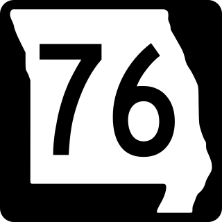
Route 76 is a highway in the west half of southern Missouri running between U.S. Route 60 and U.S. Route 63 at Willow Springs and the Oklahoma state line near Tiff City where it continues as a county road. It bypasses Branson on the Ozark Mountain High Road and is the namesake of the Branson strip, 76 Country Blvd. The road runs for its entirety through the Missouri Ozarks, and is at times very hilly and curvy.

Route 7 is a state highway with its northern terminus at U.S. Route 24 in northeast Independence and its southern terminus at Interstate 44 southeast of Richland. The section between Harrisonville and Clinton provides an important link for traffic between Springfield and Kansas City.

Route 39 is a two-lane highway in southwestern Missouri. Its northern terminus is at U.S. Route 54 between Collins and El Dorado Springs at the community of Cedar Springs; its southern terminus is at the Arkansas state line where it continues as Highway 221.
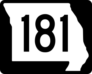
Route 181 is a highway in southern Missouri. Its southern terminus is at US 160 in Gainesville in Ozark County. It passes through eastern Douglas County and reaches its northern terminus at Business U.S. Route 60 in Cabool in Texas County.
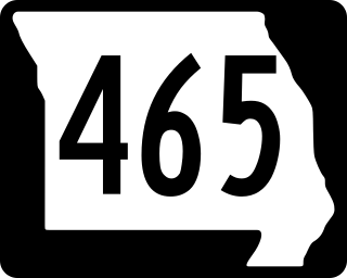
Route 465 was a short highway in southern Missouri. It followed Ozark Mountain Highroad northwest of Branson. The southern terminus was at Route 76, while the northern terminus was at U.S. Route 65 north of Branson. There were plans to eventually reconnect the route to US 65.

Route 37 is a highway in southwest Missouri. Its northern terminus is at U.S. Route 160 in Golden City ; its southern terminus is at the Arkansas state line where it continues as Highway 37, though it only runs very briefly before ending at U.S. Route 62 in Gateway, Arkansas.

Route 176 is a highway in southwestern Missouri. The eastern terminus is at U.S. Route 160 north of Forsyth; its western terminus is at Route 248/Route 265/Route 413 in Galena.

Route 165 and County Road 165 (CR 165) form a loop around the west side of Branson, Missouri, in Taney and Stone counties. The highway's southern terminus is at U.S. Route 65 (US 65) south of Branson, in Hollister. Even though the county road designation belongs to Taney County, it briefly enters Stone County at Table Rock State Park. Upon re-entering Taney County, it crosses the Table Rock Lake Dam, along with Route 265, at Table Rock Lake. Its northern terminus is at US 65 along the Red Route in north Branson.

Interstate 44 (I-44) in the US state of Missouri runs northeast from the Oklahoma state line near Joplin to I-70 in Downtown St. Louis. It runs for about 293 miles (472 km) in the state, and is the longest Interstate Highway in the state.
James River Freeway is a 14-mile-long (23 km) freeway located largely on the south side of Springfield, Missouri. Its western terminus is at Interstate 44 (I-44) north of Brookline and its eastern terminus is at U.S. Route 65 (US 65) in southeastern Springfield. It is named for the James River, which passes near the highway at the freeway's eastern terminus. A total of four highways are routed on the highway: Route 360, US 60, US 160, Route 13, and Business US 65.
U.S. Route 65 is a north–south U.S. highway that runs from Clayton, Louisiana to Albert Lea, Minnesota. In Missouri, the highway enters the state from Arkansas, just south of Branson. The highway exits the state into Iowa near South Lineville.
A total of eight special routes of U.S. Route 65 exist, divided between the U.S. states of Arkansas and Missouri. Currently, they are all business loops, although a spur route in Pine Bluff, Arkansas and bypass routes in Baton Rouge, Louisiana and Springfield, Missouri both existed in the past.

U.S. Route 60 (US 60) is a part of the United States Numbered Highway System that runs from Brenda, Arizona, east to Virginia Beach, Virginia. In the state of Missouri, US 60 is a main east–west highway that runs through the southern part of the state, from the Oklahoma border to the Illinois border.

