
The Alaska Range is a relatively narrow, 600-mile-long (950 km) mountain range in the southcentral region of the U.S. state of Alaska, from Lake Clark at its southwest end to the White River in Canada's Yukon Territory in the southeast. Denali, the highest mountain in North America, is in the Alaska Range. The range is part of the American Cordillera.
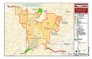
The Black Rock Desert is a semi-arid region of lava beds and playa, or alkali flats, situated in the Black Rock Desert–High Rock Canyon Emigrant Trails National Conservation Area, a silt playa 100 miles (160 km) north of Reno, Nevada, that encompasses more than 300,000 acres (120,000 ha) of land and contains more than 120 miles (200 km) of historic trails. It is in the northern Nevada section of the Great Basin with a lakebed that is a dry remnant of Pleistocene Lake Lahontan.

The Inyo Mountains are a short mountain range east of the Sierra Nevada in eastern California in the United States. The range separates the Owens Valley to the west from Saline Valley to the east, extending for approximately 70 miles (110 km) south-southeast from the southern end of the White Mountains, from which they are separated by Westgard Pass, to the east of Owens Lake.

The Dennistoun Glacier is a glacier, 50 nautical miles long, draining the northern slopes of Mount Black Prince, Mount Royalist and Mount Adam in the Admiralty Mountains of Victoria Land, Antarctica. It flows northwest between the Lyttelton Range and Dunedin Range, turning east on rounding the latter range to enter the sea south of Cape Scott.
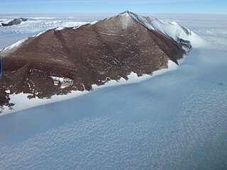
The Pensacola Mountains are a large group of mountain ranges and peaks that extend 280 nautical miles in a northeast–southwest direction in the Transantarctic Mountains System, Queen Elizabeth Land region of Antarctica. They comprise the Argentina Range, Forrestal Range, Dufek Massif, Cordiner Peaks, Neptune Range, Patuxent Range, Rambo Nunataks and Pecora Escarpment. These mountain units lie astride the extensive Foundation Ice Stream and Support Force Glacier which drain northward to the Ronne Ice Shelf.
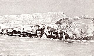
The Queen Maud Mountains are a major group of mountains, ranges and subordinate features of the Transantarctic Mountains, lying between the Beardmore and Reedy Glaciers and including the area from the head of the Ross Ice Shelf to the Antarctic Plateau in Antarctica. Captain Roald Amundsen and his South Pole party ascended Axel Heiberg Glacier near the central part of this group in November 1911, naming these mountains for the Norwegian queen Maud of Wales.

Minnesota Glacier is a broad glacier, about 40 nautical miles long and 5 nautical miles wide, flowing east through the Ellsworth Mountains in Antarctica, separating the Sentinel Range and the Heritage Range. It is nourished by ice from the plateau west of the mountains and by Nimitz Glacier and Splettstoesser Glacier, and merges into the larger Rutford Ice Stream at the eastern margin of the Ellsworth Mountains.
Lillie Glacier is a large glacier in Antarctica, about 100 nautical miles long and 10 nautical miles wide. It lies between the Bowers Mountains on the west and the Concord Mountains and Anare Mountains on the east, flowing to Ob' Bay on the coast and forming the Lillie Glacier Tongue.

The Chemehuevi Mountains are a mountain range that are found at the southeast border of San Bernardino County in southeastern California and are adjacent the Colorado River. Located south of Needles, California and northwest of the Whipple Mountains, the mountains are oriented in a north–south direction, and stretch for approximately 15 miles (24 km) in length.

Mitchel Air Force Base, also known as Mitchel Field, was a United States Air Force base located on the Hempstead Plains of Long Island, New York, United States. Established in 1918 as Hazelhurst Aviation Field #2, the facility was renamed later that year as Mitchel Field in honor of former New York City Mayor John Purroy Mitchel, who was killed while training for the Air Service in Louisiana.
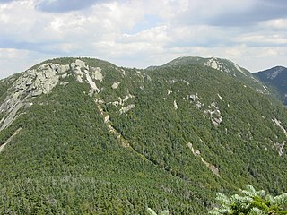
Saddleback Mountain is a mountain in the Great Range of the Adirondacks in the U. S. state of New York. It is the 17th highest of the Adirondack High Peaks, with an elevation of 4,515 feet (1,376 m). It is located in Adirondack Park in the town of Keene in Essex County. The mountain was named for the outline of its ridge, which resembles a saddle, by Orson Schofield Phelps and Frederick Perkins. It is flanked by Basin Mountain, the ninth highest of the High Peaks, and Gothics, the tenth highest. Good views of the two higher mountains are offered from the summit of Saddleback. The mountain straddles the watersheds of Johns Brook and the Ausable River. The earliest recorded ascent was made by amateur climber Newell Martin on August 5, 1894. It was claimed that an earlier ascent was made by patent lawyer James J. Storrow and mountain guide Orlando Beede, but the date of this climb is unknown.

The Wapack Range, sometimes referred to as the Pack Monadnock Range, is a 20-mile-long (32 km) range of mountains in south-central New Hampshire and adjacent Massachusetts, in the northeastern United States. The range is considered very scenic and rugged with many bare summits and ledges ranging from 1,800 to 2,290 feet. The 22-mile (35 km) Wapack Trail, one of the oldest interstate hiking trails in the United States, traverses it. The Wapack Range is also the northern terminus of the 90-mile (140 km) Midstate Trail.

Braddock Peak is a mountain summit in the Never Summer Mountains range of the Rocky Mountains of North America. The 11,972-foot (3,649 m) peak is located in State Forest State Park, 3.0 miles (4.8 km) south-southwest of Cameron Pass in Jackson County, Colorado, United States.
The Waterman Hills are a low mountain range in the Mojave Desert, just north of Barstow in San Bernardino County, California and 1 mile northwest of the Mitchel Range.
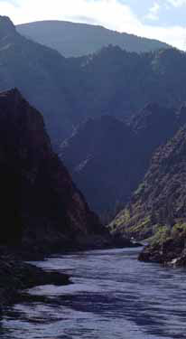
The Salmon River Mountains are a major mountain range in the western United States, covering most of the central part of Idaho. The range exceeds 120 miles (190 km) in length and its boundaries are usually defined by the Salmon River and its large tributary forks. Part of the central Rocky Mountains, the entire range lies west of the continental divide and drains to the Snake River. The highest peak is White Mountain, at 10,442 feet (3,183 m) above sea level; five peaks have summits exceeding 10,000 feet (3,050 m), and the three major subranges are defined by other forks of the Salmon River: the West, Central, and East Salmon River Mountains.
The Rampart Range is a mountain range in the western United States in Colorado, located in Douglas, El Paso, and Teller counties. Part of the Front Range of the Rocky Mountains, the range is almost entirely public land within the Pike National Forest.
Meridian Peak is a mountain summit in the Gore Range of the Rocky Mountains of North America. The 12,432-foot (3,789 m) peak is located in the Eagles Nest Wilderness, 9.0 miles (14.5 km) north by west of the Town of Vail, Colorado, United States, on the drainage divide separating White River National Forest and Eagle County from Arapaho National Forest and Summit County.
The Snake River Range is located in the U.S. states of Wyoming and Idaho and includes 10 mountains over 9,000 feet (2,700 m). The tallest peak in the range is Mount Baird at 10,030 feet (3,060 m). The range trends northwest to southeast and is bordered on the north by the Teton Range and the two ranges meet at Teton Pass. The Snake River Range is bordered by the Palisades Reservoir to the west and the Snake River, which sweeps completely around the eastern, southern and western part of the range. The range is approximate 30 miles (48 km) north to south and 33 miles (53 km) west to east, covering 528 square miles (1,370 km2). Along the southern boundary, the Snake River passes through Grand Canyon, also known as the Snake River Canyon. U.S. Route 26/U.S. Route 89 follows the course of the Snake River from Hoback Junction to the Palisades Reservoir.

Cirque Mountain is a 13,686-foot-elevation (4,171-meter) mountain summit located in Ouray County of southwest Colorado, United States. It is situated six miles west of the community of Ouray, above the north side of Yankee Boy Basin, on land managed by Uncompahgre National Forest. It is part of the Sneffels Range which is a subset of the San Juan Mountains, which in turn is part of the Rocky Mountains. Cirque ranks as the 155th-highest peak in Colorado, and the ninth-highest in the Sneffels Range. It is west of the Continental Divide, 1.12 mile east of Mount Sneffels, and 0.59 mile west of Teakettle Mountain, which is the nearest higher neighbor. Topographic relief is significant as the north aspect rises 3,000 feet above Blaine Basin in one mile, and the south aspect rises over 2,000 feet above Yankee Boy Basin in less than one mile. These basins are cirques which were carved by ancient glaciers. The mountain's name has been officially adopted by the United States Board on Geographic Names.


