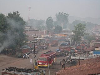
Latehar is a town which is a headquarter of Latehar district of Jharkhand state, it is known for its natural environment, forest, forest products and mineral deposits. Latehar remained a part of Palamau District as a sub division since 1924. It was elevated from sub divisional status to a district on 4 April 2001, vide Jharkhand Government Notification No 946 dated 04.04.2001. Latehar is located on the north–west corner of Jharkhand in the Palamau Commissionary. It is surrounded by Ranchi, Lohardaga, Gumla, Palamu and Chatra district apart from Chhattisgarh state and district headquarters is situated at 84.51198 East Longitude and 23.741988 North Latitude.

Palamu district is one of the twenty-four districts of Jharkhand, India. It was formed in 1892. The administrative headquarters of the district is Medininagar, situated on the Koel River.
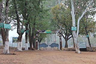
Betla National Park is a national park located on the Chota Nagpur Plateau in the Latehar and Palamu district of Jharkhand, India. The park hosts a wide variety of wildlife.
Hariharganj block is one of the administrative blocks of Palamu district, Jharkhand state, India. According to census (2001), the block has 13,579 households with aggregate population of 87,499. The block has 194 villages.
Lesliganj block is one of the administrative blocks of Palamu district, Jharkhand state, India.
Barwadih is a town and Community Development Block in Latehar district of Jharkhand state in India.
The Burha River flows through the Latehar district of Palamu division in the Indian state of Jharkhand.
North Koel River flows through the Indian state of Jharkhand.
The Auranga River flows through the Latehar and Palamu districts in the Indian state of Jharkhand.
The Amanat River flows through the Chatra and Palamu districts in the Indian state of Jharkhand.
The DIGALRiver is a tributary of the Son River and flows through the India states of Chhattisgarh, Jharkhand and Uttar Pradesh.
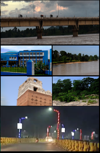
Medininagar, formerly Daltonganj, is a city municipal corporation in the Indian state of Jharkhand. It is the headquarters of Palamu division and Palamu district, as well as the subdivision and block of the same name. The city is situated on the banks of the North Koel River.
Pandwa is one of the administrative community development block of Palamu district, Jharkhand state, India. The Pandwa block has 8,985 households with aggregate population of 46,957. The block has 8 panchayats and about 34 villages.
Mohammadganj block is one of the administrative blocks of Palamu district, Jharkhand state, India.
Buchi Lami is a small village located in Padwa block of Palamu district, Jharkhand state, India. According to census (2011), The Buchi Lami village has population of 886 of which 443 are males while 443 are females.
Danda is one of the administrative blocks of Garhwa district, Jharkhand state, India.
Manjhiaon is one of the administrative blocks of Garhwa district, Jharkhand state, India.
Kandi is one of the administrative blocks of Garhwa district, Jharkhand state, India.
Rajhara Area is one of the operational areas of the Central Coalfields Limited located in the Palamu and Latehar districts in the state of Jharkhand, India.
Daltonganj Coalfield is located in Palamu district in the Indian state of Jharkhand.

