Hussainabad, Jharkhand

Last updated

Hussainabad
Japla
City
India Jharkhand location map.svg
Red pog.svg
Hussainabad
Location in Jharkhand, India
India location map 3.png
Red pog.svg
Hussainabad
Hussainabad (India)
Coordinates: 24°32′N84°01′E / 24.53°N 84.02°E / 24.53; 84.02
CountryFlag of India.svg  India
State Jharkhand
District Palamu
Named for Nawab Syed Ghulam Hussain
Elevation
145 m (476 ft)
Population
 (2012)
  Total35,433
Languages
  Official Hindi
Time zone UTC+5:30 (IST)
PIN
822116
Telephone code06566
Vehicle registration JH
Website www.japla.in

Hussainabad, informally called Japla, is a town and subdivision in Palamu district in the Indian state of Jharkhand. Hussainabad was named after its founder Nawab Ghulam Hussain. It is also known as Japla on the name of Japla Cement Factory. [1] It is situated at the western most part near Deori, on the bank of River Son

Contents

Jharkhand.

Demographics

In the 2001 Indian census, Hussainabad had a population of 23,433. Males constituted 53% of the population and females constituted 47%. Hussainabad had an average literacy rate of 54%, lower than the national average of 59.5%: the male literacy rate was 62%, and the female literacy rate was 45%. 18% of the population was under 6 years of age. [2]

Geography

Japla station Japlastation.png
Japla station

Hussainabad is situated at 24°32′N84°01′E / 24.53°N 84.02°E / 24.53; 84.02 . [3] It has an average elevation of 145 m (476 ft).

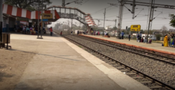
Hussainabad serves as the main market for nearby villages. It is on the border of Jharkhand and Bihar. The town has a railway station. Towards Bihar, the following stations are Kajratnawadih station and Nabinagar station. Railway is the main source for intercity commutation but local buses and small vehicles also operate between nearby cities.[ citation needed ]

Approximately 4 kilometres (2.5 mi) from Japla is Sone Valley Cements Limited (formerly known as Sone Valley Port Land Cement Company Limited), on the bank of Sone River, which ceased operating in 1993. It was first Portland cement factory of India established during the British regime. It is said[ by whom? ] that the Mohraon Bungalow of Sone Valley Cements was among some of the finest bungalows in the state of Bihar, and equipped with modern amenities. After the closure of the factory, the bungalow fell into ruin. Initial economic growth in the town could be attributed to the cement factory, whose employees visited town to purchase goods for day-to-day needs, thus promoting the town's trade and commerce. The town now serves as the main market for nearby villages.[ citation needed ]

Infrastructure

In the absence of governmental help for improvement, Hussainabad has only basic infrastructure.[ according to whom? ] Roads are single carriageway, sewerage is non-existent, and the water supply is irregular.[ citation needed ]

Basic medical facilities are provided by a government-run health centre and private medical practitioners. For advanced treatment patients either travel to the nearby town or to larger cities such as Daltonganj, Varanasi and Ranchi.[ citation needed ]

The condition of electricity supply is better than nearby towns with less than five hours of powercuts in a day.[ further explanation needed ] Solar power is also used for street lighting and domestic purposes.[ citation needed ]

The preferred form of public conveyance in the town is by rickshaw, auto-rickshaw and jeep.[ citation needed ]

The outskirts of the town are infested with naxalites because of surrounding dense jungle.[ citation needed ]

Educational infrastructure is basic. There are government-run schools for boys and girls and small private schools. For higher education students commute to larger cities. Some residents of Japla are well-placed and are doing well in big cities.[ citation needed ] People from Japla are working in IBM, TCS, Infosys and multinational banks.[ citation needed ]

The major source of income for residents is in small trading businesses and agriculture. The people of the villages surrounding the town also engage in agriculture. The government is the biggest employer, with the majority of the jobs coming from banks, schools, and government offices.

Amenities in Hussainabad include the nationalised banks of SBI and PNB, a post office, two petrol pumps, and picture halls.[ citation needed ]

See also

Related Research Articles

<span class="mw-page-title-main">Sindri (Dhanbad)</span> Neighbourhood in Dhanbad, Jharkhand, India

Sindri is a neighbourhood in Dhanbad in Dhanbad Sadar subdivision of Dhanbad district in Jharkhand state, India.

<span class="mw-page-title-main">Latehar</span> City in Jharkhand, India

Latehar is a town which is a headquarter of Latehar district of Jharkhand state, it is known for its natural environment, forest, forest products and mineral deposits. Latehar remained a part of Palamau District as a sub division since 1924. It was elevated from sub divisional status to a district on 4 April 2001, vide Jharkhand Government Notification No 946 dated 04.04.2001. Latehar is located on the north–west corner of Jharkhand in the Palamau Commissionary. It is surrounded by Ranchi, Lohardaga, Gumla, Palamu and Chatra district apart from Chhattisgarh state and district headquarters is situated at 84.51198 East Longitude and 23.741988 North Latitude.

Garhwa is a town and a municipality in, and headquarters of, Garhwa district in the state of Jharkhand, India. Uttar Pradesh, Chhattisgarh and Bihar are nearby states. Garhwa Road (Rehla) is a major Railway Junction where thousands of passengers find this station most convenient to catch their train for Delhi and Kolkata. Bus services are available for Ranchi, Ambikapur, Gaya, etc.

<span class="mw-page-title-main">Bokaro Steel City</span> Metropolis in Jharkhand, India

Bokaro, officially known as Bokaro Steel City, is a large and planned city in Jharkhand, India. It is the fourth most populous city in the state and one of the first planned cities of India. Bokaro is the administrative headquarters of Bokaro district. The city is located on the banks of Garga River and on the fringes of Bokaro river and is surrounded by hill ranges at Giridih and Ramgarh districts. It is one of the most peaceful cities in India. As per 2011 census, the city's population was 563,417 and 1,100,000 of its metropolitan area. The city span across 183 km in geographic area.

Saraikela is the district headquarters and a nagar panchayat in the Seraikela Sadar subdivision of the Seraikela Kharsawan district in the Indian state of Jharkhand. It was formerly the capital of Saraikela State, a princely state. The town is a road junction, an agricultural trade centre and upcoming industrial centre. It is situated between Jamshedpur and Chaibasa.

Hussainabad block is one of the administrative blocks of Palamu district, Jharkhand state, India. According to census (2001), the block has 29,113 households with aggregate population of 177,013. The block has 183 villages. Its largest town is Hussainabad, also known as Japla.

Barwadih is a town and Community Development Block in Latehar district of Jharkhand state in India.

Daudnagar is a town and the subdivisional headquarter of Daudnagar Subdivision in Aurangabad district in the state of Bihar, India under the Magadh division. Until 1991, there was only one Subdivision in the Aurangabad district: Aurangabad Sadar. On 31 March 1991, one other subdivision, Daudnagar, was created. Daudnagar is a 200-year-old historical city and its living proof is Daudnagar has an old historical fort situated on the eastern bank of the Son River. National Highway NH139 which connects Jharkhand's Palamu district to Patna, passes through the town.

<span class="mw-page-title-main">Jhalda</span> City in West Bengal, India

Jhalda is a city and a municipality in Purulia district in the Indian state of West Bengal. It is the headquarters of the Jhalda subdivision.

<span class="mw-page-title-main">Rafiganj</span> Town in Bihar, India

Rafiganj is a town and a notified area in Aurangabad district in the Indian state of Bihar. It is the district's second-largest town in population after Aurangabad, and also the second-largest town in area. Rafiganj is located 25 km away from the District Administration.

<span class="mw-page-title-main">Nasriganj</span> Nagar panchayat town in Bihar, India

Nasriganj is a nagar panchayat town and corresponding community development block situated in Rohtas District of Bihar, India. Located on the banks of the Son River, the town was a vibrant economic hub in the late 19th century. The town of Nasriganj had a population of 23,819, according to the 2011 Census of India, while the total population of Nasriganj block was 115,117. Besides the town of Nasriganj itself, the block consisted of 53 villages, of which 50 were inhabited and 3 were uninhabited.

Gomia is a census town in the Gomia CD block in the Bermo subdivision of the Bokaro district in the Indian state of Jharkhand. The modern name is a transformation of Gumia over the years. Though, today, it is still listed as Gumia by the South Eastern Railway (India).

<span class="mw-page-title-main">Tilouthu</span> Town in Bihar, India

Tilothu, also spelled Tilauthu or Tilothu, is a village and corresponding community development block in Rohtas district, Bihar, India. It is located 15 km from Dehri-on-Sone on the west bank of the Son River. As of 2011, the population of Tilouthu was 16,402, in 2,745 families, while the corresponding block population was 109,249.

Kumirdaha is a village in the Ranishwar block in Dumka district of Jharkhand, India. The village has an old temple dedicated to hindu Goddess Durga. Dumka-Suri main road connects Jharkhand and West Bengal. A place named 'Border' is located at the extremity of the block.

<span class="mw-page-title-main">Medininagar</span> City in Jharkhand, India

Medininagar, formerly Daltonganj, is a city municipal corporation in the Indian state of Jharkhand. It is the headquarters of Palamu division and Palamu district, as well as the subdivision and block of the same name. The city is situated on the banks of the North Koel River.

Namudag is a village in Chhatarpur Block in Palamu district of Jharkhand state, India. It is located 48 km towards the north from the district headquarters Daltonganj, 12 km from Chhattarpur, and 177 km from state capital Ranchi. Namudag Pin code is 822113 and the postal head office is Chhatarpur. Marwa (4 km), Munkeri (5 km), Khairadohar (6 km), Bara (6 km), and mahuwari and Karkata (7 km) are the nearby villages to Namudag. Namudag is surrounded by Dumaria Block towards the north, Patan Block towards the south, Hariharganj Block towards the north, and Kutumba Block towards the north.

Shamshernagar is a large village in the Daudnagar subdivision and block in Aurangabad district, located in Bihar, India. The town falls under the jurisdiction of the Magadh division. Situated on the bank of the Sone River, the National Highway 139 passes through the village. The Indrapuri Barrage canal is a local waterway. Shamshernagar is densely populated. It has adequate infrastructure, including a middle school, an intermediate high school, an additional Primary Health Centre, and a Regional Rural Bank (MBGB). Shamshernagar is an electrified village. and possesses a water tank for its water supply. It shares a border between Aurangabad and Arwal districts. Buses, auto-rickshaws and e-rickshaws provide regional transportation.

Naudiha is a village in Naudiha Bazar block in Palamu District of Jharkhand, India. It is located 62 km from district headquarters Daltonganj and 201 km from the state capital Ranchi. Naudiha is surrounded by Hariharganj Block towards North, Dumaria Block towards East, Patan Block towards South, Hussainabad Block towards west. Naudiha Population

Manauri is a town of Prayagraj, Uttar Pradesh state of India. It is a market, 18 km west of Prayagraj city headquarter. It lies on the border of Prayagraj and Kaushambi district of Uttar Pradesh. On this town, a Railway Station lying nearby on the New Delhi - Howrah main line and an Air Force Station nearby on NH-2 is also named. Due to proximity of the Town with main Railway line and National highway, it has developed into a local trade market. The town has a huge population of more than 15 thousand, both of Hindus and Muslims. The main occupation is grains, vegetable and fruits agriculture along with traditional works like metal works, blacksmith, carpenter, glass works, and construction labours.

<span class="mw-page-title-main">Kushwaha Shivpujan Mehta</span> Indian politician

Kushwaha Shivpujan Mehta is the Jharkhand state legislative assembly member from Hussainabad. In the 2014 general election, he was elected as MLA as Bahujan Samaj Party candidate. He joined All Jharkhand Students Union in November 2019, and is now District level chairman of All India Kushwaha Mahasabha, Hazaribagh from 15 December 2020.

References

  1. "Hussainabad Nagar Panchayat". udhd.jharkhand.gov.in. Retrieved 11 October 2023.
  2. "Census of India 2001: Data from the 2001 Census, including cities, villages and towns (Provisional)". Census Commission of India. Archived from the original on 16 June 2004. Retrieved 1 November 2008.
  3. Falling Rain Genomics, Inc - Hussainabad