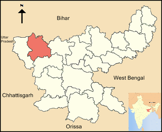
Bharveli is a census town in Balaghat district in the state of Madhya Pradesh, India.

Birwadi is a census town in Raigad district in the state of Maharashtra, India.

Chandapur is a census town in Nayagarh district in the state of Odisha, India.

Chaurai is a town and a nagar panchayat in Chhindwara district in the state of Madhya Pradesh, India.

Chinnasekkadu is a neighbourhood of Chennai in Chennai district in the state of Tamil Nadu, India. Chinnasekkadu used to be a town panchayat in Thiruvallur district. In 2011, Chinnasekkadu town panchayat wss merged with Chennai Corporation. Chinnasekkadu comes under ward 29 in Zone 3(Madhavaram) of Chennai Corporation.

Desur is a Town panchayat in Tiruvanamalai district in the Indian state of Tamil Nadu.

Dhampur is a city and a municipal board in Bijnor district in the state of Uttar Pradesh, India. It is located at 29.30°N 78.50°E, and lies in Northern India.

Kaliyakkavilai is a panchayat town in Kanniyakumari district in the Indian state of Tamil Nadu, close to the Tamil Nadu-Kerala border. It lies on Coimbatore-Kochi-Trivandrum-Kanyakumari National highway 47.

Kotwa is a census town in Varanasi district in the Indian state of Uttar Pradesh.

Manglaya Sadak is a census town in Indore district in the Indian state of Madhya Pradesh.

Nallur (Nalloor) is a panchayat town in Kanniyakumari district in the Indian state of Tamil Nadu.

Naravarikuppam is a town in Thiruvallur district in the Indian state of Tamil Nadu.also called redhills

Neyyoor is a panchayat town in Kanniyakumari district in the Indian state of Tamil Nadu.

Peerkankaranai is a town in Southern part of the metropolitan city of Chennai in the Indian state of Tamil Nadu.

Thevaram is a Town Panchayat in Theni district in the Indian state of Tamil Nadu. Thevaram is located in Tamil Nadu near on border of Kerala at the Eastern side foot-hill of Western Ghats. The State Highway SH-100 passes through this town.
Vengathur is a census town in Thiruvallur district in the Indian state of Tamil Nadu.

Venkatapur is a census town in Bhatkal Taluk in Uttara Kannada district of Karnataka.

Gangapur is a town and a nagar panchayat in Varanasi district in the state of Uttar Pradesh, India.

Fatehabad is a town and a municipal committee in Fatehabad district in the state of Haryana, India.

Kerur is a City in Bagalkot district in Karnataka, which located on NH 218. It has an average elevation of 617 meters (2024 feet). Its a birthplace of Jagadish Shettar, a former Chief Minister of Karnataka. Kerur is a Town Panchayat city in district of Bagalkot, Karnataka. The Kerur city is divided into 16 wards for which elections are held every five years. The Kerur Town Panchayat has population of 19,731 of which 9,929 are males while 9,802 are females as per report released by Census India 2011.


