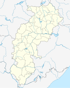
Garhwa is a town and a municipality in, and headquarters of, Garhwa district in the state of Jharkhand, India. Uttar Pradesh, Chhattisgarh and Bihar are nearby states. Garhwa Road (Rehla) is a major Railway Junction where thousands of passengers find this station most convenient to catch their train for Delhi and Kolkata. You can find bus services for Ranchi, Ambikapur, Gaya etc.

Guna is a city and a municipality in Guna district in the Indian state of Madhya Pradesh. It is the administrative headquarters of Guna District and is located on the banks of Parbati river.

Kadirur is a census town within the Thalassery Taluk of Kannur District in the State of Kerala, India. Kadirur is located about 8 km from the Thalassery Township on the Tellicherry-Mysore road.

Kushalgarh is a town and municipality in the Indian state of Rajasthan. It is located in the Banswara District approximately 65 km south of the city of Banswara.

Mon (Pron:/mɒn/) is a town and a town area committee in Mon district in the Indian state of Nagaland.

Bikihakola is a census town in Panchla CD Block of Howrah Sadar subdivision in Howrah district in the state of West Bengal, India.

Chandla is a town and a nagar panchayat in Chhatarpur district in the state of Madhya Pradesh, India.

Eksara is a census town in Bally Jagachha CD Block of Howrah Sadar subdivision in Howrah district in the Indian state of West Bengal. It is a part of Kolkata Urban Agglomeration.

Kachhwa is a town and a nagar panchayat in Mirzapur district in the Indian state of Uttar Pradesh.

Kanti is a city and a notified area in Muzaffarpur district in the Indian state of Bihar. It belongs to "Tirhut Division". It is located 15 km by road from District headquarters "Muzaffarpur" and 13 km by railway from muzaffarpur jn and 4 km from "Piprahan" halt and It is also block headquarters.

Kendua is a census town in Habibpur CD Block in Malda Sadar subdivision of Malda district in the Indian state of West Bengal.

Modak is a census town in Kota district in the Indian state of Rajasthan.Modak is in Ramganjmandi Tehsil.It is located 61 km towards South from District headquarters Kota.

Ramanujganj is a town in the Balrampur-Ramanujganj district of the Indian state of Chhattisgarh. Ramanujganj is the border town of Chhattishgarh-Jharkhand State. The nearest airports are Ranchi(250 km) and Raipur(350 km). The nearest railway stations are Garhwa(50km) and Ambikapur(110 km). District sessions court and district jail is situated here as well as district polytechnic College. A CRPF battalion is based here for training and protection of district if need arises.

Religara, also called Pachhiari, is a census town in Dadi of Hazaribag district in the Indian state of Jharkhand.

Sahapur is a census town in Panchla CD Block of Howrah Sadar subdivision in Howrah district in the Indian state of West Bengal.

Salumbar is a small town and a municipality in Udaipur district in the Indian state of Rajasthan. It was ruled by the Chundawat Sisodia rajputs of Mewar.

Singaperumal Koil is a census town located close to Chengalpet and Maraimalai Nagar in Chengalpattu district in the Indian state of Tamil Nadu.

Fatehabad is a town and a municipal committee in Fatehabad district in the state of Haryana, India.

Chhatarpur is an assembly constituency in the Indian state of Jharkhand.

Bhinder or Bhindar is a town in Udaipur District, that is located 315 km (196 mi) from the state's main city Jaipur. Bhinder borders the Chittorgarh District in Rajasthan and is located 58 kilometres (36 mi) south-east of Udaipur. Notable tourist sites nearby include Sita Mata Wildlife Sanctuary, Jaisamand Sanctuary, and Jaisamand Lake. Bhinder is surrounded by four lakes.


