Trieste is a city and seaport in northeastern Italy. It is the capital and largest city of the autonomous region of Friuli Venezia Giulia, as well as of the regional decentralization entity of Trieste.

Friuli Venezia Giulia is one of the 20 regions of Italy and one of five autonomous regions with special statute. The regional capital is Trieste on the Gulf of Trieste, a bay of the Adriatic Sea.
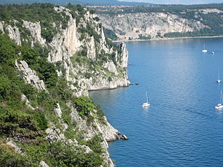
The Karst Plateau or the Karst region, also locally called Karst, is a karst plateau region extending across the border of southwestern Slovenia and northeastern Italy.
San Giovanni, the Italian form of "Saint John", is a name that may refer to dozens of saints. It may also refer to several places and religious buildings:

The Province of Trieste was a province in the autonomous Friuli Venezia Giulia region of Italy. Its capital was the city of Trieste. It had an area of 212 square kilometres (82 sq mi) and it had a total population of 234,668. It had a coastal length of 48.1 kilometres (29.9 mi). Abolished in 2017, it was reestablished in 2019 as the Regional decentralization entity of Trieste, and was reactivated on 1 July 2020.

Duino is today a seaside resort on the northern Adriatic coast. It is a hamlet of Duino-Aurisina, a municipality (comune) of the Friuli–Venezia Giulia region of northeastern Italy. The settlement, picturesquely situated on the steep Karst cliffs of the Gulf of Trieste, is known for Duino Castle, immortalized by the poet Rainer Maria Rilke in his Duino Elegies.
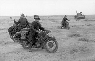
The 1st Army was a Royal Italian Army field army, in World War I, facing Austro-Hungarian and German forces, and in World War II, fighting on the North African front.

The Sixth Battle of the Isonzo, better known as the Battle of Gorizia, was the most successful Italian offensive along the Soča (Isonzo) River during World War I.
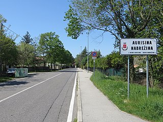
Aurisina is a town in the karst part of the comune of Duino-Aurisina near Trieste, Italy, in a region of Slovene minority. It lies 15 kilometres northwest of Trieste, and according to the 2003 census had a total of 2,406 inhabitants, 60% of them Slovenes.

Doberdò del Lago is a comune (municipality) in the Regional decentralization entity of Gorizia in the Italian region of Friuli Venezia Giulia, located about 30 kilometres (19 mi) northwest of Trieste and about 11 kilometres (7 mi) southwest of Gorizia, and borders the following municipalities: Duino-Aurisina, Fogliano Redipuglia, Komen (Slovenia), Miren-Kostanjevica (Slovenia), Monfalcone, Ronchi dei Legionari, Sagrado, and Savogna d'Isonzo. It is located in the westernmost part of the Karst Plateau.

Duino-Aurisina is a comune (municipality) in the Regional decentralization entity of Trieste in the Italian region of Friuli Venezia Giulia. Lying near the border with Slovenia, it has a substantial Slovene minority. It is named by the two major settlements, Duino and Aurisina.

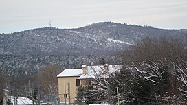
Sgonico is a comune (municipality) in the Regional decentralization entity of Trieste in the Italian region of Friuli Venezia Giulia, located about 12 kilometres (7 mi) northwest of Trieste, on the border with Slovenia. As of 31 December 2004, it had a population of 2,130 and an area of 31.3 square kilometres (12.1 sq mi). According to the 1971 census, 81.6% of the population are Slovenes.

Julius Kugy was a mountaineer, writer, botanist, humanist, lawyer and officer of Slovenian descent. He wrote mostly in German. He is renowned for his travelogues from opening up the Julian Alps, in which he reflected on the relationship between man, nature, and culture. He opposed competing nationalist ideologies in the Alpe-Adria region, insisting on the need of peaceful co-existence among Slovene, Italian and German peoples.
St. John the Baptist Church is a church in San Giovanni di Duino, a hamlet which forms part of the comune of Duino-Aurisina in the Province of Trieste, north-east Italy. It is located at the resurgence of the Timavo and is notable for the remains of a palaeo-Christian basilica.

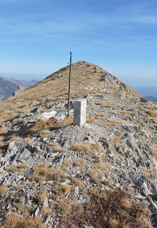
Monte Saccarello (Italian) or Mont Saccarel (French) is a mountain located on the French-Italian border between Liguria, Piedmont and Provence-Alpes-Côte d'Azur.
Municipal elections were held in the six municipalities of the Anglo-American occupation zone of the Free Territory of Trieste in June 1949, Trieste, Duino-Aurisina, San Dorligo della Valle, Sgonico, Monrupino and Muggia. There were 197,266 eligible voters in the electoral rolls in Trieste and a combined number of 15,392 eligible voters in the five other municipalities.
Duino Castle is a fourteenth-century fortification located in the village of Duino, located in the municipality of Duino-Aurisina, near Trieste, modern-day Italy, on the cliffs overlooking the Gulf of Trieste.
Cima di Pertegà (Italian) or Cime de la Pertègue (French) is a mountain located on the French-Italian border between Piemonte and Provence-Alpes-Côte d'Azur.

Giovanni Randaccio was an Italian soldier.

Monte San Michele (Italian) or Debela griža (Slovene) is a hill on the Karst Plateau, in the Italian province of Gorizia, on the border between the municipalities of Sagrado and Savogna d'Isonzo. It is located eight kilometres southwest of Gorizia, on the left bank of the Isonzo, and has four peaks, the highest two of which have an elevation of 275 meters above sea level, while the lowest has an elevation of 237 meters, and Cima Quattro stands at 264 meters.