Monte Mucrone

Last updated
Monte Mucrone
Il Monte Mucrone dal sentiero che sale al Monte Becco.jpg
View from Monte Becco slopes.
Highest point
Elevation 2,335 m (7,661 ft) [1]
Prominence 309 m (1,014 ft) [2] [3]
Listing Alpine mountains 2000-2499 m
Coordinates 45°37′13″N7°56′41″E / 45.6203565°N 7.9446632°E / 45.6203565; 7.9446632 Coordinates: 45°37′13″N7°56′41″E / 45.6203565°N 7.9446632°E / 45.6203565; 7.9446632
Geography
Alps location map.png
Red triangle with thick white border.svg
Monte Mucrone
Location in the Alps
Location Province of Biella, Italy
Parent range Alpi Biellesi
Climbing
Easiest route Hiking from the Oropa cableway upper station

Monte Mucrone (or simply Mucrone) is an Alpine mountain of Piedmont (NW Italy).

Contents

Geography

NW subsummit in winter Anticima del Monte Mucrone.jpg
NW subsummit in winter

The mountain belongs to the Biellese Alps, a sub-range of Pennine Alps; the Bocchetta del Lago, a pass at 2,026  m, divides it from the rest of the chain. The Mucrone is located between Elvo and Cervo valleys, and belongs to the Province of Biella. Administratively its main summit is the tripoint at which the borders of the municipalities of Biella, Sordevolo and Pollone meet. It visually dominates the Sanctuary of Oropa. On a subsummit at 2,302  m stands a huge metal cross. On a second subsummit, NW of the main elevation, stands the upper station of an old branch of the Oropa cableway, dismantled in 1982. [4]

SOIUSA classification

According to the SOIUSA (International Standardized Mountain Subdivision of the Alps) the mountain can be classified in the following way: [5]

Access to the summit

Summit cross. Mucrone croce.jpg
Summit cross.

The easiest route for the Mucrone summit is a waymarked footpath which starts from Oropa Sport (the Oropa cableway upper station); the hike flanks at first a small lake, then reaches the Bocchetta del Lago and from there the summit, climbing the NW ridge of the mountain. [6]

Mountain huts

Nearby Oropa Sport, at 1,850  m, is located Rifugio Rosazza, a permanent mountain hut. [7]

Maps

Related Research Articles

Grivola

The Grivola is a mountain in the Graian Alps in Italy. It lies between the Valsavarenche and the Cogne Valley.

Monte Mars Mountain in Italy

Monte Mars(in Italian) or Mont Mars(in French), at 2,600 m, is the highest peak of the Biellese Alps, north-western Italy.

Biellese Alps Mountain range in Italy

The Biellese Alps are a sub-range of the Pennine Alps located between Piemonte and Aosta Valley (Italy).

Punta Tre Vescovi

Punta Tre Vescovi is a peak in the Biellese Prealps, northern Italy. On its top, three valleys meet: Lys Valley, Valsesia, and Valle Cervo.
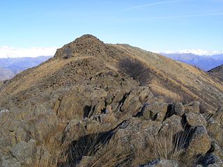
Monte Colombano

Monte Colombano is a mountain in the Alpi di Lanzo, a sub-group of the Graian Alps, with an elevation of 1,658 m.

Punta Bagnà

Punta Bagnà or Cime du Grand Vallon is a mountain of Savoie, France and of the Province of Turin, Italy. It lies in the Cottian Alps range. It has an elevation of 3,129 metres above sea level.

Monte Bo

Monte Bo is a mountain in the Alpi Biellesi, a sub-range of Pennine Alps.

Colma di Mombarone

Colma di Mombarone is a mountain of the Biellese Alps, a sub-range of Pennine Alps, in northern Italy. It visually marks, along with Monte Gregorio on the opposite side, the entrance of Aosta Valley from the Po plain. On its top in 1900 was built a huge statue, still located there, of Jesus Christ.

Monte Barone Mountain in Italy

Monte Barone is a mountain of the Alpi Biellesi, a sub-range of the Pennine Alps. Due to its isolation it offers a noteworthy point of view towards the Po plain and can be seen from quite a long distance away.

Bocchetta del Croso

Bocchetta del Croso is a pedestrian pass across the Alpi Biellesi. It connects Cervo valley (BI) and Valsesia (VC), both in Piemonte (Italy).
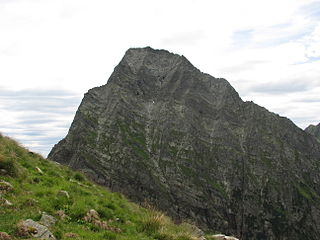
Monte Tagliaferro

Monte Tagliaferro is a mountain of the Pennine Alps. It is one of the most popular hiking destination of Valsesia.

Rognosa dEtiache

Rognosa d'Etiache or Rognosa d'Étache is a mountain in the Cottian Alps on the border of Turin, Italy, and Savoie, France. It has an elevation of 3,382 metres above sea level.

Alpi Cusiane

The Alpi Cusiane are a sub-range of the Pennine Alps located in Piemonte (Italy).

Corno Bianco

Corno Bianco is a mountain of the Pennine Alps. It's a popular climbing destination of Valsesia.

Monte Orsiera

Monte Orsiera is a mountain in the Cottian Alps belonging to the Province of Turin (Italy).

Monte Cresto

Monte Cresto (2,548 m) is the third highest peak of the Province of Biella after Monte Mars (2,600 m) and Monte Bo (2,556 m).

Bric Ghinivert Mountain in Italy

Bric Ghinivert or Eiminàl is a mountain of the Cottian Alps located in Italy.

Monte Monega Mountain in Italy

Monte Monega is a 1,882-metre (6,175 ft) mountain of the Ligurian Alps, in Italy.

Monte I Gemelli Mountain in Italy

The Monte I Gemelli is an Alpine mountain located between Aosta Valley and Piedmont.

Monte Zeda Mountain in Italy

The Monte Zeda is a mountain in the Lepontine Alps belonging to the Province of Verbano-Cusio-Ossola (Italy).

References

  1. Carta dei sentieri della Provincia di Biella 1:25.000, Provincia di Biella, year 2004
  2. Geoportale IGM on www.pcn.minambiente.it
  3. key col: Bocchetta del Lago (2,026  m)
  4. Massimo De Carli (2019-04-23). "AG Base e Intermedio 15 settembre 2019: Oropa, Lago Mucrone" (in Italian). Club Alpino Italiano - Sezione di Calco. Retrieved 2019-11-05.
  5. Marazzi, Sergio (2005). Atlante Orografico delle Alpi. SOIUSA (in Italian). Priuli & Verlucca. p. 134. ISBN   978-88-8068-273-8.
  6. Piemonte (non compresa Torino) (in Italian). Touring club italiano. 1976. p. 500. ISBN   9788836500017 . Retrieved 2019-11-05.
  7. "Rifugio Rosazza" (in Italian). AGRAP – Associazione Gestori Rifugi Alpini e posti tappa del Piemonte. Retrieved 2019-11-05.

Commons-logo.svg Media related to Monte Mucrone at Wikimedia Commons