Monte Zeda

Last updated
Monte Zeda
Montezeda0001.jpg
Highest point
Elevation 2,156 m (7,073 ft)
Listing Alpine mountains 2000-2499 m
Coordinates 46°02′42″N8°32′09″E / 46.0449800°N 8.5357600°E / 46.0449800; 8.5357600 Coordinates: 46°02′42″N8°32′09″E / 46.0449800°N 8.5357600°E / 46.0449800; 8.5357600
Geography
Alps location map.png
Red triangle with thick white border.svg
Monte Zeda
Location in the Alps
Location Piedmont, Italy
Parent range Lepontine Alps
Climbing
Easiest route hiking

The Monte Zeda is a mountain in the Lepontine Alps belonging to the Province of Verbano-Cusio-Ossola (Italy).

Contents

Geography

The mountain is located in Piedmont (Provincia del Verbano-Cusio-Ossola), between two Alpine valleys: Val Grande and Val Cannobina. Its summit is a tripoint at which the borders of the municipalities of Miazzina, Aurano and Valle Cannobina meet. Along with Cima della Laurasca is the highest summit of the surrounding area. [1] On the summit, which offers a very wide view on the surrounding mountain, stands a cross bearing a box sheltering a summit register. [2]

SOIUSA classification

According to SOIUSA (International Standardized Mountain Subdivision of the Alps) the mountain can be classified in the following way: [3]

Access to the summit

Foothpath to Monte Zeda Monte Zeda la via verso la vetta.jpg
Foothpath to Monte Zeda

Reaching the summit of Monte Zeda does not require alpinistic skill. It can be accessed starting from Premeno through Alpe Manegra, Piancavallo and, later, "Passo Folungo" (a mountain pass at 1,369 m [4] ) and Alpe Archia. Another route to Monte Zeda starts from Falmenta [5] and takes about 5 hours walking.

Nature conservation

Noth ridge of the Zeda Cresta nord della Zeda.jpg
Noth ridge of the Zeda

The Southern and Western slopes of the mountain are included in the Val Grande National Park.

Mountain huts

Related Research Articles

Monte Colombano

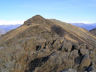
Monte Colombano is a mountain in the Alpi di Lanzo, a sub-group of the Graian Alps, with an elevation of 1,658 m.

Monte Bo

Monte Bo is a mountain in the Alpi Biellesi, a sub-range of Pennine Alps.

Alpi Cusiane

The Alpi Cusiane are a sub-range of the Pennine Alps located in Piemonte (Italy).

Monte Orsiera

Monte Orsiera is a mountain in the Cottian Alps belonging to the Province of Turin (Italy).

Val Grande National Park

Val Grande National Park is a protected area located in Piedmont, in the north of Italy, at the border with Switzerland. It is most notable for landscapes of the High Alps.

Punta Sulè Mountain in Italy

Punta Sulè is a 3,384 m a.s.l.mountain of the Graian Alps, located in Italy.

Bric Ghinivert Mountain in Italy

Bric Ghinivert or Eiminàl is a mountain of the Cottian Alps located in Italy.

Monte Politri Mountain in Italy

Monte Politri or Bric Rosso is a 3,026 m a.s.l. mountain of the Cottian Alps, located in Italy.
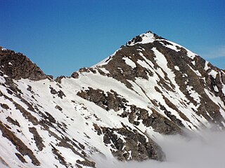
Punta Tempesta Mountain in Italy

Punta Tempesta is a 2,679 m a.s.l. mountain of the Cottian Alps, located in Italy.

Cime de Capoves

The Cime de Capoves (French) or Cima Capoves (Italian) is a mountain of the Ligurian Alps located in the French region of Provence-Alpes-Côte d'Azur, close to the French-Italian border.

Monte Monega Mountain in Italy

Monte Monega is a 1,882-metre (6,175 ft) mountain of the Ligurian Alps, in Italy.

Cime de Missun

The Cime de Mussun (French) or Cima Missun (Italian) is a mountain of the Ligurian Alps.

Monte Civrari Mountain in Italy

The Monte Civrari is a mountain of the Graian Alps, with an elevation of 2,302 m.

Bric Costa Rossa Mountain in Italy

The Bric Costa Rossa is a mountain of the Ligurian Alps located in Piedmont.

Cima della Fascia Mountain in Italy

The Cima della Fascia is a mountain of the Ligurian Alps located in Piedmont.

Monte Mongioie Mountain in Italy

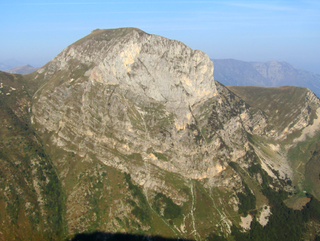
The Monte Mongioie is a mountain of the Ligurian Alps located in Piedmont.

Monte Antoroto Mountain in Italy

The Monte Antoroto is a mountain of the Ligurian Alps located in Piedmont.

Cima delle Saline Mountain in Italy

The Cima delle Saline is a mountain of the Ligurian Alps located in Piedmont.

Cima Ciantiplagna Mountain in Italy

The Cima Ciantiplagna is a mountain in the Cottian Alps belonging to the Province of Turin (Italy).

Monte Massone Mountain in Italy

The Monte Massone, at an elevation of 2,161 m (7,090 ft), is a mountain of the Pennine Alps in North-western Italy.

References

  1. Ball, John (1873). "Lepontine Alps". The Alpine guide. London: Longmans, Green & Co. p. 318. Retrieved 2020-04-19.
  2. Ceragioli, Filippo; Molino, Aldo; Salvatore, Mariano (2009). "422 - Monte Zeda (2156 m)". A piedi in Piemonte. A piedi in Italia (in Italian). 3. Subiaco: Iter edizioni. pp. 152–153. ISBN   9788881771400..
  3. Marazzi, Sergio (2005). Atlante Orografico delle Alpi. SOIUSA (in Italian). Priuli & Verlucca. p. 140. ISBN   978-88-8068-273-8.
  4. Lago Maggiore versante occidentale in mountain bike: 28 itinerari (in Italian). Ediciclo Editore. 1997. p. 128. ISBN   9788885327771 . Retrieved 2020-04-19.
  5. "Percorso n° 20 Falmenta - Fornà - Zeda" (in Italian). Comunità montana Valle Cannobina. Retrieved 2020-04-19.
  6. AA. VV. (14 June 2018). "Pian Cavallone". Guida ai rifugi del CAI: 363 rifugi del club alpino per scoprire la montagna (in Italian). RCS MEDIAGROUP (Solferino Libri). p. 173. ISBN   9788828200734 . Retrieved 2020-04-19.

Maps