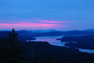
The Fulton Chain of Lakes is a string of eight lakes located in the Adirondack Park in upstate New York, United States. The chain is the dammed-up Moose River, and the dam which creates the chain holds back nearly 6.8 billion US gallons (26,000,000 m3) of water. The lakes are located in Herkimer and Hamilton Counties. Inlet, Old Forge, and Eagle Bay are towns on them. The chain begins near Old Forge and ends before it reaches Raquette Lake. The lakes are named for Robert Fulton, inventor of the steamboat, who proposed connecting the lakes to create an Adirondack canal. They are suitable for pontoon boats, kayaks, and motorboats. The chain is part of the 740-mile (1,190 km) Northern Forest Canoe Trail, which begins on First Lake and ends in Fort Kent, Maine.

Big Moose Lake, at the head of the Moose River, is a large lake about five miles (8 km) north of Fourth Lake in the Adirondacks in upstate New York. The lake is within both Herkimer and Hamilton counties, and covers portions of the towns of Webb and Long Lake. Located southwest of the lake is the hamlet of Big Moose.

Indian Lake is a 12-mile (19 km) long, 4,255-acre (1,722 ha) reservoir with a southwest to northeast orientation in the towns of Indian Lake and Lake Pleasant in Hamilton County, in the Adirondack Park of New York State, in the United States. The hamlet of Indian Lake is located 2 miles (3.2 km) north of the north end of Indian Lake. New York State Route 30 runs along the west shore of the lake. Most of the shore is part of the Forest Preserve. Indian Lake is fed by the Jessup River, and drains through the Indian River into Lake Abanakee, and from there through the Indian River to the Hudson River.

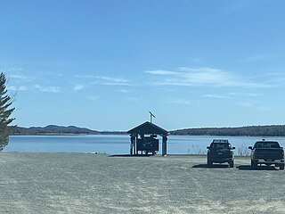
Stillwater Reservoir is a man-made lake located by Beaver River, New York within the Western Adirondacks. The lake has a large amount of recreational uses including camping, canoeing, boating, fishing, hunting, snowmobiling, and cross-country skiing. The lake has undeveloped edges with remote camping on both the islands and the shoreline. Camping permits and lake information may be obtained from the hamlet of Stillwater at the Forest Ranger Headquarters. Fish species present in the reservoir are smallmouth bass, splake, rock bass, yellow perch, sunfish and brown trout. There is a state owned hard surface ramp on Stillwater Road, 28 miles east of Lowville, New York. the record low temperature for the state of New York of −52 °F (−47 °C) took place at Stillwater Reservoir, and was later tied by Old Forge on February 17, 1979.
Big Otter Lake is located west of Thendara, New York. Fish species present in the lake are brook trout, white sucker, sunfish, yellow perch, and black bullhead. Trail access off NY-28 via Big Otter Lake Trail. No motors are allowed on Big Otter Lake.
Twitchell Lake is a lake located northeast of Big Moose, New York. The outlet is Twitchell Creek which flows into Stillwater Reservoir. Fish species present in the lake are brook trout, yellow perch, and black bullhead. There is a state owned beach launch located on Twitchell Road. There is not a horsepower motor limit on Twitchell Lake. Twitchell Mountain is located northwest of Twitchell Lake.
Middle Branch Lake is located west of Thendara, New York. The outlet is Middle Branch. Fish species present in the lake are sunfish, brook trout, and white sucker. There trail access off Route 28 on north shore via Big Otter Lake Trail. No motors are allowed on this lake.
Little Safford Lake is located southeast of Carter Station, New York. The outlet creek flows into the North Branch Moose River. Fish species present in the lake are white sucker, black bullhead, brook trout, yellow perch, and sunfish. Trail access with permit on Webb-Inlet Trail.
South Pond is a lake northeast of Big Moose, New York. The outlet creek flows into Twitchell Creek. Fish species present in the lake are brown trout, brook trout, and lake trout. There is trail access on the south shore. No motors are allowed on this lake.
West Pond is located east of Big Moose, New York. The outlet creek flows into Big Moose Lake. Fish species present in the lake are brown trout, brook trout, and brown bullhead. There is carry down access on the north shore.
Bubb Lake is located west of Eagle Bay, New York. The outlet creek flows into North Branch Moose River. Fish species present in the lake are brook trout, and brown bullhead. There is carry down access trail off Route 28. In the 1800's the lake was known as Bub's Lake. The lake was named after Otis "Bub" Arnold Jr., who lived nearby and hunted for deer there.
Lower Sister Lake is located northwest of the hamlet of Raquette Lake, New York. Fish species present in the lake are brook trout, yellow perch, and black bullhead. There is a trail from the east shore of Big Moose Lake. No motors are allowed on this lake.
Russian Lake is located west of Raquette Lake, New York. Fish species present in the lake are black bullhead, and yellow perch. There is trail access from the east shore of Big Moose Lake.

Cascade Lake is a lake located north of Inlet, New York. Fish species present in the lake are black bullhead, brook trout, white sucker and yellow perch. There is carry down access on the north shore off a trail from Big Moose Road. No motors are allowed on this lake.

Beaver Lake is located north of Morehouseville, New York. Fish species present in the lake are brook trout, brown trout, white sucker, black bullhead, and pumpkinseed sunfish. There is a carry down access on the northeast shore off trail. No motors are allowed on this lake.
Round Pond is a lake located south of Indian Lake, New York. Fish species present in the lake are brown trout, black bullhead, sunfish, and white sucker. Access to the lake via trail from Big Brook Road. No motors are allowed on this lake.
Cedar Lake is located northwest of Sled Harbor, New York. Fish species present in the lake are brook trout, black bullhead, and white sucker. There is trail access on the north and west shores from Sled Harbor. There is also trail access to Whitney Lake. No motors are allowed on this lake.
Little Moose Pond is a lake located north of Piseco, New York. Fish species present in the lake are brook trout, and white sucker. There is trail access off the road on the east shore. No motors are allowed on this lake.
Trout Lake is located west of Bolton, New York. Fish species present in the lake are brook trout, rainbow trout, splake, lake trout, smallmouth bass, largemouth bass, pickerel, yellow perch, smelt, rock bass, rainbow smelt, brown trout and brown bullhead. There is a carry down trail on the northeast shore via trail off Lamb Hill Road. There is a 50 horsepower motor limit on this lake. It is called Trout Lake due to the high numbers of lake trout and rainbow trout that are found in the lake. It is also shaped like a trout.
Trout Lake is located south of Averys Place, New York. Fish species present in the lake are pickerel, white sucker, yellow perch, and brown bullhead. There is access by trail from County Route 10. No motors are allowed on the lake.


