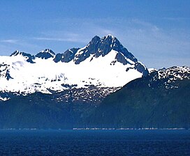
Mount Silverheels is a high and prominent mountain summit in the Front Range of the Rocky Mountains of North America. The 13,829-foot (4,215 m) thirteener is located in Pike National Forest, 4.9 miles (7.9 km) northeast of the Town of Alma in Park County, Colorado, United States.
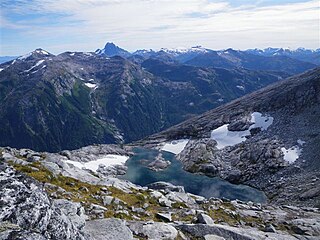
The South Baranof Wilderness is a federally designated wilderness area within the Tongass National Forest, located on Baranof Island, Alaska. Covering 319,568 acres south of Sitka, the South Baranof protects glacier-carved fjords, hanging valleys, old-growth temperate rainforests and sheer granite mountains.

Stroller White Mountain, also known as Mount Stroller White, is a 5,118-foot (1,560 m) mountain summit located in the Boundary Ranges, in the U.S. state of Alaska. The peak is situated near the toe of the Mendenhall Glacier, within Tongass National Forest, 12 mi (19 km) north-northwest of Juneau, Alaska, and 8 mi (13 km) north of Juneau International Airport. Although modest in elevation, relief is significant since the mountain rises up from sea-level in less than seven miles. Stroller White Mountain is often seen and photographed with McGinnis Mountain, a 4,199-foot (1,280 m) summit 1.6 mi (3 km) south, because they are together in the background behind Mendenhall Lake, a popular tourist and recreation area.
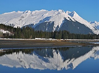
Mount Ernest Gruening is a 6,015+ ft glaciated mountain summit located in the Boundary Ranges of the Coast Mountains, in the U.S. state of Alaska. The long ridge-like mountain is situated between the Herbert Glacier and Eagle Glacier at the west edge of the Juneau Icefield, 20 mi (32 km) northwest of Juneau, Alaska, and 8 mi (13 km) east of Favorite Channel, on land managed by Tongass National Forest. Although modest in elevation, relief is significant since the east face of the mountain rises over 3,500 feet above the Herbert Glacier in less than one mile, and the west aspect rises 5,800 feet above the Eagle River valley in two miles.
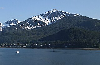
Mount Bradley is a 3,337-foot (1,017 m) elevation mountain summit located on Douglas Island in the Alexander Archipelago, in the U.S. state of Alaska. It is the third-highest peak on the island, and is situated 4 mi (6 km) south of Juneau, on land managed by Tongass National Forest. Although modest in elevation, relief is significant since the peak rises up from tidewater of Gastineau Channel in approximately two miles. Its nearest higher neighbor is Mount Ben Stewart, 5.6 mi (9 km) to the northwest.

Sinclair Mountain is a prominent 6,800+ ft mountain summit located in the Boundary Ranges of the Coast Mountains, in the U.S. state of Alaska. The peak is situated 26 mi (42 km) south of Skagway, and 15 mi (24 km) north of Lions Head Mountain, on land managed by Tongass National Forest. Although modest in elevation, relief is significant since Sinclair Mountain rises 6,800 feet above the entrance to Chilkoot Inlet in 3.5 mi (6 km). The peak's name was established in 1920 by the United States Coast and Geodetic Survey to remember Cephas Hempstone Sinclair (1847–1920), hydrographic and geodetic engineer who had 47 years of field service with that agency. The mountain's toponym was officially adopted in 1920 by the U.S. Board on Geographic Names. The first ascent of this seldom climbed peak was made in mid-June 1973 by Jerry Buckley, Joe Greenough, and Craig Lingle.
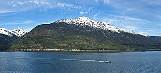
Face Mountain is a 5,052 ft (1,540 m) mountain summit located in the Boundary Ranges of the Coast Mountains, in the U.S. state of Alaska. The peak is situated 4.2 mi (7 km) west-northwest of Skagway, and 4.3 mi (7 km) north of Mount Harding, on land managed by Tongass National Forest. Although modest in elevation, relief is significant since Face Mountain rises above tidewater of Taiya Inlet in less than 2.5 miles. This geographic feature was named "Parsons Peak" in 1897 by the United States Coast and Geodetic Survey, and has had variant names "Gnome Mountain", and "The Sphinx" used locally to describe a face in the rock. The mountain's present name and summit location was officially adopted in 1985 by the U.S. Board on Geographic Names, however USGS maps still show the old name, Parsons Peak, as the summit. Precipitation runoff from the mountain drains into tributaries of Taiya Inlet.

Mount Robert Barron is a 3,475-foot (1,059 m) elevation mountain summit located on Admiralty Island in the Alexander Archipelago, in the U.S. state of Alaska. It is the highest point on the island's Mansfield Peninsula, and is situated 16 mi (26 km) west-southwest of Juneau, on land managed by Tongass National Forest. Although modest in elevation, relief is significant since the peak rises up from tidewater at Funter Bay on Lynn Canal in less than two miles, and from Stephens Passage to the east in less than three miles.
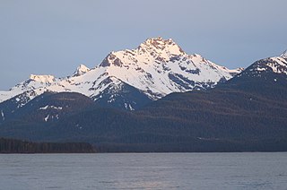
Eagle Peak is a prominent 4,650-foot (1,417 m) elevation mountain summit located on Admiralty Island in the Alexander Archipelago, in the U.S. state of Alaska. It is the second-highest peak on the island, and is situated 14 mi (23 km) southwest of Juneau, within Admiralty Island National Monument, on land managed by Tongass National Forest. Although modest in elevation, relief is significant since the peak rises up from tidewater at Stephens Passage in 4.5 mi (7 km). This geographic feature's local name was published by the U.S. Geological Survey in 1951.

Mount Carmack is a prominent 6,808-foot-elevation (2,075-meter) mountain summit located in the Boundary Ranges of the Coast Mountains, in the U.S. state of Alaska. The peak is situated 7 mi (11 km) north-northeast of Skagway, and 3.5 mi (6 km) south of Mount Cleveland, on land managed by Tongass National Forest. As the highpoint on the divide between the Taiya River and the Skagway River, precipitation runoff from the mountain drains east into the Skagway River and west into Taiya River, both of which empty into Taiya Inlet. Although modest in elevation, relief is significant since Mount Carmack rises 6,800 feet above the Taiya valley in less than 2 mi (3 km), and 5,800 feet above Skagway valley in about 2 miles. Mount Carmack has a lower subsidiary summit, elevation 6,621 ft (2,020 m), about 0.5 mi (1 km) to the northeast of the true summit. The USGS topographic map has this lower northeast peak labelled as Mount Carmack.

Wasatch Peak is a 13,156-foot elevation (4,010 m) mountain summit located in Summit County, Utah, United States.
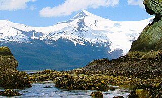
Mount Sumdum is a 6,666-foot-elevation (2,032-meter) mountain summit in Alaska, United States.
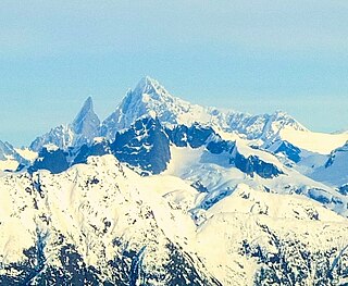
Mount Burkett is a 9,730-foot-elevation (2,966-meter) mountain summit in Alaska, United States.

Ptarmigan Peak is a 2,972-foot-elevation (906-meter) mountain summit in Alaska, United States.

Mount Bagot is a 2,181-metre (7,156-foot) mountain summit located on, and in part defining, the international border between British Columbia, Canada, and Alaska, United States.
Mount Ogilvie is a 7,867-foot-elevation (2,398-meter) mountain summit located on, and in part defining, the international border between Alaska, United States, and British Columbia, Canada.

Mount Leland is a 7,810-foot-elevation (2,380-meter) glaciated mountain summit located in the Boundary Ranges of the Coast Mountains, in the U.S. state of Alaska. It is situated 27 miles (43 km) southeast of Skagway along the western edge of the Juneau Icefield, on land managed by Tongass National Forest. Topographic relief is significant as the summit rises 4,400 feet (1,340 m) above the Meade Glacier in 1.25 mi (2.01 km). Precipitation runoff and glacial meltwater from the mountain drains to Lynn Canal via the Katzehin River. Mount Leland's toponym was officially adopted in 1972 by the U.S. Board on Geographic Names to commemorate surveyor Ora Miner Leland (1876–1962), who led the International Boundary Commission Party of 1907. The peak rises a little over four miles (6.4 km) from the US–Canada boundary.

Observation Peak is a 4,931-foot (1,503 m) mountain summit located in the Boundary Ranges of the Coast Mountains, in the U.S. state of Alaska. The peak is situated 4.5 miles (7.2 km) northeast of Juneau along the southern periphery of the Juneau Icefield, on land managed by Tongass National Forest. Precipitation runoff and glacial meltwater from the mountain drains to Gastineau Channel via Lemon and Salmon creeks, whereas the southeast slope drains to Taku Inlet via Carlson Creek. Although modest in elevation, relief is significant as the summit rises over 3,700 feet (1,128 m) above Salmon Creek Reservoir in 1.6 miles (2.6 km). This peak's local name was published in 1962 by the U.S. Geological Survey and the toponym has been officially adopted by the U.S. Board on Geographic Names.

Virginia Peak is a 3,760-foot (1,146 m) mountain summit in Alaska, United States. The peak is located 17 miles (27 km) south-southwest of Wrangell in Tongass National Forest on Etolin Island. Precipitation runoff from the mountain's slopes drains to Anita Bay and Zimovia Strait. Although modest in elevation, topographic relief is significant as the summit rises from sea-level at Anita Bay in 1.3 miles (2.1 km). The mountain was named in 1886 by US Navy Lieutenant Commander Albert Sydney Snow in command of the United States Coast and Geodetic Survey steamer Patterson, and the toponym has been officially adopted by the United States Board on Geographic Names. Virginia Peak is the southernmost peak of the "Three Sisters" along with Helen Peak (3,856 ft) and Bessie Peak (3,915 ft).

The Sisters are mountain summits in Alaska, United States.
