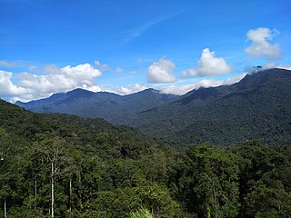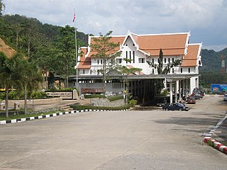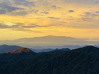
Taman Negara is a national park in Peninsular Malaysia. It was established in 1938/1939 as the King George V National Park after Theodore Hubback lobbied the sultans of Pahang, Terengganu and Kelantan to set aside a piece of land that covers the three states for the creation of a protected area. It was renamed Taman Negara after independence, which means "national park" in Malay. Taman Negara has a total area of 4,343 km2 and it is one of the world's oldest deciduous rainforests, estimated to be more than 130 million years old.

The Titiwangsa Mountains, also known as Banjaran Besar by locals, is the chain of mountains that forms the backbone of the Malay Peninsula. The northern section of the range is in southern Thailand, where it is known as Sankalakhiri Range.
East–West Highway or also known as Gerik–Jeli Highway, Kulim–Baling Highway and Titi Karangan–Gerik Highway, Federal Route 4, Asian Highway Route 140 is the 215 kilometres (134 mi) federal highway constructed by the Malaysian Public Works Department (JKR) to shorten the journey from Kota Bharu, Kelantan to northwestern towns and cities of Malaysia such as Alor Star, Kedah and Penang. The highway connects Gerik, Perak in the west to Jeli, Kelantan in the east, before being extended further to Lunas, Kedah.

Mount Batu Brinchang, or Mount Brinchang, is a mountain in the Titiwangsa Range, situated on the border between the Malaysian states of Pahang and Perak. At 2,032 metres above sea level, it is the second highest mountain in the Cameron Highlands region, as well as the highest mountain in the area that can be accessed by car. It is one of the mountains in Malaysia where its summit can be reached by road. Due to easy accessibility, this mountain enjoys many visitors all year round.
This article lists important figures and events in Malayan public affairs during the year 1955, as well as births and deaths of significant Malayans.

Betong is the southernmost district (amphoe) of Yala province, southern Thailand.

The Senoi Praaq is a unit of the Royal Malaysia Police made up almost entirely of the tribal people of Peninsular Malaysia known as the Orang Asli (aborigines). The name Senoi Praaq means war people or those who fight in the Semai language. Roy Davis Linville Jumper considered them one of the finest jungle fighting forces and was highly successful in diminishing the threat by communist forces during the Malayan Emergency.

Mount Korbu is a mountain in Hulu Kinta, Perak, Malaysia, about 25 km from Ipoh. It is the highest peak in the state of Perak, located on the Titiwangsa Mountains, the southernmost section of the Tenasserim Hills.
Mount Gayong is a mountain in Peninsular Malaysia, situated within the Titiwangsa Range along the border between the states of Perak and Kelantan. It is fourth highest mountain in the Malay Peninsula, at 2,173 metres. It can be reached in about an hour's trek from the peak of Mount Korbu, the highest mountain of the range and the second highest mountain in Peninsular Malaysia. Due to the close proximity between the two mountains, they are collectively known as Korga among the hiking and mountaineering community.

The Communist insurgency in Malaysia, also known as the Second Malayan Emergency, was an armed conflict which occurred in Malaysia from 1968 to 1989, between the Malayan Communist Party (MCP) and Malaysian federal security forces.
The New Zealand armed forces saw action in Malaysia throughout the 1950s and 1960s, first as part of the British Commonwealth response to the Malayan Emergency, and then in defence of Malaysia in the Indonesia–Malaysia confrontation.

Mount Yong Yap is a mountain located along the Perak and Kelantan state border in Peninsular Malaysia. At 2,168 m (7,113 ft), it is the third highest mountain in Kelantan and the sixth highest in Peninsular Malaysia. This mountain is part of the Titiwangsa Range which is an extension of the Tenasserim Range from Myanmar and Thailand.

The communist insurgency in Sarawak was an insurgency in Malaysia from 1962 to 1990, and involved the North Kalimantan Communist Party and the Malaysian Government. It was one of the two Communist insurgencies to challenge the former British colony of Malaysia during the Cold War. As with the earlier Malayan Emergency (1948–1960), the Sarawak Communist insurgents were predominantly ethnic Chinese, who opposed British rule over Sarawak and later opposed the merger of the state into the newly created Federation of Malaysia. The insurgency was triggered by the 1962 Brunei Revolt, which had been instigated by the left-wing Brunei People's Party in opposition to the proposed formation of Malaysia.

The Lojing Autonomous Sub-District, or colloquially known as the Lojing Highlands, is a mountainous region in Gua Musang District, Kelantan, Malaysia. It is located next to the famed Cameron Highlands in Pahang, along the Second East-West Highway Federal Route 185.

Mount Yong Belar is a mountain on the border of the states Kelantan and Perak in the Titiwangsa Mountains of Malaysia. Its summit is 2,181 m (7,156 ft) above sea level, making it the highest mountain in the state of Kelantan, and the third highest in Peninsular Malaysia, behind Mounts Tahan and Korbu, the latter being located 8 km north.

Mount Benum or Mount Benom is a mountain in the state of Pahang in Malaysia. Its summit is 2,107 m (6,913 ft) above sea level. The mountain is located in a centre of an isolated massif east of the Titiwangsa Mountains.

Mining is one of the main industries in Malaysia. Malaysia produces aggregate, bauxite, clay, coal, copper, feldspar, gold, gravel, ilmenite, iron ore, kaolin, limestone, mica, monazite, sand, silica sand, struverite and tin.

The Peninsular Malaysian montane rain forests is an ecoregion on the Malay Peninsula. It occupies the mountainous spine of the peninsula in Malaysia and southernmost Thailand. It is in the tropical and subtropical moist broadleaf forests biome.

Mount Setong or Mount Stong is a mountain located in Dabong, southern Kuala Krai District, Kelantan, Malaysia. It is situated approximately 300 km (186 mi) from Kota Bharu, the state capital. While it stands within Kuala Krai, it is also relatively closer to Gua Musang.
Nepenthes limiana is a tropical pitcher plant endemic to the northern Titiwangsa Range in Peninsular Malaysia. Nepenthes limiana was compared to Nepenthes sericea and Nepenthes sanguinea. The species differs from N. sericea by its upper pitchers being narrowly cylindrical which has an infundibular base with a pitcher hip on the lower part as compared to the wholly infundibular pitcher with a pitcher hip just below the mouth or pitchers that are basally infundibular turning cylindrical to slightly infundibular above the medial hip in N. sericea. Additionally, the narrowly oblanceolate to almost linear laminae that are slightly decurrent and the proportionally wider and bulbous peristome of the lower pitchers which are often flared and crenellated characterize this species from the sessile and oblanceolate to obovate-oblong laminae and the proportionally thinner peristome that are expanded near column only and not crenellated in N. sericea.


