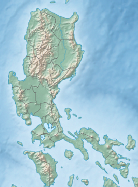
The Zambales Mountains is a mountain range on western Luzon island in the Philippines. The mountains spread along a north-south axis, separating Luzon's central plain from the South China Sea. The range extends into five provinces: Zambales, Pangasinan, Tarlac, Pampanga, and Bataan. One of its most prominent sections is known as the Cabusilan Mountain Range composed of Mount Pinatubo, Mount Negron and Mount Cuadrado, which are believed to be remnants of the ancestral Pinatubo peak. The highest elevation in the Zambales Mountains is Mount Tapulao, also known as High Peak, in Zambales province which rises to 2,037 metres (6,683 ft).

Pampanga, officially the Province of Pampanga (Kapampangan: Lalawigan ning Pampanga; Ilocano: Probinsia ti Pampanga; Pangasinan: Luyag/Probinsia na Pampanga; Tagalog: Lalawigan ng Pampanga, is a province in Central Luzon in the Philippines. Lying on the northern shore of Manila Bay, Pampanga is bordered by Tarlac to the north, Nueva Ecija to the northeast, Bulacan to the east, Manila Bay to the central-south, Bataan to the southwest and Zambales to the west. Its capital is the City of San Fernando, the regional center of Central Luzon. Angeles City is the largest LGU, but while geographically within Pampanga, it is classified as a first-class, highly urbanized city and has been governed independently of the province since it received its charter in 1964.

Zambales, officially the Province of Zambales, is a province in the Philippines located in the Central Luzon region. Its capital is Iba, which is located in the middle of the province. Olongapo is the largest city of the province wherein it is geographically located but politically independent.

Tarlac, officially the Province of Tarlac, is a landlocked province in the Philippines located in the Central Luzon region. Its capital is the city of Tarlac, which is the most populous in the province. It is bounded on the north by the province of Pangasinan, Nueva Ecija on the east, Zambales on the west, and Pampanga in the south. The province comprises three congressional districts and is subdivided into 17 municipalities and one city, Tarlac City, which is the provincial capital.

Central Luzon, designated as Region III, is an administrative region in the Philippines. The region comprises seven provinces: Aurora, Bataan, Bulacan, Nueva Ecija, Pampanga, Tarlac, and Zambales; and two highly urbanized cities, Angeles and Olongapo. San Jose del Monte is the most populous city in the region. The region contains the largest plain in the country and produces most of the country's rice supply, earning itself the nickname "Rice Granary of the Philippines". It is also the region to have the most number of provinces.

Mount Pinatubo is an active stratovolcano in the Zambales Mountains in Luzon in the Philippines. Located on the tripoint of Zambales, Tarlac and Pampanga provinces, most people were unaware of its eruptive history before the pre-eruption volcanic activity in early 1991. Dense forests, which supported a population of several thousand indigenous Aetas, heavily eroded and obscured Pinatubo.

Iba, officially the Municipality of Iba, is a 1st class municipality and capital of the province of Zambales, Philippines. According to the 2020 census, it has a population of 55,581 people.

Masinloc, officially the Municipality of Masinloc, is a 1st class municipality in the province of Zambales, Philippines. According to the 2020 census, it has a population of 54,529 people.

Bamban, officially the Municipality of Bamban, is a 2nd class municipality in the province of Tarlac, Philippines. According to the 2020 census, it has a population of 78,260 people.
Capas, officially the Municipality of Capas, is a 1st class municipality in the province of Tarlac, Philippines, and one of the richest towns in the province. The town also consists of numerous subdivisions and exclusive villages.

Tarlac City, officially the City of Tarlac, is a 1st class city and the capital of the province of Tarlac, Philippines. According to the 2020 census, it has a population of 385,398 people making it the most populous in the province.

The Agno River, also known as the Pangasinan River, is a river on the island of Luzon in the Philippines. Traversing the provinces of Benguet, Pangasinan, and Tarlac, it is one of the largest river systems in the country, with a drainage area of 5,952 square kilometres (2,298 sq mi).

Victory Liner, Inc. (VLI) is a bus company in the Philippines that was established in 1945 by José Hernandez, is recognized as one of the primary providers of bus transportation in the Philippines, servicing key locations across Luzon. Initially using a fleet of repurposed military vehicles, the company was instrumental in meeting the post-WWII demand for public transport.
The Sambalic languages are a part of the Central Luzon language family spoken by the Sambals, an ethnolinguistic group on the western coastal areas of Central Luzon and the Zambales mountain ranges.
Abellen, Abenlen, Aburlin, or Ayta Abellen, is a Sambalic language. It has about 3,500 speakers and is spoken in a few Aeta communities in Tarlac province, Philippines. Ayta Abellen itself is part of the Sambalic language family in the Philippines and is closely related to not only the five other Ayta dialects but also the Botolan dialect of Sambal. Ethnologue reports 45 monolinguists.

The Diocese of Iba is a Latin Church ecclesiastical jurisdiction or diocese of the Catholic Church in the Philippines that comprises the province of Zambales and City of Olongapo.

Iba Airport is an airport serving the general area of Iba, located in the province of Zambales in the Philippines. It is one of the five airports in Zambales. It is classified as a feeder airport by the Air Transportation Office, a body of the Department of Transportation that is responsible for the operations of not only this airport but also of all other airports in the Philippines except the major international airports. Iba Airport serves as a training area for the Philippine Air Force and today, most of the traffic that goes in Iba Airport are general aviation.

Mount Tapulao is the highest mountain in the Zambales Mountain Range and in the province of Zambales in the Philippines. The peak, which rises to an elevation of 2,037 metres (6,683 ft) above sea level, and is located in the municipality of Palauig, Zambales. Its name is derived from the abundance of Sumatran Pine trees in the area, known in Zambal as tapolaw.

Romulo Highway, also known as Carlos P. Romulo Highway, is a 77.2-kilometer (48.0 mi) major highway in the Philippines that connects the provinces of Tarlac and Pangasinan. It is alternatively known as Tarlac–Pangasinan Road from Tarlac City to Bugallon, Pangasinan and as a component of Pangasinan–Zambales Road and Bugallon–Lingayen Road from Bugallon to Lingayen.
The Monasterio de Tarlac is a Catholic monastery on top of Mount Resurrection, part of the Zambales Mountain Range on the island of Luzon in the Philippines. It is part of the Mount Resurrection Eco Park in Barangay Lubigan, San José, Tarlac. It houses a relic believed to be a fragment of the True Cross of Jesus.