Related Research Articles

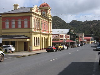
Queenstown is a town in the West Coast region of the island of Tasmania, Australia. It is in a valley on the western slopes of Mount Owen on the West Coast Range.

Zeehan is a town on the west coast of Tasmania, Australia 139 kilometres (86 mi) south-west of Burnie. It is part of the West Coast Council, along with the seaport Strahan and neighbouring mining towns of Rosebery and Queenstown.

The Lyell Highway is a highway in Tasmania, running from Hobart to Queenstown. It is the one of two transport routes that passes through the West Coast Range, the other being the B28 Anthony Road.

The West Coast Range is a mountain range located in the West Coast region of Tasmania, Australia.
The North Mount Lyell disaster refers to a fire that broke out on 12 October 1912 at the Mount Lyell Mining and Railway Company operations on the West Coast of Tasmania, killing 42 miners. The mine had been taken over from the North Mount Lyell Company in 1903.
Mount Read is a mountain located in the West Coast region of Tasmania, Australia, and is at the north west edge of the West Coast Range.
Crotty is the site of a former gazetted town in Western Tasmania, Australia. The town was on the southern bank of the King River, on the eastern lower slopes of Mount Jukes, below the West Coast Range. The locality was formerly named King River

The North Mount Lyell Railway was built to operate between the North Mount Lyell mine in West Coast Tasmania and Pillinger in the Kelly Basin of Macquarie Harbour.

Mount Owen is a mountain directly east of the town of Queenstown on the West Coast Range in Western Tasmania, Australia.

The Queen River, part of the King River catchment, is a minor perennial river located in the West Coast region of Tasmania, Australia. It is notable for its high level of pollution caused by mining runoff which has led the river to be uninhabitable to life.

Mount Jukes is a mountain located on the Jukes Range, a spur off the West Coast Range, in the West Coast region of Tasmania, Australia.
The history of the railways on the West Coast of Tasmania has fascinated enthusiasts from around the world, because of the combination of the harsh terrain in which the railways were created, and the unique nature of most of the lines.
The Strahan–Zeehan Railway, also known as the "Government Railway", was a railway from Strahan to Zeehan on the west coast of Tasmania.
William Harper Twelvetrees was an English geologist who was important for the characterisation of the geology of Tasmania.
Thomas Bather Moore was a pioneer explorer of Western and South West, Tasmania, Australia.
Lake Selina is a natural glacial lake located to the east of Mount Read, in the West Coast Range, on the west coast of Tasmania, Australia.

Philosophers Ridge is the long spur that connects Mount Lyell and Mount Owen in the West Coast Range of Western Tasmania.
Zeehan Highway is a road between Zeehan and Queenstown in Western Tasmania.
The Mount Lyell Standard was a Queenstown based newspaper in Western Tasmania, that was contemporaneous with the Zeehan and Dundas Herald. It was also known as the Mount Lyell Standard & Strahan gazette. The newspaper operated between 1896 and 1902.
References
- Blainey, Geoffrey (2000). The Peaks of Lyell (6th ed.). Hobart: St. David's Park Publishing. ISBN 0-7246-2265-9.
- Whitham, Charles (2003). Western Tasmania – A land of riches and beauty (Reprint 2003 ed.). Queenstown: Municipality of Queenstown.
- Whitham, Lindsay (2002). Railways, Mines, Pubs and People and other historical research. Sandy Bay: Tasmanian Historical Research Association. ISBN 0-909479-21-6.
- Wyman, B., Cooke, D. and Large, R. Granite Related Copper-Gold Mineralisation in the Southern Mount Read Volcanics, Western Tasmania, Australia pp. 17–20 . 1997. Third International Mining Geology Conference, 10–14 November 1997 Launceston, Tasmania ISBN 1-875776-50-8