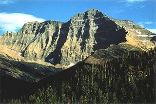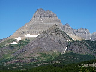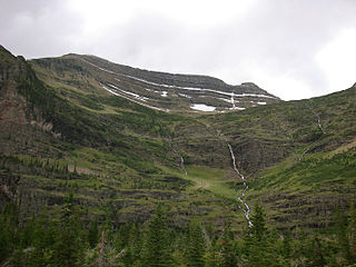
Glacier National Park is an American national park located in northwestern Montana, on the Canada–United States border, adjacent to the Canadian provinces of Alberta and British Columbia. The park encompasses over 1 million acres (4,000 km2) and includes parts of two mountain ranges, over 130 named lakes, more than 1,000 different species of plants, and hundreds of species of animals. This vast pristine ecosystem is the centerpiece of what has been referred to as the "Crown of the Continent Ecosystem," a region of protected land encompassing 16,000 square miles (41,000 km2).

The Beartooth Mountains are located in south central Montana and northwest Wyoming, U.S. and are part of the 944,000 acres (382,000 ha) Absaroka-Beartooth Wilderness, within Custer, Gallatin and Shoshone National Forests. The Beartooths are the location of Granite Peak, which at 12,807 feet (3,904 m) is the highest point in the state of Montana. The mountains are just northeast of Yellowstone National Park and are part of the Greater Yellowstone Ecosystem. The mountains are traversed by road via the Beartooth Highway with the highest elevation at Beartooth Pass 10,947 ft (3,337 m)). The name of the mountain range is attributed to a rugged peak found in the range, Beartooth Peak, that has the appearance of a bear's tooth.

Mount Stimson is the second highest peak in Glacier National Park, located in Montana, United States. It is part of the Lewis Range, which spans much of the park. It is located in the remote southwestern portion of the park, approximately 5 miles (8.0 km) west of the Continental Divide and 12 miles (19 km) southeast of Lake McDonald. It is drained by Pinchot Creek and Nyack Creek, both of which flow into the Middle Fork of the Flathead River. The mountain is named for Henry L. Stimson (1867–1950), former U.S. Secretary of State and twice Secretary of War, who hiked and assisted George Bird Grinnell survey the area in and around Glacier National Park in the 1890s, and supported efforts to establish the national park.

Mount Cleveland is the highest mountain in Glacier National Park, located in Montana, United States. It is also the highest point in the Lewis Range, which spans part of the northern portion of the Park and extends into Canada. It is located approximately 3 mi (4.8 km) southeast of the southern end of Waterton Lake, and approximately 5 mi (8.0 km) south of the US/Canada border. The east side of the future national park was purchased by the federal government from the Blackfoot Confederacy in 1895 during the second term of President Cleveland. According to the United States Board on Geographic Names, the mountain is named for the former president.

Heavens Peak is located in the Livingston Range, Glacier National Park in the U.S. state of Montana. Heavens Peak is a little more than 1 mile (1.6 km) north of McPartland Mountain.

Mount Wilbur is located in the Lewis Range, Glacier National Park in the U.S. state of Montana. Plainly visible from the region of Many Glacier, the peak rises over 4,500 feet (1,372 m) above Swiftcurrent Lake and is a steep pyramid on three sides. The west slopes of the peak join to ridges along the continental divide. Much of the climbing routes are rated at class 4 to 5, with some only used once. The sedimentary rock of the mountains makes for often poor anchoring points and enhances the difficulty. A cirque on the north slopes of the mountain shelter Iceberg Lake, a popular hiking destination from Many Glacier.

Kinnerly Peak is located in the Livingston Range, Glacier National Park in the U.S. state of Montana. It is approximately 1 mile (1.6 km) north of Kintla Peak, the highest peak in the Livingston Range, and 3 miles (4.8 km) south of the Canada–United States border. Both peaks are in the remote northwest corner of the park. Kinnerly Peak is the eighth tallest peak in Glacier National Park.

Mount Siyeh, with a height of 10,019 feet (3,054 m), is the fifth tallest and one of six peaks over 10,000 feet (3,048 m) in Glacier National Park, Montana, United States. Mount Siyeh was named after a Blackfeet Indian, Sai-yeh, whose name means "Crazy Dog" or "Mad Wolf."

Mount Jackson is located in the Lewis Range, Glacier National Park in the U.S. state of Montana. Mount Jackson is the fourth tallest mountain in Glacier National Park and it is situated on the Continental Divide. Both the mountain and its namesake Jackson Glacier are easily seen from the Going-to-the-Sun Road. Harrison Glacier, the park's largest remaining glacier, is located on the mountain's southern flank. Based on the Köppen climate classification, Mount Jackson has an alpine climate characterized by long, usually very cold winters, and short, cool to mild summers. Temperatures can drop below −10 °F with wind chill factors below −30 °F.

Kaiser Point is located in the Lewis Range, Glacier National Park in the U.S. state of Montana. Maps indicate the peak is listed only by the elevation of 9,996 ft (3,047 m) according to the Sea Level Datum of 1929, however the updated elevation by the currently implemented North American Vertical Datum of 1988 indicates the peak exceeds 10,000 ft (3,048 m). The National Park Service reports that six peaks rise to over 10,000 ft (3,048 m) in Glacier National Park, but Kaiser Point is listed as the seventh tallest. Kaiser Point is only .67 miles (1.08 km) northeast of Mount Cleveland, the tallest summit in the park.

Goat Haunt Mountain is located in the Lewis Range, Glacier National Park in the U.S. state of Montana. Goat Haunt Mountain is in the northeastern section of Glacier National Park, approximately 1.85 miles (2.98 km) north of Mount Cleveland. The stagnant Miche Wabun Glacier is located on the eastern slopes of the mountain. The total altitude gain from the trailhead to the mountain summit is more than 4,400 ft (1,300 m). Goat Haunt Lake is northwest of the peak.

Ipasha Peak is located in the Lewis Range, Glacier National Park in the U.S. state of Montana. Ipasha Peak is 1.29 miles (2.08 km) south of Mount Merritt and is in the northeastern section of Glacier National Park. Ahern Glacier is located on the southeastern slopes of the mountain while the Ipasha Glacier is to the southwest of the peak. Helen Lake lies almost 4,500 feet (1,400 m) below the summit of Ipasha Peak to the southeast.

Mount Ellsworth is located in the Lewis Range, Glacier National Park in the U.S. state of Montana. Mount Ellsworth is in the southeastern section of Glacier National Park and can be seen from Two Medicine Lake and surrounding areas. Mount Ellsworth is named, "for "Billy" Ellsworth, an oldtimer who packed for the U. S. Geological Survey."

Mount Helen is located in the Lewis Range, Glacier National Park in the U.S. state of Montana. Mount Helen rises immediately to the northwest roughly 3,100 feet (940 m) above Upper Two Medicine Lake in the southeastern part of Glacier National Park. The Continental Divide of the Americas passes over the summit of Mount Helen.

Norris Mountain is located in the Lewis Range, Glacier National Park in the U.S. state of Montana. Norris Mountain is situated along the Continental Divide and is less than 1 mile (1.6 km) northwest of Triple Divide Peak.

Mount Peabody is located in the Livingston Range, Glacier National Park in the U.S. state of Montana. Agassiz Glacier is located on the western slopes of Mount Peabody.

Mount Phillips is located in the Lewis Range, Glacier National Park in the U.S. state of Montana. Lupfer Glacier is located on the east slope of Mount Phillips.

Mount Pinchot is located in the Lewis Range, Glacier National Park in the U.S. state of Montana. Mount Pinchot is less than 1.5 miles (2.4 km) SSE of Mount Stimson while Beaver Woman Lake is southeast of Mount Pinchot.

Mount Thompson is located in the Lewis Range, Glacier National Park in the U.S. state of Montana.

Vigil Peak is located in the Lewis Range, Glacier National Park in the U.S. state of Montana. Lake Isabel is northwest of the peak.


