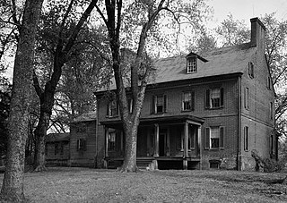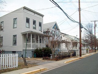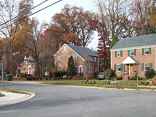
Mount Rainier is a city in Prince George's County, Maryland, United States, bordering Washington D.C.. The population was 8,333 at the 2020 census. Mount Rainier is contained between the Northwest Branch Anacostia River, Cedar Lane Alley, and 34th Street to the north, 37th Street and 37th Place to the northeast, Upshur Street and Queens Chapel Road to the west, the Cargo Train tracks to the east, and Eastern Avenue NE to the south. Mount Rainier got its start as a streetcar suburb, when tracks were laid for the 82 Streetcar Line. According to local tradition, surveyors from the Pacific Northwest named the town, giving the streets names such as Shasta and Cascade. Historic U.S. 1 runs through the center of the town and serves as the main street and central business district.

Piscataway is an unincorporated community in Prince George's County, Maryland, United States. It is one of the oldest European-colonized communities in the state. The Piscataway Creek provided sea transportation for export of tobacco. It is located near the prior Piscataway tribe village of Kittamaqundi.

Mount Washington is an area of northwest Baltimore, Maryland. It is a designated city historic district and divided into two sections: South Road/Sulgrave to the southeast and Dixon's Hill to the north. The Mount Washington Historic District was listed on the National Register of Historic Places in 1990 with a boundary increase in 2001, with five contributing buildings and four contributing structures.

Oxon Cove Park and Oxon Cove Farm is a national historic district that includes a living farm museum operated by the National Park Service, and located at Oxon Hill, Prince George's County, Maryland. It is part of National Capital Parks-East. It was listed on the National Register of Historic Places in 2003.

Mount Pleasant is 2+1⁄2-story brick structure with a gambrel roof and is about two-thirds its original length. It is located near Upper Marlboro in Prince George's County, Maryland. Mount Pleasant was patented in 1697 to Richard Marsham, whose wife Anne was the daughter of Leonard Calvert, Governor of Maryland. Their grandson, Marsham Waring, inherited the home from his grandfather in 1713. His son, Richard Marsham Waring had a son, Richard Marsham Jr., born in 1733, who then inherited Mount Pleasant and Patented and Certified the tract of land dubbed "Mount Pleasant Enlarged" in 1760. On August 21, 1764, Richard Marsham Jr. sold the 451 ¾ acre tract of land to his brother John for £474.6s.9d. John later built the standing house in the years between 1764 and 1785. John died in 1813 and was buried at Mount Pleasant.

The Spacecraft Magnetic Test Facility, also known historically as the Attitude Control Test Facility, is an experimental spacecraft test facility at the Goddard Space Flight Center in Greenbelt, Maryland, United States. It was built in 1966 to allow the evaluation of magnetic movement in manned and unmanned spacecraft, and for the precision calibration of magnetometers used in space flight. The building is constructed of non-magnetic materials and contains a magnetic coil system that allows the cancellation of the Earth's magnetic field. This unique building was designated a National Historic Landmark in 1985.

University Town Center, formerly New Town Center, is located in Hyattsville, Prince George's County, Maryland, United States. It was a planned urban center designed by Edward Durell Stone and located on a 105-acre (0.42 km2) parcel at the intersection of Belcrest Road and East-West Highway and across from the then new Prince George's Plaza. The initial construction on this development took place in 1963-64; its buildings are listed on the National Register of Historic Places. A second phase commenced after the opening of the Prince George's Plaza station, Washington Metro rapid transit station in 1993.

Langley Park, also known as McCormick-Goodhart Mansion, is a Colonial Revival style estate mansion in Langley Park, Prince George's County, Maryland. In 1924, the McCormick-Goodhart family erected an 18,000-square-foot (1,700 m2), 28-room Georgian Revival mansion, designed by architect George Oakley Totten, Jr., at a cost of $100,000 that remains a community landmark on 15th Ave.

Snow Hill is a manor house located south of Laurel, Maryland, off Maryland Route 197, in Prince George's County. Built between 1799 and 1801, the 1+1⁄2-story brick house is rectangular, with a gambrel roof, interior end chimneys, and shed dormers. It has a center entrance with transom and a small gabled porch. A central hall plan was used, with elaborate interior and corner cupboards. The original south wing was removed and rebuilt, and the home restored in 1940. The Late Georgian style house was the home of Samuel Snowden, part owner of extensive family ironworks, inherited from his father Richard Snowden. and is now owned and operated by the Maryland-National Capital Park and Planning Commission as a rental facility.
Avondale is an unincorporated community in Prince George's County Maryland, United States. It is contained between Eastern Avenue NE to the south, Queens Chapel Road (MD-500) to the east, and the Northwest Branch Anacostia River to the north and west.

The National Archives Site is an archeological site at the National Archives facility in College Park, Prince George's County, Maryland. The site contains archeological remains from prehistoric settlements during the Late Archaic period, c. 4000-1500 B.C. Stone artifacts recovered through archeological testing indicate that this camp served as a place of stone tool manufacture and probably as a staging point for hunting and foraging. Physical integrity of the prehistoric component is high, with little plow disturbance or admixture with artifacts from other periods. The presence of a small number of other artifacts, including the projectile points, a spokeshave, and utilized flakes, indicates that the site also served in other hunting and foraging pursuits. It is one of a relatively small percentage of known prehistoric properties in Maryland with undisturbed archeological deposits.

Calvert Hills Historic District is a national historic district in College Park, Prince George's County, Maryland. It is roughly bounded on the north by Calvert Road, on the east by the Green Line metrorail corridor, on the south by the northern boundary of Riverdale Park, and on the west by Baltimore Avenue. It does not include Calvert Park on the southeast corner. Primarily a middle-class single-family residential neighborhood, it also includes some apartment houses as well as the College Park Post Office, a contributing property at 4815 Calvert Road.

This is a list of the National Register of Historic Places listings in Prince George's County, Maryland.

Concord is a historic home located in District Heights, Prince George's County, Maryland. It is a 1790s 2+1⁄2-story Flemish bond brick house with a five-bay south facade, and a later two-part wing which stretches to the west. The home was built for Zachariah Berry, Sr. (1749-1845), a prosperous planter who had large landholdings in Maryland, the District of Columbia, and Kentucky. A great deal of the home's features are Greek Revival-influenced, dating from an 1860s renovation. A family cemetery and a number of 20th century outbuildings are located on the property.

Content, also known as the Bowling House, is a historic home located in Upper Marlboro, Prince George's County, Maryland, United States, across the street from the county courthouse. The home is a 2+1⁄2-story, two-part frame structure built in three stages. The first section, built in 1787, consisted of the present main block, with a stair hall and porch added ca. 1800. A north wing was added before 1844. Content is one of the oldest buildings remaining in the county seat of Upper Marlboro, along with Kingston and the Buck House. Content has always been owned by prominent families in the civic, economic, and social affairs of town, county, and state including the Magruder, Beanes, and Lee families; and the Bowling and Smith families of the 20th century.

Kingston, or Sasscer's House, is a 1+1⁄2-story historic home located at Upper Marlboro, Prince George's County, Maryland, United States. It is believed to be the oldest building remaining in the town of Upper Marlboro and may have been built, at least in part, before 1730. Many alterations and additions were made to it in the Victorian era, including "gingerbread" details typical of this era. The Craufurd family cemetery is located in the woods northwest of the house.
Nottingham is a small town on the Patuxent River in Prince George's County, Maryland, United States. It contains an archaeological site which was listed on the National Register of Historic Places in 1975.

St. Matthew's Church, also known as Addison Chapel, is a historic Episcopal church located at Seat Pleasant, Prince George's County, Maryland.

The North Brentwood Historic District, is a national historic district located in the town of North Brentwood, Prince George's County, Maryland. It was the earliest incorporated African American community in the county. The historic district comprises 128 buildings reflecting its development over the period from 1891 to 1950. All of the early vernacular dwellings were of wood-frame construction with Late Victorian inspiration. The 1920s house forms represented included bungalows, multi-family houses, and larger Foursquares. Small brick cottages were primarily built in the period immediately following World War II. The surviving historic buildings illustrate the forms and styles of buildings typically constructed in working-class suburban communities of the period.

The University Park Historic District is a national historic district located in the town of University Park, Prince George's County, Maryland. The district encompasses 1,149 contributing buildings and 2 contributing sites and is almost exclusively residential and developed as a middle-class, automobile suburb of Washington, D.C. The primary building type is the detached single-family dwelling, with the only non-residential buildings within the district and the town being two churches and the Town Hall, which is located in a former residence. Notable features within the district include the property's original plantation house, known as Bloomfield, and the nearby family cemetery. It was developed over the period 1920 to 1945, and houses are built in a range of popular early-20th-century architectural styles including Tudor and Mediterranean Revival, and varied interpretations of the Craftsman Aesthetic and the Colonial Revival, including interpretations of Dutch, Georgian, and Federal period substyles.


