
Mount Terror is a large shield volcano that forms the eastern part of Ross Island, Antarctica. It has numerous cinder cones and domes on the flanks of the shield and is mostly under snow and ice. It is the second largest of the four volcanoes which make up Ross Island and is somewhat overshadowed by its neighbor, Mount Erebus, 30 km (19 mi) to the west. Mt. Terror was named in 1841 by Sir James Clark Ross for his second ship, HMS Terror. The captain of Terror was Captain Francis Crozier who was a close friend of Ross.

Mount Markham is a twin-peaked massif surmounting the north end of Antarctica's Markham Plateau. The main peak has an elevation of 4,350 metres (14,272 ft) and the lower sub-peak is 4,280 metres (14,042 ft) high. Discovered by the British National Antarctic Expedition (1901–04), it is named for Sir Clements Markham, who, as President of the Royal Geographical Society, planned the expedition and chose Robert Falcon Scott as its leader. It is the fourth highest ultra prominent peak in Antarctica.

Mount Discovery is a conspicuous, isolated stratovolcano, lying at the head of McMurdo Sound and east of Koettlitz Glacier, overlooking the NW portion of the Ross Ice Shelf. It forms the center of a three-armed mass of which Brown Peninsula is one extension to the north; Minna Bluff is a second to the east; the third is Mount Morning to the west.
Mount Frakes is a prominent shield volcano marking the highest elevation in the Crary Mountains, in Marie Byrd Land, Antarctica and is the third highest volcanic elevation on the continent.

Mount Melbourne is a massive stratovolcano that makes up the projection of the coast between Wood Bay and Terra Nova Bay, in Victoria Land of Antarctica. It was discovered in 1841 by James Clark Ross, who named it for Lord Melbourne, British prime minister when the expedition was being planned.

Mount Français is a mountain which forms the summit of Anvers Island, Antarctica standing southeast of the center of the island and 6 miles north of Borgen Bay. Mount Français has an elevation of 2,760 metres (9,055 ft) and is part of the Trojan mountain range.
Mount Stephenson a mountain in Antarctica. It is located within the central portion of the Douglas Range, standing at the heads of Toynbee Glacier and Sedgwick Glacier 8 miles west of George VI Sound, near the east coast of Alexander Island within the British Antarctic Territory. At an elevation of 2,987 metres (9,800 ft), Mount Stephenson is the highest mountain in the Douglas Range and the highest point on Alexander Island. Mount Egbert ranks second, standing at 2,895 m and lies 8 nautical miles (15 km) south-southeast of Mount Stephenson.
Mount McClintock is the highest mountain in the Britannia Range in Antarctica, surmounting the south end of Forbes Ridge, 10 kilometres (6.2 mi) east of Mount Olympus. It was discovered by the Discovery expedition (1901–04) and named for Admiral Sir Leopold McClintock, Royal Navy, a member of the Ship Committee for the expedition.
Mount Haddington is a massive 1,630 m (5,350 ft) high shield volcano comprising much of James Ross Island in Graham Land, Antarctica. It is 60 km (37 mi) wide and has had numerous subglacial eruptions throughout its history, forming many tuyas. Some of its single eruptions were bigger in volume than a whole normal-sized volcano. Old eruption shorelines are widespread on the volcano's deeply eroded flanks.
Mount Supernal is a large double summit mountain (3,655 m) surmounting the southeast corner of Hercules Neve and the heads of the Gair and Meander Glaciers, in Victoria Land, Antarctica. The feature has at times been mistaken for Mount Murchison. Named by the northern party of New Zealand Geological Survey Antarctic Expedition (NZGSAE), 1962–63, because of its prominent and lofty appearance.
Mount Irving is a mountain rising to ca. 1,950 metres (6,398 ft) that is the dominant elevation on Clarence Island, in the South Shetland Islands. The rounded, heavily glaciated mountain is situated in Urda Ridge occupying the southern part of the island. A prominent feature, the mountain doubtless was known to sealers in the area in the 1820s. It was named by United Kingdom Antarctic Place-Names Committee (UK-APC) for Rear Admiral Sir Edmund George Irving, Royal Navy, Hydrographer of the Navy, 1960-66. First ascent by a team comprising Capt. Crispin Agnew, John Hult and George Bruce of the Joint Services Expedition to Elephant Island on 6 December 1970.
Mount Lister is a massive mountain, 4,025 metres (13,200 ft) high, forming the highest point in the Royal Society Range of Victoria Land, Antarctica. It was discovered by the British National Antarctic Expedition (1901–04) which named it for Lord Joseph Lister, President of the Royal Society, 1895–1900.
Mount Foster is a peak rising to 2,105 metres (6,906 ft) in the Imeon Range on Smith Island in the South Shetland Islands, Antarctica. It is the highest point of the South Shetland Islands archipelago. Mount Foster has triple peaks of which Mount Foster proper is the southernmost, the central one is Evlogi Peak (2090 m), and the northern one is Antim Peak (2070 m). The first ascent was made by Greg Landreth and team on 29 January 1996.
Mount Guéguen is a sharp rocky peak, 365 metres (1,200 ft) high, standing 0.25 nautical miles (0.5 km) northwest of Louise Peak in the northern part of Booth Island, in the Wilhelm Archipelago, Antarctica. It was discovered by the French Antarctic Expedition, 1903–05, under Jean-Baptiste Charcot, who named it for F. Guéguen, a stoker on the Français, and later on the Pourquoi Pas?.
Mount Elizabeth is a massive ice-free mountain, 4,480 metres (14,700 ft) high, standing 6 nautical miles (11 km) south of Mount Anne in the Queen Alexandra Range, Antarctica. It was discovered by the British Antarctic Expedition, 1907–09, and named for Elizabeth Dawson-Lambton, a supporter of the expedition.
Mount Parry is a mountain in Stribog Mountains, Antarctica with an elevation of 2,520 metres (8,268 ft). Mount Parry rises eastward of Minot Point and dominates the central portion of Brabant Island, in the Palmer Archipelago. It has steep and partly ice-free north and west slopes, and surmounts Djerassi Glacier to the north-northwest, Mackenzie Glacier to the east, Balanstra Glacier to the south-southeast and Pirogov Glacier to the southwest.
Mount Gaudry is a mountain, 2,315 metres (7,600 ft) high, rising close southwest of Mount Barre and 5 nautical miles (9 km) north-northwest of Mount Liotard in the southern part of Adelaide Island, Antarctica. It was discovered by the French Antarctic Expedition, 1903–05, under Jean-Baptiste Charcot, who named it after Albert Gaudry, a prominent French paleontologist.
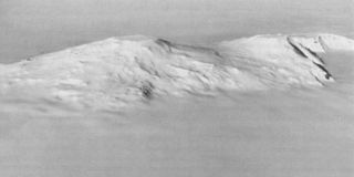
Hawkes Heights is an ice-filled crater rising to 2,000 metres (6,600 ft) that dominates the southern part of Coulman Island, in the Ross Sea, Antarctica, and marks the island's summit. The feature was named by the New Zealand Geological Survey Antarctic Expedition (NZGSAE), 1958–59, for Captain William M. Hawkes, U.S. Navy, who took a leading part in early air operations from Williams Field near McMurdo Station, including long range photo reconnaissance and supply flights, and the first air landing at the South Pole. He was commander of one of the two planes which made the historic first flight from Christchurch to McMurdo Station on December 17, 1955. His air photos proved of great value to two NZGSAE parties to this part of Victoria Land. Mount Hawkes is also named for Hawkes, who was assigned to Air Development Squadron Six (VX-6) in 1955–56.
Mount Murchison is a mountain in Victoria Land, Antarctica. Sources differ as to whether Murchison is the highest peak of the Mountaineer Range; or the second highest if Mount Supernal is considered part of the range.


