
This article is about the demographic features of the population of Malawi, including population density, ethnicity, education level, health of the populace, economic status, religious affiliations and other aspects of the population.

Lilongwe is the capital and most populated city of the African country of Malawi. It has a population of 989,318 as of the 2018 Census, up from a population of 674,448 in 2008. In 2020 that figure was 1,122,000. The city is located in the central region of Malawi, in the district of the same name, near the borders with Mozambique and Zambia, and it is an important economic and transportation hub for central Malawi. It is named after the Lilongwe River.
Zomba is a city in southern Malawi, in the Shire Highlands. It is the former capital city of Malawi.
Rumphi is the capital of the Rumphi District in the Northern Region of Malawi. It is a lively town with a market which serves the widespread tobacco farming community. Rumphi is noted for the kindness of the people. It is directly on the way to Nyika National Park, Nyika Plateau, Vwaza Marsh Game Reserve. Unlike its larger neighbour, Mzuzu, which has mild sunny weather almost all year, Rumphi has a differing climate. The town, being surrounded by hills, always has a nice wind. The town is bounded by the Rumphi river in the east and the South_Rukuru_River in the south.
Kasungu is a town in the Kasungu District of the Central Region of Malawi. The population of Kasungu was 58,653 according to the 2018 census. Kasungu is approximately 130 kilometres (81 mi) north-west of the capital of Malawi, Lilongwe, and is 35 kilometres (22 mi) east of Kasungu National Park. The main industry in Kasungu is tobacco-growing.

Nkhotakota (Un-kho-tah-kho-tuh) is a town and one of the districts in the Central Region of Malawi. It is on the shore of Lake Malawi and is one of the main ports on Lake Malawi. As of 2018, Nkhotakota had a population estimated at 28,350. The district had a population of 301.000.

Mulanje, formerly called Mlanje, is a town in the Southern Region of Malawi, close to the border with Mozambique, to the east. It is near the Mulanje Massif.

The Central Region of Malawi, population 7,523,340 (2018), covers an area of 35,592 km². Its capital city is Lilongwe, which is also the national capital. The region has an outlet on Lake Malawi and borders neighbouring countries Zambia and Mozambique. The Chewa people make up the majority of the population today.
Dedza is a district in the Central Region of Malawi. It covers an area of 3,624 km.² to the south of the Malawi capital, Lilongwe, between Mozambique and Lake Malawi. The capital is Dedza.

Dowa is a district in the Central Region of Malawi. The capital is Dowa.
Lilongwe is a district in the Central Region of Malawi. The capital is Lilongwe.
Ntchisi is a district in the Central Region of Malawi. The district covers an area of 1,655 km.² and has a population of 317,069. The capital is Ntchisi.
Salima is a district in the Central Region of Malawi. The capital is Salima. The district covers an area of 2,196 km.² and has a population of 478,346. The beach at Senga Bay is the weekend retreat of many from the capital, Lilongwe, and has hosted the annual Lake of Stars festival since 2008, when it was moved from Chintheche in order to be less remote. There is a range of accommodation options in the area, though most are a few km off the main road.
Dowa is a town located in the Central Region of Malawi. It is the administrative capital of Dowa District. William Kamkwamba, author of The Boy Who Harnessed the Wind: Creating Currents of Electricity and Hope, was born and raised in Dowa.
Chipoka is a town located in the Central Region district of Salima, in Malawi. It is one of the main ports on Lake Malawi and is the closest port to the capital city of Lilongwe. Chipoka is located on the western shore of Kasangha Bay across from Cape Maclear.
Ntchisi is a town located in the Central Region of Malawi. It is the administrative capital of Ntchisi District.
Nathenje is a town located in the Central Region district of Lilongwe in Malawi in the continent of Africa. Central Region's capital Lilongwe (Lilongwe) is approximately 19 km / 12 mi away from Nathenje. The distance from Nathenje to Malawi's capital Lilongwe (Lilongwe) is approximately 19 km / 12 mi.

Malawi is divided into 3 regions which comprise a combined total of 28 districts.
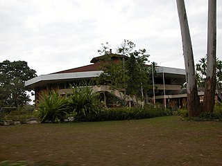
New Finance Bank (NFB), whose complete name is New Finance Bank Malawi Limited is a commercial bank in Malawi. It is one of the commercial banks licensed by the Reserve Bank of Malawi, the central bank and national banking regulator.
