Banaskantha district is one of the thirty-three districts of the Gujarat state of India. The administrative headquarters of the district is at Palanpur which is also its largest city. The district is located in the Northeast of Gujarat and is presumably named after the West Banas River which runs through the valley between Mount Abu and Aravalli Range, flowing to the plains of Gujarat in this region and towards the Rann of Kutch. The district is famous for the Ambaji temple which draw many tourists. As of 2011, 13.27% of Banaskantha's population is urban and 86.70% is rural. It covers an area of 12703 km2 and is the second largest district in the state.

Patan was the capital of Gujarat's Chalukya dynasty in medieval times. It is said to have been established by Vanraj Chavada, a Chavda king. The city has had an old history, with several Hindu and Muslim dynasties making it a thriving trading city and a regional capital of northern Gujarat. It was also known as 'Anhilpur-Patan'.

Palanpur is a city and a municipality of Banaskantha district in the Indian state of Gujarat. Palanpur is the administrative headquarters of Banaskantha district. Palanpur is the ancestral home to an industry of Indian diamond merchants.

Patan district is one of the 33 districts of Gujarat state in western India. Its main city is Patan. This district is located in northern Gujarat and bounded by Banaskantha district in the north and northeast, Mehsana district in the east and southeast, Surendranagar district in the south and Kutch District and the Kutch nu Nanu Ran in the west. The district occupies an area of 5792 km².

Chanasma is a small town and a municipality in Chanasma Taluka of Patan district in the state of Gujarat, India.
Harij is a city and a municipality in Patan district in the Indian state of Gujarat.

Patan is a town and a nagar panchayat in Jabalpur district in the Indian state of Madhya Pradesh. Patan is 30 km from Jabalpur on State Highway 37A which connects Damoh to Jabalpur.
Maktupur is a small village in North Gujarat, West India. It is in Mehsana district. Maktupur is between the three cities of Patan, Visanagar, and Mahesana.
Odhava is a small village located in Patan Taluka in Northern district of Patan, Gujarat, India.
Chanasma is one of the 182 Legislative Assembly constituencies of Gujarat state in India. It is part of Patan district.
Patan is one of the 182 Legislative Assembly constituencies of Gujarat state in India. It is part of Patan district and a segment of Patan.
Daskroi is one of the 182 Legislative Assembly constituencies of Gujarat state in India. It is part of Ahmedabad district.
Mahudha is one of the 182 Legislative Assembly constituencies of Gujarat state in India. It is part of Kheda district.
Jalalpore is one of the 182 Legislative Assembly constituencies of Gujarat state in India. It is part of Navsari district.
Navsari is one of the 182 Legislative Assembly constituencies of Gujarat state in India. It is part of Navsari district.
Pethapur State was a small princely state belonging to the Mahi Kantha Agency of the Bombay Presidency during the era of the British Raj. It was centered on Pethapur village, in present-day Gandhinagar district of Gujarat State, a place renowned for block-making.
Santalpur is a village in Santalpur Taluka of Patan district of Gujarat state, India.
Panchasar is a village in shankheshwarTaluka of Patan district of Gujarat, India.
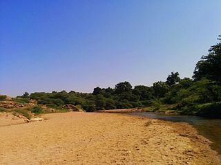
Jagana is a village in the Palanpur taluka of Banaskantha district in northern Gujarat, India. The villages Vasna, Bhagal, Sedrasana are located near to Jagana and it is just 6 km away from the district headquarters, Palanpur.

