Jhajjar is a town in Jhajjar district in the Indian state of Haryana. It is situated on the road connecting Rewari to Rohtak (NH-352), Loharu to Meerut (NH334B), Charkhi Dadri to Delhi and Gurgaon to Bhiwani. Jhajjar is located 55 km (34 mi) west of Delhi.
Chhabra is a city and a municipality in Baran district in the state of Rajasthan, India, near to the border with Madhya Pradesh. Chhabra is a historic walled city with a fort. Its name comes from the six gates in the walls.

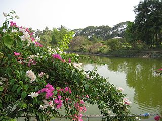
Sainthia is a city and a municipality in Suri Sadar subdivision of Birbhum district in the Indian state of West Bengal. The city is known as business city of Birbhum district. The city is under the jurisdiction of Sainthia police station. Sainthia is the fourth most populous city in Birbhum district and 95th most populous city in West Bengal. The city covers an area of 10 km2 and had a population of 44,601 in 2011. Located on the banks of Mayurakshi River, Sainthia has been a major human settlement. The city is famous for Nandikeshwari Temple, one of the Shakti Peethas in Indian subcontinent.

Samrala is a city and a municipal council in Ludhiana district in the Indian state of Punjab. It is about 35 km east of the district headquarters Ludhiana, on the highway to Chandigarh. Samrala is a Class III Municipality. It is also known for the oldest tehsil situated in this city. It is also believed that the name Samrala came from the name of two brothers Sama and Rala.
Satwas is a town and a Nagar Panchayat in Dewas district in the Indian state of Madhya Pradesh. Satwas is around 136.8 km (85.0 mi) from Dewas.
Thevur is a Town Panchayat city in Salem district, Tamil Nadu.

North Delhi is an administrative district of the National Capital Territory of Delhi in India. Alipur is the administrative headquarters of this district. North Delhi is bounded by the Yamuna River and the district of Central Delhi on the east and by the district of North West Delhi to the west.
North East Delhi is one of the eleven administrative district of Delhi, India. The district was established in 1997. North East Delhi borders the Yamuna River on the west, Ghaziabad District to the north and east, East Delhi to the south, and North Delhi to the west across the Yamuna. Karawal Nagar, Seelampur and Yamuna Vihar are 3 sub-divisions of this district.
Eyyal is a village in Thrissur District in the state of Kerala, India. Archeologists have unearthed a collection of old Roman coins in 1946. These coins date from 123 BC to 117 AD. These coins currently exhibited in the Archeological Museum of Thrissur.
Khujner is a town and a nagar panchayat in Rajgarh district in the Indian state of Madhya Pradesh.
Dadra is one of the two talukas in Dadra and Nagar Haveli district, India. It is an enclave lying a few kilometres north of Nagar Haveli and is surrounded by Gujarat.
Shyampur II is a community development block that forms an administrative division in Uluberia subdivision of Howrah district in the Indian state of West Bengal.
Zalaki is a village in the southern state of Karnataka, India. It is located in the Chadachan Taluk of Vijayapur district, Karnataka.
Pratap Pur Chhataura is located in Azamgarh district of Uttar Pradesh. It is 40 km away from District head office. Its pin code is 276142 and its post office is Mangitpur. As per Census 2011 information the village code of Pratap Pur Chhataura village is 192003. The ambitious project of Gorakhpur Link Expressway Under UPIEDA is passing through the village.
Tilkhoja is a village and Gram Panchayat located in Moyna Tehsil/ Block of Purba Medinipur district in the Indian state of West Bengal hosting 1318 families. Moyna is the nearest town.
Bungpa is a generic reference to two villages, Bungpa Khullen and Bungpa Khunou located south of Ukhrul in Ukhrul district, Manipur state, India. The village falls under Kamjong sub division. The villages are connected by Ukhrul-Kamjong state highway. Bungpa is flanked by Phungyar in the west, Grihang in the south, Lakhan in the east and Kamjong in the north. Locally, the inhabitants speak Bungpa dialect that belongs to the Tibeto-Burman language family.
Razai is a generic reference two villages, Razai Khullen and Razai Khunou Ukhrul in Ukhrul district, Manipur state, India. The village falls under Chingai sub division. National Highway 150 that connects Imphal-Kohima via Ukhrul and Jessami passes through the village. Razai is about 50 kilometers from Ukhrul; and is flanked by Peh in the west, Awang Kasom in the south, Chingai in the east and Maremphung in the north. Locally, the inhabitants speak Razai dialect that belongs to the Tibeto-Burman language family.
Sanoda is a village in Kotkasim tehsil Alwar District in the state of Rajasthan, India.
Shikar Pur is a large village located in Najafgarh of South West Delhi district, Delhi with total 457 families residing. The village is located near Haryana-Border near Gurgaon. Gurgaon border is only 2 km from the village. Najafgarh Drain acts a border between the two states here. The village is very well developed having 100% permanent houses, RCC streets, street lights, Internet and telephone connectivity, a transport facility, Delhi Jal Board water supply, and all-round electricity. There is also plenty of greenery around the village. The Shikar Pur village has population of 2842 of which 1532 are males while 1310 are females as per Population Census 2011.
Narayanpur is a large village in Bhatar CD block in Bardhaman Sadar North subdivision of Purba Bardhaman district in the state of West Bengal, India.
