The Fens or Fenlands in eastern England are a naturally marshy region supporting a rich ecology and numerous species. Most of the fens were drained centuries ago, resulting in a flat, dry, low-lying agricultural region supported by a system of drainage channels and man-made rivers and automated pumping stations. There have been unintended consequences to this reclamation, as the land level has continued to sink and the dykes have been built higher to protect it from flooding.

Gudbrandsdalen is a valley and traditional district in the Norwegian county of Innlandet. The valley is oriented in a north-westerly direction from Lillehammer and the lake of Mjøsa, extending 230 kilometers (140 mi) toward the Romsdalen valley. The river Gudbrandsdalslågen (Lågen) flows through the valley, starting from the lake Lesjaskogsvatnet and ending at the lake Mjøsa. The Otta river which flows through Otta valley is a major tributary to the main river Lågen. The valleys of the tributary rivers such as Otta and Gausa (Gausdal) are usually regarded as part of Gudbrandsdalen. The total area of the valley is calculated from the areas of the related municipalities. Gudbrandsdalen is the main valley in a web of smaller valleys. On the western side there are long adjacent valleys: Ottadalen stretches 100 kilometers (62 mi) from Otta village, Gausdal some 50 kilometers (31 mi) from Lillehammer and Heidal some 40 kilometers (25 mi) from Sjoa. Gudbrandsdalen runs between the major mountain ranges of Norway including Jotunheimen and Dovrefjell–Rondane.

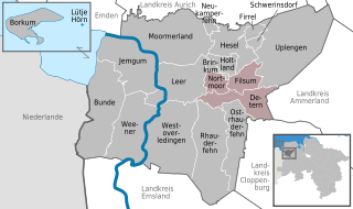
Jümme is a collective municipality (Samtgemeinde) in the district of Leer in the German state of Lower Saxony. It is named after the River Jümme which flows through all three constituent communities. It has an area of 82.34 km2 and a population of 6,421. It is situated in the region of East Frisia. Along with the Samtgemeinde of Hesel, it is one of two in the district. It was formed in the wake of local government reform in 1973. Filsum serves as the administrative centre.

Odžaci is a town and municipality located in the West Bačka District of the autonomous province of Vojvodina, Serbia. The town of Odžaci has a population of 7,556 people, while the population of the municipality of Odžaci is 24,926 people.

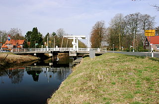
Wiesmoor is a town in the district of Aurich in the northwest of Lower Saxony. It lies on the Nordgeorgsfehnkanal and is the youngest town in the East Frisia area having been bestowed town rights on 16 March 2006, two days later on 18 March 2006, Wiesmoor celebrated the Centenary of the settlement's founding. The town owes its growth to the industrialisation of the harvesting of peat from the surrounding moors. Wiesmoor holds an annual flower festival and the town is also known as the ‘Flower City’, the name originates from the large numbers of flowers which are grown in the town’s industrial greenhouse. Formerly the greenhouses were heated by waste heat from the now defunct peat burning power station which was located in the city. Wiesmoor also has the official title of a Luftkurort; tourism now plays an important role in the local economy.

Vossbarg is a row village in East Frisia, Germany. It is a Moorland colony consisting mostly of pasture land and is predominantly an agricultural area.

Kačarevo is a village in northern Serbia, situated in the municipality of Pančevo, South Banat District, Vojvodina province. The village has a Serb ethnic majority and its population numbering 6,346 people.

Twist is a municipality in the Emsland district, in Lower Saxony, Germany. It is situated directly on the Dutch border.

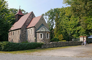
Stahnsdorf is a municipality in the Potsdam-Mittelmark district, in Brandenburg, Germany.

Pančevački Rit is a small geographical area in south-western Banat, Serbia. It is situated between the rivers Danube and Tamiš, in Belgrade's municipality of Palilula.
Široka Bara is a bog and also a suburban settlement of Belgrade, the capital of Serbia. Both are located in Belgrade's municipality of Palilula.

The Teufelsmoor is a region of bog and moorland north of Bremen, Germany. It forms a large part of the district of Osterholz, and extends into the neighbouring districts of Rotenburg.

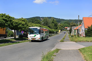
Strašice is a municipality and village in Rokycany District in the Plzeň Region of the Czech Republic. It has about 2,900 inhabitants.

The Großes Moor near Gifhorn is part of the Northwest German raised bog region, which stretches from the Netherlands to the eastern border of Lower Saxony on the sandy areas (geest) left behind by the ice age. The moor has a total area of about 6,100 hectares, of which around 5,000 hectares are raised bog and some 1,100 hectares are fen. The peat layer is up to almost 6 metres (20 ft) thick in places. Individual parts of the moor have their own names like Stüder Moor, Hestenmoor or Weißes Moor.

Marcardsmoor is a village and district (Stadtteil) of the East Frisian town of Wiesmoor, in Lower Saxony. It is located north of the town, on the intersection of the Ems-Jade Canal and the Nordgeorgsfehn Canal.
Auricher Wiesmoor II is a district (Stadtteil) of the East Frisian town of Wiesmoor, in Lower Saxony. A linear settlement, it is located southwest of the town and runs along the Voßbarg Canal.

Hinrichsfehn is a district (Stadtteil) of the East Frisian town of Wiesmoor, in Lower Saxony. It is located south of the town and west of the Nordgeorgsfehn Canal.
Rammsfehn is a district (Stadtteil) of the East Frisian town of Wiesmoor, in Lower Saxony. A linear settlement, it is located south of the town, along the Nordgeorgsfehn Canal, just to the northeast of Hinrichsfehn.
Wilhelmsfehn II is a district (Stadtteil) of the East Frisian town of Wiesmoor, in Lower Saxony. A linear settlement, it is located west of the town, to the south of Wilhelmsfehn I.
Zwischenbergen is a village and district (Stadtteil) of the East Frisian town of Wiesmoor, in Lower Saxony. It is located approximately six kilometers southwest of the town center.


