The Innere Stadt is the 1st municipal district of Vienna located in the center of the Austrian capital. The Innere Stadt is the old town of Vienna. Until the city boundaries were expanded in 1850, the Innere Stadt was congruent with the city of Vienna. Traditionally it was divided into four quarters, which were designated after important town gates: Stubenviertel (northeast), Kärntner Viertel (southeast), Widmerviertel (southwest), Schottenviertel (northwest).

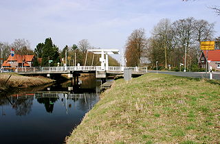
Wiesmoor is a town in the district of Aurich in the northwest of Lower Saxony. It lies on the Nordgeorgsfehnkanal and is the youngest town in the East Frisia area having been bestowed town rights on 16 March 2006, two days later on 18 March 2006, Wiesmoor celebrated the Centenary of the settlement's founding. The town owes its growth to the industrialisation of the harvesting of peat from the surrounding moors. Wiesmoor holds an annual flower festival and the town is also known as the ‘Flower City’, the name originates from the large numbers of flowers which are grown in the town’s industrial greenhouse. Formerly the greenhouses were heated by waste heat from the now defunct peat burning power station which was located in the city. Wiesmoor also has the official title of a Luftkurort; tourism now plays an important role in the local economy.

Municipalities are the lowest level of official territorial division in Germany. This can be the second, third, fourth or fifth level of territorial division, depending on the status of the municipality and the Land it is part of. The city-states Berlin and Hamburg are second-level divisions. A Gemeinde is one level lower in those states which also include Regierungsbezirke as an intermediate territorial division. The Gemeinde is one level higher if it is not part of a Gemeindeverband.

Strausberg is a town in Brandenburg, in eastern Germany, located 30 km (19 mi) east of Berlin. With a population of about 27,000 it is the largest town in the district of Märkisch-Oderland.

Warstein ( ) is a municipality with town status in the district of Soest, in North Rhine-Westphalia, Germany. It is located at the north end of Sauerland.

Meckenheim is a town in the Rhein-Sieg district, in North Rhine-Westphalia, Germany.

Klötze is a town in the Altmarkkreis Salzwedel (district), in Saxony-Anhalt, Germany. It is situated approximately 20 km northwest of Gardelegen, and 35 km northeast of Wolfsburg. It was mentioned first in 1144 with the name Cloetze, which means a wooden block. In January 2010, with the disbanding of the Verwaltungsgemeinschaft of Klötze, the town absorbed 11 former municipalities.

Město Touškov is a town in Plzeň-North District in the Plzeň Region of the Czech Republic. It has about 2,400 inhabitants. The historic town centre is well preserved and is protected by law as an urban monument zone.

Malmsheim station is in the town of Malmsheim in the municipality of Renningen in the German state of Baden-Württemberg. It is located at kilometer 22.4 of the Black Forest Railway and it is served by line S 6 of the Stuttgart S-Bahn.

The 1st District of Budapest is the Castle District and is the historical part of the Buda side of Budapest. It consists of the Buda Castle Hill and some other neighborhoods around it, like Tabán, Krisztinaváros and parts of Gellért Hill.

Franziska Mascheck is a German dancer, social worker and politician for the SPD and since 2021 member of the German Bundestag, the federal diet.

Marcardsmoor is a village and district (Stadtteil) of the East Frisian town of Wiesmoor, in Lower Saxony. It is located north of the town, on the intersection of the Ems-Jade Canal and the Nordgeorgsfehn Canal.
Auricher Wiesmoor II is a district (Stadtteil) of the East Frisian town of Wiesmoor, in Lower Saxony. A linear settlement, it is located southwest of the town and runs along the Voßbarg Canal.

Hinrichsfehn is a district (Stadtteil) of the East Frisian town of Wiesmoor, in Lower Saxony. It is located south of the town and west of the Nordgeorgsfehn Canal.
Mullberg is a district (Stadtteil) of the East Frisian town of Wiesmoor, in Lower Saxony. A linear settlement, it is located southeast of the town and east of the Nordgeorgsfehn Canal.
Rammsfehn is a district (Stadtteil) of the East Frisian town of Wiesmoor, in Lower Saxony. A linear settlement, it is located south of the town, along the Nordgeorgsfehn Canal, just to the northeast of Hinrichsfehn.
Wiesederfehn is a small village and district (Stadtteil) of the East Frisian town of Wiesmoor, in Lower Saxony. It is located northeast of the town, along the Bundesstraße 436.
Wilhelmsfehn II is a district (Stadtteil) of the East Frisian town of Wiesmoor, in Lower Saxony. A linear settlement, it is located west of the town, to the south of Wilhelmsfehn I.
Zwischenbergen is a village and district (Stadtteil) of the East Frisian town of Wiesmoor, in Lower Saxony. It is located approximately six kilometers southwest of the town center.


