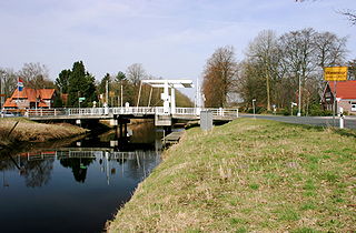
The Fens or Fenlands in eastern England are a naturally marshy region supporting a rich ecology and numerous species. Most of the fens were drained centuries ago, resulting in a flat, dry, low-lying agricultural region supported by a system of drainage channels and man-made rivers and automated pumping stations. There have been unintended consequences to this reclamation, as the land level has continued to sink and the dykes have been built higher to protect it from flooding.

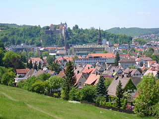
Altenburg is a city in Thuringia, Germany, located 40 kilometres south of Leipzig, 90 kilometres west of Dresden and 100 kilometres east of Erfurt. It is the capital of the Altenburger Land district and part of a polycentric old-industrial textile and metal production region between Gera, Zwickau and Chemnitz with more than 1 million inhabitants, while the city itself has a population of 33,000. Today, the city and its rural county is part of the Central German Metropolitan Region.

Heidenheim an der Brenz, or just Heidenheim, is a town in Baden-Württemberg in southern Germany. It is located near the border with Bavaria, approximately 17 km south of Aalen and 33 km north of Ulm. Heidenheim is the largest town and the seat of the district of Heidenheim, and ranks third behind Aalen and Schwäbisch Gmünd in size among the towns in the region of East Württemberg. Heidenheim is the economic center for all the communities in Heidenheim district and is the headquarters of the Voith industrial company. The town's population in 2021 was just below the 50,000 mark. Heidenheim collaborates with the town of Nattheim in administrative matters.

Nordhorn is a town in Lower Saxony, Germany. It is the district seat of Grafschaft Bentheim in Lower Saxony's southwesternmost corner, near the border with the Netherlands and the boundary with North Rhine-Westphalia.

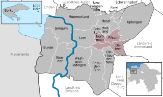
Jümme is a collective municipality (Samtgemeinde) in the district of Leer in the German state of Lower Saxony. It is named after the River Jümme which flows through all three constituent communities. It has an area of 82.34 km2 and a population of 6,421. It is situated in the region of East Frisia. Along with the Samtgemeinde of Hesel, it is one of two in the district. It was formed in the wake of local government reform in 1973. Filsum serves as the administrative centre.

Šilutė is a city in the south of the Klaipėda County in western Lithuania. The city was part of the Klaipėda Region and ethnographic Lithuania Minor. Šilutė was the interwar capital of Šilutė County and is currently the capital of Šilutė District Municipality.

Wiesmoor is a town in the district of Aurich in the northwest of Lower Saxony. It lies on the Nordgeorgsfehnkanal and is the youngest town in the East Frisia area having been bestowed town rights on 16 March 2006, two days later on 18 March 2006, Wiesmoor celebrated the Centenary of the settlement's founding. The town owes its growth to the industrialisation of the harvesting of peat from the surrounding moors. Wiesmoor holds an annual flower festival and the town is also known as the ‘Flower City’, the name originates from the large numbers of flowers which are grown in the town’s industrial greenhouse. Formerly the greenhouses were heated by waste heat from the now defunct peat burning power station which was located in the city. Wiesmoor also has the official title of a Luftkurort; tourism now plays an important role in the local economy.

Vossbarg is a row village in East Frisia, Germany. It is a Moorland colony consisting mostly of pasture land and is predominantly an agricultural area.

Līvāni is a town in Līvāni Municipality in the Latgale region of eastern Latvia. It is situated at the junction of the Dubna and Daugava rivers, approximately 170 kilometers east of the Latvian capital Riga.

Haren is a town in Lower Saxony, Germany in the district of Emsland.

Twist is a municipality in the Emsland district, in Lower Saxony, Germany. It is situated directly on the Dutch border.

Skalná is a town in Cheb District in the Karlovy Vary Region of the Czech Republic. It has about 1,900 inhabitants.

The Chapel of Reconciliation is a place of worship in Berlin, Germany. It stands on the site of the old Church of Reconciliation, on Bernauer Strasse in the Mitte district.

Marcardsmoor is a village and district (Stadtteil) of the East Frisian town of Wiesmoor, in Lower Saxony. It is located north of the town, on the intersection of the Ems-Jade Canal and the Nordgeorgsfehn Canal.
Auricher Wiesmoor II is a district (Stadtteil) of the East Frisian town of Wiesmoor, in Lower Saxony. A linear settlement, it is located southwest of the town and runs along the Voßbarg Canal.
Mullberg is a district (Stadtteil) of the East Frisian town of Wiesmoor, in Lower Saxony. A linear settlement, it is located southeast of the town and east of the Nordgeorgsfehn Canal.
Rammsfehn is a district (Stadtteil) of the East Frisian town of Wiesmoor, in Lower Saxony. A linear settlement, it is located south of the town, along the Nordgeorgsfehn Canal, just to the northeast of Hinrichsfehn.

Wilhelmsfehn I is a district (Stadtteil) of the East Frisian town of Wiesmoor, in Lower Saxony. A linear settlement, it is located northwest of the town, to the north of Wilhelmsfehn II.
Wilhelmsfehn II is a district (Stadtteil) of the East Frisian town of Wiesmoor, in Lower Saxony. A linear settlement, it is located west of the town, to the south of Wilhelmsfehn I.
Zwischenbergen is a village and district (Stadtteil) of the East Frisian town of Wiesmoor, in Lower Saxony. It is located approximately six kilometers southwest of the town center.


