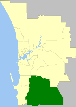
The Shire of Serpentine-Jarrahdale is a local government area in the outer southeastern metropolitan area of Perth, the capital of Western Australia, and has an area of 905 square kilometres (349 sq mi) and a population of 32,173 as at the 2021 census. Despite being named after two towns in the area, neither Serpentine nor Jarrahdale function as either the Shire's largest settlement (Byford) or the seat of government (Mundijong).
The Peel region is one of the nine regions of Western Australia. It is located on the west coast of Western Australia, about 75 km (47 mi) south of the state capital, Perth. It consists of the City of Mandurah, and the Shires of Boddington, Murray, Serpentine-Jarrahdale and Waroona.

Perth railway station is the largest station on the Transperth network, serving the central business district of Perth, Western Australia. It serves as an interchange between the Airport, Armadale, Ellenbrook, Fremantle, Midland, and Thornlie lines as well as Transwa's Australind service. It is also directly connected to Perth Underground railway station, which has the Yanchep and Mandurah lines.

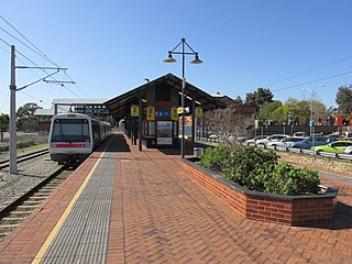
Armadale is a temporarily closed suburban and regional railway station, located on the South Western Railway 30 kilometres from Perth station serving the suburb of Armadale, Brookdale and Haynes. It was demolished in November 2023 as part of a project to rebuild the station on an elevated viaduct and extend the Armadale line to Byford. Before closure, it was the terminating point for Transperth Armadale line services and a calling point for Transwa Australind services.

Waroona is a town located in the Peel region of Western Australia along the South Western Highway, between Pinjarra and Harvey. The town is the seat of the Shire of Waroona. At the 2016 census, Waroona had a population of 2,934.

The Australind is a currently suspended rural passenger train service in Western Australia operated by Transwa on the South Western Railway between Perth and Bunbury.

Brunswick Junction is a town in the South West of Western Australia, situated along the South Western Highway between Harvey and Bunbury. It had a population of 772 people at the 2016 census, down from 797 at the 2006 census.

Byford is a suburb on the south-eastern edge of Perth, Western Australia, within the Shire of Serpentine-Jarrahdale. The town has its origins in a township that was gazetted under the name "Beenup" in 1906. In 1920, the name of the township was changed to Byford.

Harvey is a town located in the South West of Western Australia along the South Western Highway, 140 kilometres (87 mi) south of Perth, between Pinjarra and Bunbury. It has a population of 2,797. Harvey Town is known for its dairy industry and oranges.

Serpentine is a town located 55 kilometres (34 mi) south-southeast of Perth, the capital of Western Australia, and 7 km south of Mundijong.

Mundijong is an outer suburb of the Western Australian capital city of Perth.

Jarrahdale is a small historic town located 45 km south-east of Perth, Western Australia in the Darling Range. The name is derived from its situation in a jarrah forest. Established in the late 1800s as the state's first major timber milling operation, it played a key role in the development of Western Australia through the exportation of jarrah around the world. At the 2016 census, Jarrahdale had a population of 1,192. Since 2001, the historic precinct has been managed by the state's National Trust organisation alongside private residential and tourism-oriented developments.

The South Western Railway, also known as the South West Main Line, is the main railway route between Perth and Bunbury in Western Australia.

The Old Bunbury railway station was the main railway station for Bunbury, Western Australia from 1894 until 1996. It was the terminus for the Australind passenger railway service from Perth. It was replaced in May 1985 by the current Bunbury Terminal in East Bunbury.

Forrest Highway is a 95-kilometre-long (59 mi) highway in Western Australia's Peel and South West regions, extending Perth's Kwinana Freeway from east of Mandurah down to Bunbury. Old Coast Road was the original Mandurah–Bunbury route, dating back to the 1840s. Part of that road, and the Australind Bypass around Australind and Eaton, were subsumed by Forrest Highway. The highway begins at Kwinana Freeway's southern terminus in Ravenswood, continues around the Peel Inlet to Lake Clifton, and heads south to finish at Bunbury's Eelup Roundabout. There are a number of at-grade intersections with minor roads in the shires of Murray, Waroona, and Harvey including Greenlands Road and Old Bunbury Road, both of which connect to South Western Highway near Pinjarra.

Harvey railway station is located on the South Western Railway in Western Australia. It serves the town of Harvey.

The Kwinana freight railway lines are a network of railways predominantly servicing the heavy industrial areas at Kwinana Beach south of Perth and to provide for the transport of freight servicing Fremantle Harbour, Kewdale Intermodal Facility and other freight destinations in Perth. While some lines were constructed in the 1900s, most of the network was constructed in the 1950s and 1960s.

Neil McNeil was a prominent Australian businessman who was significant in the development of railways across Australia along with Western Australia's timber industry.

The Northcliffe branch, also known as the Northcliffe section or Picton to Northcliffe line, is the railway route between Picton and Northcliffe in Western Australia.

The Jarrahdale to Rockingham railway line was a private timber railway line connecting the timber mill at Jarrahdale with the port at Rockingham. It was the second railway line to operate in Western Australia, opening in 1872. From 1893, it connected to the South Western Railway at Mundijong. The section from Mundijong to Rockingham was removed in 1950 but the Jarrahdale to Mundijong section remained in operation until 1962.


