Pre-Pottery Neolithic A (PPNA) denotes the first stage of the Pre-Pottery Neolithic, in early Levantine and Anatolian Neolithic culture, dating to c. 12,000 – c. 10,800 years ago, that is, 10,000–8800 BCE. Archaeological remains are located in the Levantine and Upper Mesopotamian region of the Fertile Crescent.

Pre-Pottery Neolithic B (PPNB) is part of the Pre-Pottery Neolithic, a Neolithic culture centered in upper Mesopotamia and the Levant, dating to c. 10,800 – c. 8,500 years ago, that is, 8800–6500 BC. It was typed by British archaeologist Kathleen Kenyon during her archaeological excavations at Jericho in the West Bank, territory of Palestine.
Mureybet is a tell, or ancient settlement mound, located on the west bank of the Euphrates in Raqqa Governorate, northern Syria. The site was excavated between 1964 and 1974 and has since disappeared under the rising waters of Lake Assad. Mureybet was occupied between 10,200 and 8,000 BC and is the eponymous type site for the Mureybetian culture, a subdivision of the Pre-Pottery Neolithic A (PPNA). In its early stages, Mureybet was a small village occupied by hunter-gatherers. Hunting was important and crops were first gathered and later cultivated, but they remained wild. During its final stages, domesticated animals were also present at the site.

Girsu was a city of ancient Sumer, situated some 25 km (16 mi) northwest of Lagash, at the site of what is now Tell Telloh in Dhi Qar Governorate, Iraq. As the religious center of the kingdom of Lagash, it contained significant temples to the god Ningirsu (E-ninnu) and his wife Bau and hosted multi-day festivals in their honor.

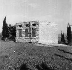
Hamadia is a kibbutz in the Beit She'an Valley, just north of Beit She'an in northern Israel. It belongs to the Valley of Springs Regional Council. In 2022 it had a population of 439.

Yosef Garfinkel is an Israeli archaeologist and academic. He is a professor of Prehistoric Archaeology and of Archaeology of the Biblical Period at the Hebrew University of Jerusalem.

Yiftahel is an archaeological site located in the Lower Galilee in northern Israel. Various salvage excavations took place here between 1992 and 2008. The best known periods of occupation are the Early Bronze Age I and Pre-Pottery Neolithic B.

The Yarmukian culture was a Pottery Neolithic A (PNA) culture of the ancient Levant. It was the first culture in prehistoric Syria and one of the oldest in the Levant to make use of pottery. The Yarmukian derives its name from the Yarmuk River, which flows near its type site of Sha'ar Hagolan at the foot of the Golan Heights. This culture existed alongside the Lodian, or Jericho IX culture and the Nizzanim culture to the south.

Abu Zurayq is a cluster of archaeological sites at a well-watered spot at the western edge of the Jezreel Valley and its transition to the Menashe Heights, next to Highway 66, between the modern kibbutzim of HaZore'a and Mishmar HaEmek.
Tureng Tepe is a Neolithic and Chalcolithic archaeological site in northeastern Iran, in the Gorgan plain, approximately 17 kilometers northeast of the town of Gorgan. Nearby is a village of Turang Tappeh. The site was a major fort on the Sassanian period "Alexander’s wall".
Tell Aswad, Su-uk-su or Shuksa, is a large prehistoric, neolithic tell, about 5 hectares (540,000 sq ft) in size, located around 48 kilometres (30 mi) from Damascus in Syria, on a tributary of the Barada River at the eastern end of the village of Jdeidet el Khass.

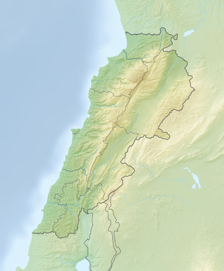
Jabal es Saaïdé, Jabal es Saaide, Jabal as Sa`idah, Jabal as Sa`īdah, Jebal Saaidé, Jebel Saaidé or Jabal Saaidé is a Mountain in Lebanon near the inhabited village of Saaïdé, approximately 12 kilometres (7.5 mi) northeast of Baalbek, Lebanon.
Avi Gopher is an Israeli archaeologist. He is a professor at the University of Tel Aviv.
The Sands of Beirut were a series of archaeological sites located on the coastline south of Beirut in Lebanon.
Qdeir is a prehistoric, Neolithic Tell and plateau in the El Kowm oasis, a 20 km (12 mi) gap in the Syrian mountains that houses a series of archaeological sites. It is located northeast of Palmyra in Syria, near Al-Sukhnah.

Jean Perrot was a French archaeologist who specialised in the late prehistory of the Middle East and Near East.

Cafer Hoyuk or Cafer Höyük is an archaeological site located around 40 kilometres (25 mi) northeast of Malatya, Turkey in the Euphrates valley. It was inhabited over ten thousand years ago during the Neolithic Revolution.
Kharaysin is a Pre-Pottery Neolithic site (PPN) located in the village of Quneya, at the Zarqa River valley, Jordan. This site was discovered in 1984 by Hanbury-Tenison and colleagues during the Jerash Region Survey. The site was allocated to the Pre-Pottery Neolithic B because of the analysis of archaeological artefacts recovered on the surface.
Sha'ar HaGolan is a Neolithic archaeological site near Kibbutz Sha'ar HaGolan in Israel. The type site of the Yarmukian culture, it is notable for the discovery of a significant number of artistic objects, as well as some of the earliest pottery in the Southern Levant.


