You can help expand this article with text translated from the corresponding article in Dutch. (February 2026)Click [show] for important translation instructions.
|
Munnekeburen | |
|---|---|
Village | |
 Munnekeburen Church | |
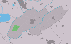 Location in Weststellingwerf municipality | |
 Munnekeburen Location in the Netherlands  Munnekeburen Munnekeburen (Netherlands) | |
| Country | |
| Province | |
| Municipality | |
| Area | |
• Total | 7.88 km2 (3.04 sq mi) |
| Elevation | −0.3 m (−0.98 ft) |
| Population (2021) [1] | |
• Total | 455 |
| • Density | 57.7/km2 (150/sq mi) |
| Time zone | UTC+1 (CET) |
| • Summer (DST) | UTC+2 (CEST) |
| Postal code | 8485 [1] |
| Dialing code | 0561 |
Munnekeburen (West Frisian : Munnikebuorren) is a village in Weststellingwerf in the province of Friesland, the Netherlands. It had a population of around 430 in 2017. [3]
The village was first mentioned in 1243 as Monkeburen, and means monk neighbourhood. The monks were from the Saint Odulphus monastery in Stavoren. [4] Munnekeburen started as peat excavation settlement along the Padsloot. [5] The Dutch Reformed church was rebuilt in 1806. [6] It was extensively modified in 1860. [5]
Munnekeburen was home to 267 people in 1840, however that included a part of Langelille. [6]