Nijeholtpade | |
|---|---|
Village | |
 Nicolas Church | |
 Flag | |
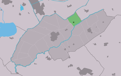 Location in Weststellingwerf municipality | |
 Nijeholtpade Location in the Netherlands  Nijeholtpade Nijeholtpade (Netherlands) | |
| Coordinates: 52°54′45″N6°4′42″E / 52.91250°N 6.07833°E | |
| Country | |
| Province | |
| Municipality | |
| Area | |
• Total | 8.65 km2 (3.34 sq mi) |
| Elevation | 1.9 m (6.2 ft) |
| Population (2021) [1] | |
• Total | 495 |
| • Density | 57.2/km2 (148/sq mi) |
| Postal code | 8475 [1] |
| Dialing code | 0561 |
Nijeholtpade (West Frisian : Nijeholtpea) is a village in Weststellingwerf in the province of Friesland, the Netherlands. It had a population of around 485 in 2017. [3]
The village was first mentioned in 1399 as Nyeholepat, which means "new low-lying path". Nije (new) has been added to distinguish from Oldeholtpade. [4] [5]
The Dutch Reformed church was built in 1525 and has a bell tower. The church was a replacement of a wooden church. [6]
Nijeholtpade was home to 150 people in 1840. [6]