Steenwijkerland is a municipality in the province of Overijssel, in the eastern Netherlands. Prior to a name change in 2003, it was known as Steenwijk.

Weststellingwerf is a municipality in the province of Friesland in the northern Netherlands. It is one of the municipalities of Friesland, where the spoken language is not West Frisian; instead, Stellingwerfs, a dialect of Dutch Low Saxon, is spoken here.

Steenwijk is a city in the Dutch province of Overijssel. It is located in the municipality of Steenwijkerland. It is the largest town of the municipality.

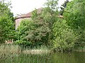
Blokzijl is a small city located southwest of Steenwijk in the province of Overijssel, the Netherlands. The city is a major tourist destination near the De Weerribben-Wieden National Park and attracts many water sports enthusiasts.
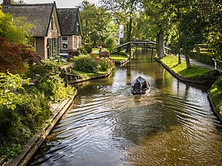
Giethoorn is a village in the province of Overijssel, Netherlands, with a population of 2,795 in 2020. It is located in the municipality of Steenwijkerland, about 5 km (3.1 mi) southwest of Steenwijk. As a popular Dutch tourist destination both within Netherlands and abroad, Giethoorn is often referred to as "Dutch Venice" or the "Venice of the Netherlands".
Stellingwarfs is a Westphalian and Friso-Saxon dialect spoken in Ooststellingwerf and Weststellingwerf in the Dutch province of Friesland, and also in Steenwijkerland and Westerveld in the Dutch province of Overijssel and Drenthe.

Steggerda is a village of the Dutch municipality of Weststellingwerf. The village consists of one long stretch with housing and has a population of 1,049.

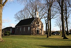
Blankenham is a village in the Netherlands, in the municipality of Steenwijkerland. Until 1973, it was a separate municipality.

Kuinre is a village in the Dutch province of Overijssel. It was a separate municipality until 1973, when it became a part of IJsselham, which in turn merged into the municipality of Steenwijkerland in 2001.

Oldemarkt is a village in the Dutch province of Overijssel. It is located in the municipality of Steenwijkerland, about 12 km west of Steenwijk. Oldemarkt was a separate municipality until 1973, when it became a part of IJsselham.

Wanneperveen is a village in the Dutch province of Overijssel. It is located in the municipality of Steenwijkerland, about 4 km west of Meppel.
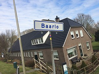
Baarlo is a hamlet in the Dutch province of Overijssel. It is located in the municipality Steenwijkerland, about 1 km northwest of the city of Blokzijl.
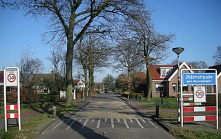
Oldeholtpade is a village in Weststellingwerf in the province of Friesland, the Netherlands. It had a population of around 1,020 in 2017.

Noordwolde is a village in Weststellingwerf in the province of Friesland, the Netherlands. It had a population of around 3,600 as of 2017. Noordwolde-Zuid, the settlement to the south of Noordwolde is considered a separate village.

Wolvega, is the largest town in the municipality of Weststellingwerf in the province of Friesland (Fryslan), in the Netherlands. It had a population of around 13,090 in 2021. Wolvega is the capital and largest town of the municipality.

Spanga is a village in Weststellingwerf in the province of Friesland, the Netherlands. It had a population of around 210 in 2017.

Slijkenburg is a village in Weststellingwerf in the province of Friesland, the Netherlands. It had a population of around 36 in 2017.
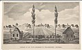
Marijenkampen is a hamlet in Steenwijkerland, a municipality in the province Overijssel in the Netherlands. Until 1867, the area was called Huttenberg and was overgrown with heath. The first inhabitants were people who had been banned from the neighbouring colony Willemsoord, founded by the Society of Humanitarianism. These inhabitants settled in and led an independent life. The village was named after Marij van Essen who owned several lots of land in the area.

Kalenberg is a tourist hamlet within the De Weerribben-Wieden National Park in the Dutch province of Overijssel. The hamlet belongs to the municipality of Steenwijkerland.

Tuk is a village in the municipality of Steenwijkerland in the province Overijssel, Netherlands. It forms a single urban area with Steenwijk