Blankenham

Last updated
Blankenham
Blankenham, Kanon en kruithuisje.jpg
Canon in Blankenham
2010-NL-P04-Overijssel-positiekaart-gemnamen.jpg
Red pog.svg
Blankenham
Location in the Netherlands
Netherlands location map.svg
Red pog.svg
Blankenham
Blankenham (Netherlands)
Coordinates: 52°45′44″N5°53′37″E / 52.7623°N 5.8935°E / 52.7623; 5.8935
Country Netherlands
Province Overijssel
Municipality Steenwijkerland
Area
[1]
  Total13.35 km2 (5.15 sq mi)
Elevation
[2]
−0.4 m (−1.3 ft)
Population
 (2021) [1]
  Total220
  Density16/km2 (43/sq mi)
Time zone UTC+1 (CET)
  Summer (DST) UTC+2 (CEST)
Postal code
8373 [1]
Dialing code 0527

Blankenham is a village in the Netherlands, in the municipality of Steenwijkerland. Until 1973, it was a separate municipality.

Contents

History

Blankenham is situated on the dike along the former Zuiderzee. It was named after Frederick of Blankenheim, the Prince-Bishop of Utrecht [3] who gave the villagers permission to build a church and establish an independent parish. [4] The village was severely effected by floods in 1776 and 1825. [3] In 1840, it was home to 282 people. [5]

The Dutch Reformed Church was finished in 1893, and is near a little pond which is a remnant of the 1825 flood. It replaced an 1816 church which was lost due to a lightning strike. [3] The canon dates from 1817, [5] and was last fired in 1964. [6] There used to be two, but one was donated to the museum in Schokland. [5] On 31 December 1963, the canon was stolen and moved to Luttelgeest. After 18 days, the canon was returned with a stone lion to guard it. The lion was stolen from Emmeloord. [6]

Related Research Articles

<span class="mw-page-title-main">Opperdoes</span> Village in North Holland, Netherlands

Opperdoes is a village in the Dutch province of North Holland. It is a part of the municipality of Medemblik, and lies about 12 km north of Hoorn. It has a certain fame for its local variety of potatoes, "Opperdoezer Ronde".

<span class="mw-page-title-main">Puttershoek</span> Village in South Holland, Netherlands

Puttershoek is a village and former municipality in the western Netherlands. It is located on the banks of the Oude Maas, on the island Hoeksche Waard, in the province of South Holland. On 1 January 1984, the municipality of Puttershoek was merged with several others into Binnenmaas. With 6,293 inhabitants Puttershoek was the largest settlement in the municipality of Binnenmaas until 's-Gravendeel joined Binnenmaas in 2007. Since 1 January 2019, it is part of the new municipality Hoeksche Waard.

<span class="mw-page-title-main">Espel</span> Village in Flevoland, Netherlands

Espel is one of the so-called green villages (Dutch: groendorpen) in the Dutch province of Flevoland. It lies in the municipality of Noordoostpolder next to a crossroads where provincial road N712 from Urk to Lemmer intersects with road N714 to Emmeloord, roughly 6 km to the east.

<span class="mw-page-title-main">Luttelgeest</span> Village in Flevoland, Netherlands

Luttelgeest is a village in the Dutch province of Flevoland. It is a part of the municipality of Noordoostpolder, and was created in 1950 as one of ten planned villages around the new city of Emmeloord.

<span class="mw-page-title-main">Stellendam</span> Village in South Holland, Netherlands

Stellendam is a village in the Dutch province of South Holland. It is a part of the municipality of Goeree-Overflakkee, and lies about 9 km west of Hellevoetsluis.

<span class="mw-page-title-main">Bruinisse</span> Village in Zeeland, Netherlands

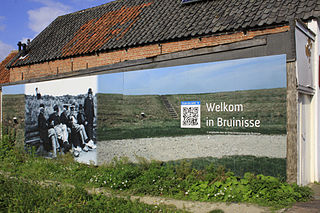
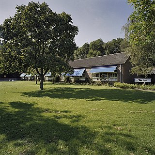
Bruinisse is a village in the south-west of the Netherlands. It is located in the municipality of Schouwen-Duiveland, Zeeland.

<span class="mw-page-title-main">Oosterland, Zeeland</span> Village in Zeeland, Netherlands

Oosterland is a village in the south-west Netherlands. It is located in the municipality of Schouwen-Duiveland, Zeeland, about 22 km south of Hellevoetsluis.

<span class="mw-page-title-main">Sirjansland</span> Village in Zeeland, Netherlands

Sirjansland is a village in the Dutch province of Zeeland. It is a part of the municipality of Schouwen-Duiveland, and lies about 19 km south of Hellevoetsluis.

<span class="mw-page-title-main">Kortgene</span> Small city in Zeeland, Netherlands

Kortgene is a small city in the southwest Netherlands. It is located in the municipality of Noord-Beveland, Zeeland, about 15 km northeast of Middelburg. It received city rights in 1431, but was flooded in 1530 and 1532. The new settlement received city rights in 1684.

<span class="mw-page-title-main">Colijnsplaat</span> Town in Zeeland, Netherlands

Colijnsplaat is a village in the Province of Zeeland, the Netherlands It is a part of the Municipality of Noord-Beveland, and lies about 20 km (12 mi) northeast of Middelburg.

<span class="mw-page-title-main">Wissenkerke</span> Village in Zeeland, Netherlands

Wissenkerke is a village in the Dutch province of Zeeland. It is a part of the municipality of Noord-Beveland, and lies about 20 km northeast of Middelburg.

<span class="mw-page-title-main">Stavenisse</span> Village in Zeeland, Netherlands

Stavenisse is a village in the Dutch province of Zeeland. It is a part of the municipality of Tholen, and lies about 22 kilometres (14 mi) west of Bergen op Zoom.

<span class="mw-page-title-main">Zwartewaal</span> Town in South Holland, Netherlands

Zwartewaal is a village in the Dutch province of South Holland, The Netherlands. It is a part of the municipality of Voorne aan Zee and lies about 5 km south of Maassluis.

<span class="mw-page-title-main">Graauw</span> Village in Zeeland, Netherlands

Graauw is a village in the Dutch province of Zeeland. It is a part of the municipality of Hulst, and lies about 22 km southwest of Bergen op Zoom.

<span class="mw-page-title-main">Ossenisse</span> Village in Zeeland, Netherlands

Ossenisse is a village in the Dutch province of Zeeland. It is a part of the municipality of Hulst, and lies about 24 km west of Bergen op Zoom.

<span class="mw-page-title-main">Heinenoord</span> Village and former municipality in South Holland, Netherlands

Heinenoord is a village in the Dutch province of South Holland on the island Hoekse Waard. It is located about 10 km south of Rotterdam, in the municipality of Hoeksche Waard.

<span class="mw-page-title-main">Herkingen</span> Village in South Holland, Netherlands

Herkingen is a village in the Dutch province of South Holland. It is located on the south coast of the island Goeree-Overflakkee, in the municipality of Goeree-Overflakkee.

<span class="mw-page-title-main">Pingjum</span> Village in Friesland, Netherlands

Pingjum is a village in the municipality of Súdwest-Fryslân in Friesland, in the northern Netherlands and lies 6.6 kilometres (4.1 mi) southwest of Harlingen. It had a population of around 585 in January 2017.

<span class="mw-page-title-main">Drieborg</span> Village in Groningen, Netherlands

Drieborg is a dike village in the Dutch province of Groningen. It is a part of the municipality of Oldambt.

<span class="mw-page-title-main">Westernieland</span> Village in Groningen, Netherlands

Westernieland is a village in the Dutch province of Groningen. It is part of the municipality of Het Hogeland. The village is located near the Wadden Sea.

References

  1. 1 2 3 "Kerncijfers wijken en buurten 2021". Central Bureau of Statistics. Retrieved 17 March 2022. Two entries
  2. "Postcodetool for 8373EC". Actueel Hoogtebestand Nederland (in Dutch). Het Waterschapshuis. Retrieved 16 March 2022.
  3. 1 2 3 Ronald Stenvert & Jan ten Hove (1998). "Blankenham" (in Dutch). Zwolle: Waanders. p. 63. ISBN   90 400 9200 1 . Retrieved 17 March 2022.
  4. "Blankenham - (geografische naam)". Etymologiebank (in Dutch). Retrieved 17 March 2022.
  5. 1 2 3 "Blankenham" (in Dutch). Retrieved 17 March 2022.
  6. 1 2 "Kanon van Blankenham terug, en nu door leeuw bewaakt". Nieuwsblad van het Noorden (in Dutch). 21 January 1964. Retrieved 17 March 2022.