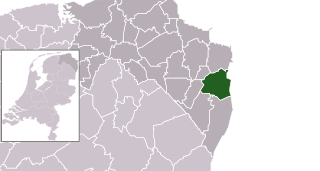
Bellingwedde was a municipality with a population of in the province Groningen in the northeast of the Netherlands. Bellingwedde was established in 1968, when the municipalities of Bellingwolde and Wedde had merged. It contained the villages Bellingwolde, Blijham, Oudeschans, Veelerveen, Vriescheloo, and Wedde. After almost 50 year, Bellingwedde was disestablished in 2018, when the municipalities of Bellingwedde and Vlagtwedde had merged into Westerwolde.

Pekela is a municipality in the province of Groningen in the Netherlands. It was created in 1990 when Oude Pekela and Nieuwe Pekela were merged.

Stadskanaal is a town and municipality with a population of 32,715 in the province of Groningen in the northeast of the Netherlands. It was named after the canal Stadskanaal.

Vlagtwedde is a village in the very southeast of Groningen province in the northeastern Netherlands. It lies on the Dutch border with the German state of Lower Saxony to the east.

Ter Apel is a village with a population of 8,866 residents in the municipality Westerwolde in the northern Netherlands, in the province Groningen in the region Westerwolde. The town lies on the stream Ruiten Aa, which has the valley that together with the Ter Apeler forest belongs to the national network of nature reserves, the Ecologische Hoofdstructuur. An accommodation centre for refugees is located at Ter Apel, functioning as a "departure centre" for rejected refugees and a registration point, operated by the Centraal Orgaan opvang Asielzoekers. Ter Apel lies on the roads N366, N976 and N391. It forms the southern point of the border between Groningen and Drenthe, the Semslinie.
Wildervank is a village in the Dutch province of Groningen. It is located in the municipality of Veendam, about 3 km south of the centre of Veendam itself. It was founded in 1647 by Adriaan Geerts Wildervanck as a peat colony in the Wildervankster bog. Wildervank was a separate municipality until 1969, when the area was divided between Veendam and Stadskanaal.

Ter Apelkanaal is a town in the Dutch province of Groningen. It is a part of the municipality of Westerwolde, and lies about 17 km (11 mi) northeast of Emmen.

Nieuwe Pekela is a village in the Dutch province of Groningen. It is located in the municipality of Pekela, about 7 km southeast of Veendam. The village started as a peat colony, and was named after the river Pekel A. During the 19th century, the village was active in the maritime trade, and contains a museum dedicated to the maritime history. In December 1969, the first women strike of the Netherlands occurred in Nieuwe Pekela.
Onstwedde is a village in the region of Westerwolde and part of Groningen in the Netherlands. It is located in the municipality of Stadskanaal.

Oude Pekela is a town in the Dutch province of Groningen. It is located in the municipality of Pekela, about 5 km southwest of Winschoten. It was established to exploit the peat in the area. During the 19th century, it was known for its maritime transport. During the 20th century, Oude Pekela became the centre of the cardboard and potato starch industry.

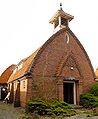
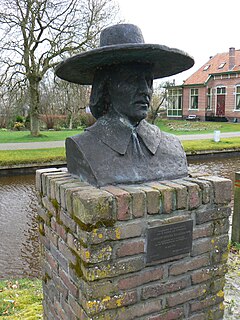
Wedde is a village in the municipality Westerwolde in the province Groningen in the Netherlands. It is located 9 km southeast of Winschoten. The castle Wedderborg is located in the village.

Emmer-Compascuum is a village in the Netherlands and is part of the Emmen municipality in Drenthe.

Alteveer is a village in the Dutch province of Groningen. It is largely located in the municipality Stadskanaal, about 7 km northeast of the centre of Stadskanaal. The houses on the western edge of the village are part of the municipality of Pekela. The name literally means "all too far".
Grenszicht or Molen van Geerdink is a smock mill in Emmer-Compascuum, Netherlands. It was built in 1907. The mill is listed as a Rijksmonument, number 14690.

The Bourtanger Moor was a bog in eastern parts in the Dutch provinces of Drenthe and Groningen and the bordering German districts of Bentheim and Emsland. A remaining stretch on the border between Drenthe and the districts Emsland and Betheim is now a nature reserve, the Internationaler Naturpark Bourtanger Moor-Bargerveen.

The Semslinie is a part of the border between the Dutch provinces of Groningen and Drenthe that runs right through the former Bourtanger Moor. The almost straight line runs from Wolfsbarge to the Huis ter Haar at Musselkanaal. The border is slightly bent at Stadskanaal. The slightly bent line between Musselkanaal and Stadskanaal is sometimes called Koningsraai. The Semslinie is named after Johan Sems.

Westerwolde is a municipality in the province of Groningen in the northeast of the Netherlands.

Zandberg is a village in the north of the Netherlands, partly located in the Groningen municipality of Westerwolde and partly in the Drenthe municipality of Borger-Odoorn. The village was created in the early nineteenth century as a settlement in the peat colonies. The first residents came from the neighboring part of Germany. Zandberg is therefore one of the Catholic enclaves in the Northern Netherlands.

Pekel A is a river in the Province of Groningen in the Netherlands. The villages of Oude Pekela and Nieuwe Pekela have been named after the river. The name translates to Brine River (A), and used to flow from the Dollart into a large raised bog. The Dollart was poldered from the 15th century until 1924, and the river now has its source at the confluence with the Westerwoldsche Aa at De Bult. The river was canalised and extended. The part from Oude Pekela to Stadskanaal was renamed Pekelderdiep. From 1599 until 1810, the area through which the river flowed, was a peat colony. In the 20th century, the Pekel A was a heavily polluted river, but it has been cleaned up since the 1970s.
Adriaan Geerts Wildervanck was a Dutch businessman and coloniser. In 1643, he lost most of his money when De Oevelgunne stranded on the Boschplaat with expensive lace. In 1647, he founded the Muntendammer Company to exploit a peat colony. As part of the colony, the villages of Wildervank (1647) and Veendam (1648) were established.