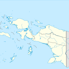
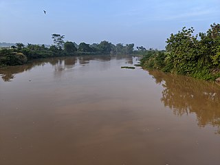
The Digul River is a major river in southern Papua province, Indonesia, on the island of New Guinea. It is the fourth longest river in New Guinea after Sepik River, Mamberamo River and Fly River. With a total length of 853 km (530 mi) and has a drainage basin of 45,900 km2 (17,700 sq mi).
The Tariku or Rouffaer River is a river in the northern part of the Indonesian province of Papua. It is one of the major tributary of Mamberamo River with a total length of 488 km (303 mi).
The Van Daalen River is a river of Western New Guinea in the province of Papua, Indonesia. It is a tributary of Tariku River.
The Taritatu or Idenburg River also called Baliem River is a river in the northern part of the Indonesian province of Papua. It is the largest tributary of Mamberamo River with a total length of 808 km (502 mi).
The Kumbe is a river of Merauke Regency, Papua Province, Indonesia. It has a distinct meandering course, with a total length of 242 km, and width around 97–700.1 m. The Bian River and the Maro River are part of the same basin.
The Widas River is a river in northern East Java, Indonesia. It is a tributary of the Brantas River.
The Wamma River is a river in northern part of Western Papua, Papua province, Indonesia.
The Tabai River is a river in northern part of Western Papua, Papua province, Indonesia.
The Warenai River is a river in northern New Guinea, Indonesia. Tributaries include the Wapoga River.
The Sobger River is a river in northern New Guinea, province of Papua, Indonesia. It is a tributary of the Taritatu River, The total length is 188.861 km. which it forms by merging with the Nawa River.
The Waruta River is a river in northern Western Papua in the province of Papua, Indonesia. It is a tributary of the Taritatu River.
The Songgato River is a river in northern Western Papua, Papua province, Indonesia. It is a tributary of the Taritatu River. The total length is 131.2 km.
The Seremuk River is a river in Southwest Papua, Indonesia.
The Kamundan River is a river in southern West Papua province, Indonesia. Kamundan is mostly still natural with the upstream in Manokwari Regency and river mouth at the border of Bintuni Bay and Sorong Selatan Regency. It is also known as the "Sungai Kamundan".
The Wiriagar or AimauRiver is a river in southern West Papua province, Indonesia.
The Momats River is a river in southern Western Papua, Indonesia.
The Mapi River or Mappi River is a river in southern Papua province, Indonesia.
The Bulaka River is a river in southern Western Papua, in the Papua province, Indonesia.
The Kampung River is a river in southern Papua province, Indonesia. It is a tributary of the Pulau River.
The Wildeman River is a river in southern Papua province, Indonesia. It is a tributary of the Pulau River.