Waruta River

Last updated
Waruta River
Sungai Waruta, Waroeta River, Nawa Waroeta
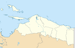
Indonesia Papua 2022 location map.svg
Red pog.svg
Location of river mouth
Indonesia relief location map.jpg
Red pog.svg
Waruta River (Indonesia)
Location
Country Indonesia
Physical characteristics
Source 
  location Western Papua
Mouth  
  location
Taritatu River

The Waruta River is a river in northern Western Papua in the province of Papua, Indonesia. [1] [2] It is a tributary of the Taritatu River.

Contents

Geography

The river flows in the northern area of Papua with predominantly tropical rainforest climate (designated as Af in the Köppen-Geiger climate classification). [3] The annual average temperature in the area is 21 °C. The warmest month is July, when the average temperature is around 22 °C, and the coldest is March, at 20 °C. [4] The average annual rainfall is 3489 mm. The wettest month is March, with an average of 444 mm rainfall, and the driest is July, with 162 mm rainfall. [5]

See also

Related Research Articles

The Maro River also known as Sungai Merauke and Merauke-rivier, Merauki River flows in Merauke Regency, Papua, Indonesia. It is located just to the west of the Bensbach River of Western Province, Papua New Guinea.

<span class="mw-page-title-main">Tariku River</span> River in Indonesia

The Tariku or Rouffaer River is a river in the northern part of the Indonesian province of Papua. It is one of the major tributary of Mamberamo River with a total length of 488 km (303 mi).

The Van Daalen River is a river of Western New Guinea in the province of Papua, Indonesia. It is a tributary of Tariku River.

The Kumbe is a river of Merauke Regency, South Papua, Indonesia. It has a distinct meandering course, with a total length of 242 km, and a width of around 97–700.1 m. The Bian River and the Maro River are part of the same basin.

The Wamma River is a river in Central Papua, Indonesia.

The Tabai River is a river in Central Papua, Indonesia.

The Warenai River is a river in northern New Guinea, Central Papua, Indonesia. Tributaries include the Wapoga River.

The Wapoga River is a river in northern New Guinea, Central Papua, Indonesia. It is a tributary of the Warenai River. The Wapoga River basin and surrounding mountains were surveyed by a team of scientists organized by Conservation International in 1998. The rainbowfish Glossolepis leggetti and Melanotaenia rubripinnis are only known from this river system.

The Sobger River is a river in northern New Guinea, province of Papua, Indonesia. It is a tributary of the Taritatu River, The total length is 188.861 km. which it forms by merging with the Nawa River.

The Songgato River is a river in northern Western Papua, Papua province, Indonesia. It is a tributary of the Taritatu River. The total length is 131.2 km.

The Seremuk River is a river in Southwest Papua, Indonesia.

The Kamundan River is a river in southern West Papua province, Indonesia. Kamundan is mostly still natural with the upstream in Manokwari Regency and river mouth at the border of Bintuni Bay and Sorong Selatan Regency. It is also known as the "Sungai Kamundan".

The Wiriagar or AimauRiver is a river in southern West Papua province, Indonesia.

The Momats River is a river in southern Western Papua, Indonesia.

The Mapi River or Mappi River is a river in South Papua, Indonesia.

The Bulaka River is a river in South Papua province, Indonesia.

The Kampung River is a river in southern South Papua, Indonesia. It is a tributary of the Pulau River.

The Wildeman River is a river in South Papua, Indonesia. It is a tributary of the Pulau River.

The Bila River is a river in northern Sumatra, Indonesia, about 1,200 km northwest of the capital Jakarta. It is a tributary of the Barumun River.

<span class="mw-page-title-main">Wowei River</span> River in Indonesia

The Wowei River is a river in northern Southwest Papua, Indonesia. It flows in the Tambrauw Regency and discharges into the Pacific Ocean.

References

  1. Rand McNally, The New International Atlas, 1993.
  2. Sungai Waruta - Geonames.org.
  3. Peel, M C; Finlayson, B L; McMahon, T A (2007). "Updated world map of the Köppen-Geiger climate classification". Hydrology and Earth System Sciences. 11 (5): 1633–1644. Bibcode:2007HESS...11.1633P. doi: 10.5194/hess-11-1633-2007 .
  4. "NASA Earth Observations Data Set Index". NASA. 30 January 2016.
  5. "NASA Earth Observations: Rainfall (1 month - TRMM)". NASA/Tropical Rainfall Monitoring Mission. 30 January 2016.

3°18′00″S140°08′00″E / 3.3°S 140.13333°E / -3.3; 140.13333