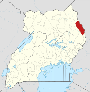
Moroto District is a district in the Northern Region of Uganda. The town of Moroto is the site of the district headquarters.

Kapchorwa District is a district in the Eastern Region of Uganda. The town of Kapchorwa is the district's main municipal, administrative, and commercial center, and is the site of the district headquarters. It is also the home district of Stephen Kiprotich, men's marathon gold medalist at the 2012 Olympic Games in London.

Mbale is a city in the Eastern Region of Uganda. It is the main municipal, administrative, and commercial center of Mbale District and the surrounding sub-region.

Moroto is a town in Moroto District in the Northern Region of Uganda. It is the location of the district headquarters.

Katakwi is a town in the Eastern Region of Uganda. It is the main municipal, administrative, and commercial center of Katakwi District and the site of the district headquarters. It borders Moroto District.
Nakapiripirit is a town in the Nakapiripirit District of the Northern Region of Uganda. It is the seat of the district headquarters. The town is an administrative unit of the district, at the level of a sub-county; one of the eight sub-counties in the district.
Manafwa is a town in the Eastern Region of Uganda. It is the largest town in Manafwa District and the site of the district headquarters.
Busembatya, sometimes spelled Busembatia, is a town in the Eastern Region of Uganda.
Nagongera is a town in Tororo District, in the Eastern Region of Uganda.
Bududa is a town in the Eastern Region of Uganda. It is the main municipal, administrative, and commercial center of Bududa District.
Bulambuli is a town in Eastern Uganda. It is the main municipal, administrative and commercial center of Bulambuli District. The district is named after the town.
Moroto–Nakapiripirit Road is a road in the Northern Region of Uganda. The road connects the towns of Moroto, the largest town in the Karamoja sub-region, and Nakapiripirit in the same sub-region.
Bumbobi–Bubulo–Lwakhakha Road is a road in the Eastern Region of Uganda, connecting the city of Mbale to the town of Lwakhakha at the International border with Kenya.
Suam, Uganda is a border crossing between Uganda and Kenya. The settlement sits directly across the Suam River from Suam, Kenya.
Muyembe–Nakapiripirit Road is a road in the Eastern and Northern regions of Uganda. The road connects the towns of Muyembe in Bulambuli District, to the town of Nakapiripirit in District.
Atutur General Hospital, also Atutur Hospital, is a government-owned hospital in the Eastern Region of Uganda.
The Jinja–Iganga–Bugiri–Tororo Road is a road in the Eastern Region of Uganda, connecting the towns of Jinja and Tororo. Sometimes referred to as Tororo–Jinja Road, it is a busy transport corridor, connecting traffic from neighboring Kenya, and northeastern Uganda to Jinja, a major commercial and industrial center, and ultimately to Kampala, the country's capital and points beyond.
Siti II Hydroelectric Power Station is a 16.5 megawatts (22,100 hp), run of river, hydroelectric power station in the Eastern Region of Uganda.
Butebo is a town in the Eastern Region of Uganda. It is the chief municipal, administrative and commercial center of Butebo District.
Namisindwa District is a district in the Eastern Region of Uganda. The town of Bupoto is the district headquarters.

