Related Research Articles

The Berwyn range is an isolated and sparsely populated area of moorland in the northeast of Wales, roughly bounded by Llangollen in the northeast, Corwen in the northwest, Bala in the southwest, and Oswestry in the southeast.
Coity Mountain is a flat-topped mountain in the South Wales Valleys, between Blaenavon and Abertillery. The highest points of both Torfaen and Blaenau Gwent unitary authorities are at the summit of Coity Mountain. The summit is also known as Twyn Ffynhonnau Goerion. Some 2 km (1 mi) to the southeast lies a major subsidiary top of the hill, Mynydd Varteg Fawr (549m) at the southeastern end of whose broad ridge is a trig point at 544m. A few hundred metres to the southeast of this summit is a memorial known as the Dog Stone which commemorates Carlo the Red Setter, a dog shot accidentally by his master while hunting on the 12 August 1864. Co-ordinates for the Dog Stone 51.45'15.58N 3.05'08.81W. Other notable tops include those of Mulfran (524m) which overlooks the town of Brynmawr and Mynydd James immediately east of the town of Blaina.

Mynydd Machen or Machen Mountain is a 362-metre-high (1,188 ft) hill lying between the town of Risca and the village of Machen in Caerphilly County Borough in south Wales. Its summit is crowned by a trig point and a mast.
Mynydd Llangynidr is a mountain in the Brecon Beacons National Park largely in the county of Powys, south Wales. Its southern slopes extend into the northernmost parts of the county borough of Blaenau Gwent. It is named from the village of Llangynidr which sits in the valley of the River Usk to the north of it. It is essentially an undulating plateau rising in the west to a height of 557m at Garn Fawr at OS grid ref SO 123151. A secondary high point is achieved at a point marked by a trig point at SO 147159. To the north the hill overlooks the valleys of Dyffryn Crawnon and Cwm Claisfer, themselves tributary valleys of the Usk. The shallow upper valley of the Ebbw River reaches into the plateau in the southeast whilst the upper reaches of the Sirhowy Valley and its tributary the Nant Trefil define its western margins. A further tributary, the Nant Milgatw, reaches in from the south whilst the sharp edge of Rassau Industrial Estate also defines a part of its southern margin. Passing east across the B4560, the hill merges with Mynydd Llangatwg which has a similar character.

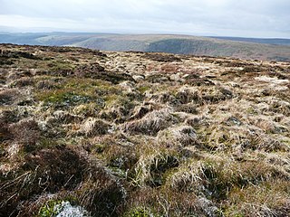
Mynydd-y-glog is a hill just east of the village of Penderyn in the northern corner of the county borough of Rhondda Cynon Taff in south Wales. It lies within the Brecon Beacons National Park and Fforest Fawr Geopark. Its summit plateau rises to a height of 389m / 1277 ft at OS grid ref SN 982088, a spot marked by a trig point. To its north lies the partly dry valley of Pant Sychbant which forms the eastern extension of Cwm Cadlan. Its southern slopes are drained by various streams which feed into the Afon Cynon.
Penmoelallt or Onllwyn is a hill in the northern part of the county borough of Rhondda Cynon Taff in south Wales. It lies within the Brecon Beacons National Park and Fforest Fawr Geopark. To its east lies the deep valley of Cwm Taf and to its north a rather shallower valley in which the Nant Cadlan originates. To the west is the hill known as Mynydd-y-glog and to the south are slopes draining into the River Taff and the Afon Cynon. The hill culminates in a broken plateau with several knolls rising above the 420m contour. Its afforested nature makes it difficult to determine the precise location of its highest point but this probably lies somewhere around OS grid ref SO 003096. Older maps indicate a spot height of 1376 ft above sea level at SO 000090.

Mynydd Myddfai is a hill 4.5 miles southeast of Llandovery in the county of Carmarthenshire, southwest Wales. It lies within the Brecon Beacons National Park and Fforest Fawr Geopark. The hill is in the form of a broad ridge aligned southwest to northeast with three or four distinct tops separated by cols. The northwest side drops steeply away towards the village of Myddfai whilst the other side is a more shallow slope down towards Glasfynydd Forest which encircles Usk Reservoir. The plateau surface of the hill rises to a height of 440m at OS grid ref SN 806297 where a trig point has been erected.
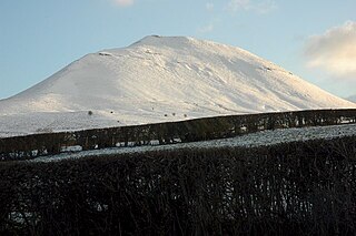
Mynydd Troed is a hill in the Black Mountains of the Brecon Beacons National Park in Powys, south Wales. Its name literally translates to "Foot Mountain," based how it appears when viewed from the Allt Mawr ridge.

Mynydd Llangorse is a hill on the western edge of the Black Mountains in the Brecon Beacons National Park in Powys, south Wales. It lies two miles east of Llangors and its lake and 5 miles south of Talgarth. Its summit at 515m overtops the location 600m to the south at which a trig point is sited by 9m. The broad spur of Cefn Moel extends south towards the village of Bwlch whilst a spur to the southeast forms Pen Tir which reaches just over 450m above sea level. It is a Marilyn with a prominence of 161 metres.

Mynydd Carn-y-cefn is the name given to the broad ridge of high ground between the Ebbw Vale and the valley of the Ebbw Fach in the Valleys region of South Wales. It lies within the unitary area of Blaenau Gwent, formerly Monmouthshire.

Mynydd Merthyr is a broad ridge of high ground between Taff Vale and the Cwm Cynon in the Valleys region of South Wales. It forms the boundary between the unitary authorities of Rhondda Cynon Taff to the west and Merthyr Tydfil to the east.

Mynydd Cilfach-yr-encil attains a height of 445m at OS grid reference SO 079033 making it the high point of the broad ridge of high ground between Taff Vale and Cwm Bargod in the Valleys region of South Wales. It lies within the unitary area of Merthyr Tydfil.
Mynydd Bedwellte is the name given to the broad ridge of high ground between the Rhymney Valley and the Sirhowy Valley in the Valleys region of South Wales. It straddles the boundary of the unitary areas of Caerphilly and Blaenau Gwent.

Mynydd y Drum is a hill on the border between the county of Powys and Neath Port Talbot County Borough, south Wales. The summit of the hill is in Neath Port Talbot at 298m and lies towards the western end of a broad curving ridge, the larger part of which is in Powys. The eastern half of the hill is currently being opencasted for coal. The hill is sometimes referred to simply as The Drum.
Mynydd Marchywel is a 418-metre (1,371 ft) high hill in the Neath Port Talbot area in South Wales. Its summit is marked both by a cairn and a trig point. The larger part of the hill is cloaked in modern forestry through which numerous streams fall away westward to the River Tawe, eastward to the River Dulais and southward into the Clydach, the latter two being tributaries of the River Neath.
Mynydd Meio is a 322-metre-high hill in the county borough of Caerphilly in South Wales. Parts of its western slopes fall within Rhondda Cynon Taf county borough. Its eastern slopes drop away to Cwm yr Aber between Caerphilly and Abertridwr and its western slopes to the valley of the Taf. The high point is just over 200 m north of the trig point which sits at 322 metres (1,056 ft) above sea-level.
Mynydd y Gaer is a 295-metre-high hill in Bridgend County Borough in South Wales. The summit is crowned by a trig point.

Mynydd Twyn-glas is a sprawling 472-metre-high mountain extending into Caerphilly and Torfaen county boroughs in South Wales. It lies southwest of Pontypool, west of Cwmbran and east of Newbridge and taking the form of a rolling plateau the margins of which are defined by steep slopes, many of which are cloaked with conifer plantations. A broad shoulder extending south from the summit is known as Mynydd Maen whilst to the north is Mynydd Llwyd. The thickly afforested northern slopes of the hill drop down steeply into Cwm y Glyn.

Mynydd William Meyrick is a 535-metre-high hill straddling the boundary of Bridgend and Rhondda Cynon Taf county boroughs between the valley of the Rhondda Fawr and Ogmore Valley in South Wales. It takes the form of a broad northwest-southeast ridge with numerous broad shoulders extending to the east, south and west, each of which have different names and some of which constitute minor tops. Listed clockwise from the north these are; Mynydd Maendy, Mynydd Ton, Mynydd Bwllfa, Mynydd Pwllyrhebog, Mynydd Maes-teg, Mynydd y Gwair and Mynydd yr Aber. The summit of the entire massif is often referred to as Mynydd Ton. Its western sides are open moorland whilst its eastern sides have been afforested by the Forestry Commission.
Mynydd Garnclochdy is a gentle summit on the long moorland ridge which extends south from Blorenge towards Pontypool and which defines the boundary between the modern county of Monmouthshire to the east and the county borough of Torfaen to the west though historically it was entirely within the traditional county of Monmouthshire. Its summit, at a height of 448 m (1407 ft), is marked by a small cairn. The summit and the eastern slopes of the hill fall within the Brecon Beacons National Park. A southern top of the hill, Mynydd Garn-wen achieves a height of 436m, and carries a trig point further south again at an elevation of 425m. To the north the broad moorland ridge runs via a poorly defined 425m top and a col at 404m elevation just south of a minor east–west road, into Mynydd y Garn-fawr, east of Blaenavon.
References
- ↑ British Geological Survey 1:50,000 map sheet 248 Pontypridd & accompanying memoir
- ↑ Ordnance Survey Explorer map 166 Rhondda
- ↑ https://www.charlesclosesociety.org/files/153Meridians.pdf [ bare URL PDF ]