Baranya is a county in southern Hungary. It is part of the Southern Transdanubia statistical region and the historical Baranya region, which was a county (comitatus) in the Kingdom of Hungary dating back to the 11th century. Its current status as one of the 19 counties of Hungary was established in 1950 as part of wider Soviet administrative territorial reform following World War II. It is bordered by Somogy County to the northwest, Tolna County to the north, Bács-Kiskun County and the Danube to the east, and the border with Croatia to the south.

Baranya or Baranja is a geographical and historical region between the Danube and the Drava rivers. Its territory is divided between Hungary and Croatia. In Hungary, the region is included in Baranya county, while in Croatia, it is part of Osijek-Baranja county.

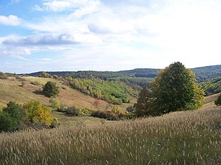
Abaliget is a village in central Baranya County, Pécs District, in southern Hungary. Until the end of World War II, the inhabitants' majority was Danube Swabian, also called locally as Stifolder, because their ancestors arrived in the 17th and 18th centuries from Fulda (district). Most of the former German settlers were expelled to Allied-occupied Germany and Allied-occupied Austria in 1945–1948, pursuant to the Potsdam Agreement. Only a few Germans of Hungary live there, the majority today are the descendants of Hungarians from the Czechoslovak–Hungarian population exchange. They got the houses of the former Danube Swabian inhabitants. It is located in the western Mecsek Mountains. The nearby Abaliget Cave and the area's lakes and hiking trails make it a popular tourist destination. Its population at the 2011 Census was 598.

Babarc is a village and municipality in Baranya county, Hungary. Until the end of World War II, the inhabitants were Danube Swabians, also called locally as Stifolder, because their ancestors were from Fulda (district). Most of the former German settlers were expelled to Germany and Austria in 1945–1948, as a result of the Potsdam Agreement. Only a few Germans of Hungary live there, the majority today are the descendants of Hungarians from the Czechoslovak–Hungarian population exchange. They occupied the houses of the former Danube Swabian inhabitants.

Bakonya is a village in central Baranya County, Pécs District, in southern Hungary. It is located in the western Mecsek mountain range and was the site of a uranium mine from the 1950s to 1989. Its population at the 2011 Census was 335.

Olasz is a village and municipality in Baranya County, Hungary.
Aranyosgadány is a village in central Baranya County, Pécs District, in southern Hungary. It is located in the western Baranya Hills. It was established in 1941 with the merger of the settlements of Keménygadány and Pécsaranyos. Its population at the 2011 Census was 355.

Baranyajenő is a village in Hegyhát District, northern Baranya county, in the Southern Transdanubia region of Hungary. Its population at the 2011 census was 455.
Belvárdgyula is a village and municipality in Baranya county, Hungary.

Borjád is a village and municipality in Baranya county, Hungary.
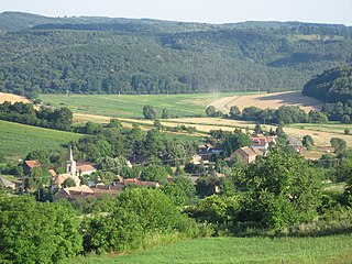
Gödre is a village in Hegyhát District, northern Baranya county, in the Southern Transdanubia region of Hungary. Its population at the 2011 census was 913.

Hásságy is a village and municipality in Baranya county, in southern Hungary.

Kisbudmér is a village and municipality in Baranya county, Hungary.

Liptód is a village and municipality in Baranya County, Hungary.
Monyoród is a village and municipality in Baranya County, Hungary. Until the end of World War II, the majority of the inhabitants was Danube Swabian, also called locally as Stifolder, because their ancestors arrived in the 17th and 18th centuries from Fulda (district). Most of the former German settlers were expelled to allied-occupied Germany and allied-occupied Austria in 1945–1948, as a result of the Potsdam Agreement. Only a few Germans of Hungary live there, the majority today are the descendants of Hungarians from the Czechoslovak–Hungarian population exchange. They occupied the houses of the former Danube Swabian inhabitants.

Nagybudmér is a village and municipality in Baranya County, Hungary. Residents are Magyars, with minority of Germans.
Nagyhajmás is a village in the Hegyhát District, northern Baranya county, in the Southern Transdanubia region of Hungary. Its population at the 2011 census was 346.

Pócsa is a village and municipality in Baranya county, Hungary. Residents are Magyars, with minority of Germans. Until the end of World War II, the inhabitants' majority was Danube Swabian, also called locally as Stifolder, because their ancestors arrived in the 17th and 18th centuries from Fulda (district). Most of the former German settlers were expelled to Allied-occupied Germany and Allied-occupied Austria in 1945–1948, as a result of the Potsdam Agreement. Only a few Germans of Hungary live there, the majority today are the descendants of Hungarians from the Czechoslovak–Hungarian population exchange. They got the houses of the former Danube Swabian inhabitants.
Szágy is a village in Hegyhát District, northern Baranya county, in the Southern Transdanubia region of Hungary. Its population at the 2011 census was 140.
Tékes is a village in Hegyhát District, northern Baranya county, in the Southern Transdanubia region of Hungary. Its population at the 2011 census was 248.


