Namoukouka | |
---|---|
Coordinates: 12°09′27.76″N0°05′14.95″W / 12.1577111°N 0.0874861°W | |
Country | |
Province | Kouritenga |
Department | Gounghin |
Elevation | 335 m (1,099 ft) |
Population (2006) | |
• Total | 810 |
Time zone | UTC+0 (GMT) |
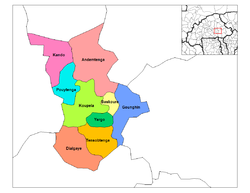
Namoukouka is a village in the Gounghin Department of Kouritenga Province in the Centre-Est region of Burkina Faso. It had a population of 810 in 2006. [1] [2]
Gounghin is a department of Kouritenga Province in eastern Burkina Faso. Its capital lies at the town of Gounghin. According to the 2006 census the department has a total population of 35,257.
Kouritenga, sometimes spelt Kourittenga, is one of the 45 provinces of Burkina Faso, located in its Centre-Est Region. In 2006 the province had a population of 330,342. Its capital is Koupéla.
Centre-Est is one of Burkina Faso's 13 administrative regions. The population of Centre-Est was 1,132,023 in 2006. The region's capital is Tenkodogo. Three provinces—Boulgou, Koulpélogo, and Kouritenga, make up the region.
An association between the French city of Nice and Namoukouka exists under the name "Laagm-Taaba" which was originally setup in the city of Koupéla in 2012 to aid the young people of Namoukouka to purchase footballs to play football with. Subsequently, a football club and annual tournament was established in which the local people, mainly farmers and breeders, participate. The association has also carried out agricultural aid work. [3]
Nice is the seventh most populous urban area in France and the capital of the Alpes-Maritimes département. The metropolitan area of Nice extends beyond the administrative city limits, with a population of about 1 million on an area of 721 km2 (278 sq mi). Located in the French Riviera, on the south east coast of France on the Mediterranean Sea, at the foot of the Alps, Nice is the second-largest French city on the Mediterranean coast and the second-largest city in the Provence-Alpes-Côte d'Azur region after Marseille. Nice is approximately 13 kilometres (8.1 mi) from the principality of Monaco and 30 kilometres (19 mi) from the French-Italian border. Nice's airport serves as a gateway to the region.
Koupéla is a city in Burkina Faso, lying east of Ouagadougou and west of Fada-Ngourma in an area settled by the Mossi people. It is known for its pottery and sculptures; these were made from natural clays found in the area. In 1900 Koupéla became the site of the first Catholic mission in Burkina Faso. Today it is the seat of an archdiocese, and contains a cathedral.
Association football, more commonly known as football or soccer, is a team sport played with a spherical ball between two teams of eleven players. It is played by 250 million players in over 200 countries and dependencies, making it the world's most popular sport. The game is played on a rectangular field called a pitch with a goal at each end. The object of the game is to score by moving the ball beyond the goal line into the opposing goal.
The Laagm-Taaba association reports that Namoukouka faces emigration of young people to the capital, Ouagadougou, in particular because of a low prospect of employment outside the agricultural sector, basic comfort and a lack of entertainment. [4] Namoukouka does not contain a running water system and has not been electrified. [5]
Ouagadougou, also Vagaga, is the capital of Burkina Faso and the administrative, communications, cultural, and economic centre of the nation. It is also the country's largest city, with a population of 2,200,000 in 2015. The city's name is often shortened to Ouaga. The inhabitants are called ouagalais. The spelling of the name Ouagadougou is derived from the French orthography common in former French African colonies.
Electrification is the process of powering by electricity and, in many contexts, the introduction of such power by changing over from an earlier power source. The broad meaning of the term, such as in the history of technology, economic history, and economic development, usually applies to a region or national economy. Broadly speaking, electrification was the build-out of the electricity generation and electric power distribution systems that occurred in Britain, the United States, and other now-developed countries from the mid-1880s until around 1950 and is still in progress in rural areas in some developing countries. This included the transition in manufacturing from line shaft and belt drive using steam engines and water power to electric motors.
Namoukouka is located 200 km east of Ouagadougou, the capital of Burkina Faso. It covers an area of about 8 km². [5]
It is one of the 43 administrative villages of the department of Gounghin in the province of Kourittenga in the Centre-Est region of Burkina Faso. [5]
It is about 1 km from the department capital Gounghin on the old Koupéla-Fada road and is bounded to the east by the villages of Natinga, Belemsaghin and the Fada region 45 km away, to the west by the villages of Kabega, Dapelogo and the city of Koupela 35 km away, to the north by the villages of Yarkanre and Banogo and to the south by the villages of Wobzoughin and Doimtinga. Namoukouka is composed of 5 districts as of 2014 instead of the 4 listed in the 2006 census, as reported at the time by the President of Laagm-Taaba in Burkina Faso Alfred Tougma. [5]
Gounghin, also spelled Gougue and also called Gougen-Pissi, is a commune in the Gounghin Department of Kouritenga Province in the Centre-Est region of Burkina Faso. It had a population of 921 in 2006.
Fada N'Gourma, also written Fada-Ngourma, or Noungu is a city and an important market town in eastern Burkina Faso, lying 219 kilometres (136 mi) east of Ouagadougou, in the Gourmantché area. It is the capital of the East region and of Gourma province. It is known for its blanket and carpet manufacturing as well as its honey.
Belembaoghin, also spelt Belembaghin, Belmbaghin or Bélembaoguen, is a commune in the Gounghin Department of Kouritenga Province in the Centre-Est region of Burkina Faso. It had a population of 522 in 2006.
The terrain is somewhat monotonous with large expanses of lowlands throughout the centre. Elevations are observed in some places. Throughout Namoukouka, the soils are lateritic, clayey and sandy, upon which several types of crops are grown. There is a distribution of crop types according to soil types in Namoukouka. [6]
Soil type | Crop type |
---|---|
Lateritic | millet, cowpea, sorghum, sesame |
Clayey | rice, corn, sorghum |
Sandy | peanut, earth pea, millet |
Year | Population |
---|---|
1985 | 804 [7] |
1996 | 928 [8] |
2006 | 810 [1] [2] |
Neighbourhood | Population (2006) [1] |
---|---|
Kasoulyorghin | 162 |
Kiniraboghin | 121 |
Namoukouka | 243 |
Tanbinsinghin | 284 |
Belemboulghin, also spelt Belemboulgui, is a commune in the Gounghin Department of Kouritenga Province in the Centre-Est region of Burkina Faso. It had a population of 1,350 in 2006.
Bonsin-Dagoule, also spelled Bonsin Dagoule, is a commune in the Gounghin Department of Kouritenga Province in the Centre-Est region of Burkina Faso. It had a population of 2,133 in 2006.
Dakonsin, also spelt Dakosem, is a commune in the Gounghin Department of Kouritenga Province in the Centre-Est region of Burkina Faso. It had a population of 696 in 2006.
Dapelgo, also spelt Dapelogo, Dapélogo, Dapelego or Dapélégo, is a commune in the Gounghin Department of Kouritenga Province in the Centre-Est region of Burkina Faso. It had a population of 840 in 2006.
Douamtenga, also spelt Douantenga or Doimtinga, is a commune in the Gounghin Department of Kouritenga Province in the Centre-Est region of Burkina Faso. It had a population of 765 in 2006.
Godin is a commune in the Gounghin Department of Kouritenga Province in the Centre-Est region of Burkina Faso. It had a population of 291 in 2006.
Kabèga-Peulh is a commune in the Gounghin Department of Kouritenga Province in the Centre-Est region of Burkina Faso. It had a population of 115 in 2006.
Kontaga is a commune in the Gounghin Department of Kouritenga Province in the Centre-Est region of Burkina Faso. It had a population of 500 in 2006.
Kougdo is a commune in the Gounghin Department of Kouritenga Province in the Centre-Est region of Burkina Faso. It had a population of 890 in 2006.
Lezotenga, also spelt Lezogotenga, Leosgotenga or Lézogotenga, is a commune in the Gounghin Department of Kouritenga Province in the Centre-Est region of Burkina Faso. It had a population of 1,993 in 2006.
Niongretenga is a commune in the Gounghin Department of Kouritenga Province in the Centre-Est region of Burkina Faso. It had a population of 1,104 in 2006.
Nioughin is a commune in the Gounghin Department of Kouritenga Province in the Centre-Est region of Burkina Faso. It had a population of 987 in 2006.
Nougbini is a commune in the Gounghin Department of Kouritenga Province in the Centre-Est region of Burkina Faso. It had a population of 247 in 2006.
Ouédogo-Bokin, also written Ouedogo Bokin, Ouedogo-bokin, Ouedogo-Bokin or Ouedogo boken and also simply called Boken, is a commune in the Gounghin Department of Kouritenga Province in the Centre-Est region of Burkina Faso. It had a population of 1,407 in 2006.
Oueffin, also spelt Ouefin, is a commune in the Gounghin Department of Kouritenga Province in the Centre-Est region of Burkina Faso. It had a population of 818 in 2006.
Sankouissi is a commune in the Gounghin Department of Kouritenga Province in the Centre-Est region of Burkina Faso. It had a population of 245 in 2006.
Teyogodin, also spelt Teyogdin and Teyogden, is a commune in the Gounghin Department of Kouritenga Province in the Centre-Est region of Burkina Faso. It had a population of 1,662 in 2006.
Zaka is a commune in the Gounghin Department of Kouritenga Province in the Centre-Est region of Burkina Faso. It had a population of 464 in 2006.