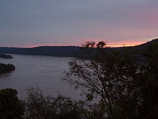
The Uruguay River is a major river in South America. It flows from north to south and forms parts of the boundaries of Brazil, Argentina, and Uruguay, separating some of the Argentine provinces of La Mesopotamia from the other two countries. It passes between the states of Santa Catarina and Rio Grande do Sul in Brazil; forms the eastern border of the provinces of Misiones, Corrientes, and Entre Ríos in Argentina; and makes up the western borders of the departments of Artigas, Salto, Paysandú, Río Negro, Soriano, and Colonia in Uruguay.

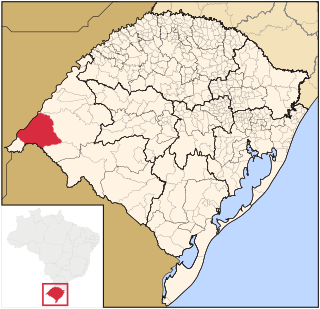
Corrientes ; officially the Province of Corrientes is a province in northeast Argentina, in the Mesopotamia region. It is surrounded by : Paraguay, the province of Misiones, Brazil, Uruguay, and the provinces of Entre Rios, Santa Fe and Chaco.
Uruguaiana is a municipality in the Brazilian state of Rio Grande do Sul. It is located on the left-hand (eastern) shore of the Uruguay River that forms the border with Argentina. Opposite Uruguaiana, and joined to it by a road/railway bridge, lies the Argentine city of Paso de los Libres, Corrientes. North of Uruguaiana lies the Brazilian municipality of Itaqui, connected by a bridge constructed by the English in 1888 over the Ibicuí River. The municipality also borders the municipalities of Alegrete, Barra do Quaraí and Quaraí, and, also, Uruguay, making it one of the few international triple-border municipalities of Brazil.

Paso de los Libres is a city in the east of the province of Corrientes in the Argentine Mesopotamia. It had about 44,000 inhabitants at the 2010 census [INDEC], and is the head town of the department of the same name.

In the Paraguayan War, the Battle of Yatay was fought on August 17, 1865 between the troops of the Triple Alliance and the soldiers of Paraguay near Paso de los Libres, Corrientes, Argentina.
The pulp mill dispute was a dispute between Argentina and Uruguay concerning the construction of pulp mills on the Uruguay River. The presidents at the time were Néstor Kirchner (Argentina) and Tabaré Vázquez (Uruguay). As a diplomatic, economic, and public relations conflict between both parties, the dispute also affected tourism and transportation as well as the otherwise amicable relations between the two countries. The feud was unprecedented between the two countries, which have shared historical and cultural ties.

The Paso de los Libres-Uruguaiana International Bridge is a road and railroad bridge that joins Argentina and Brazil over the Uruguay River, running between Paso de los Libres, Corrientes Province, Argentina, and Uruguaiana, Rio Grande do Sul, Brazil. It measures 1,419 metres (4,656 ft) in length.

Ruta Nacional 3 is an Argentine highway, stretching from the eastern side of the country in Buenos Aires, crossing the provinces of Buenos Aires, Río Negro, Chubut Province, Santa Cruz and Tierra del Fuego. Since its start at Avenida General Paz (A001) until the end, on the bridge over Lapataia River, it measures 3,045 kilometres (1,892 mi).

National Route 9 is a major road in Argentina, which runs from the center-east to the northwest of the country, crossing the provinces of Buenos Aires, Santa Fe, Córdoba, Santiago del Estero, Tucumán, Salta and Jujuy. It starts on Avenida General Paz, which marks the border between the Autonomous City of Buenos Aires and the surrounding province of the same name, and ends at the Horacio Guzmán International Bridge, on the La Quiaca River, traversing 1,967 km (1,222 mi). The road is a limited access motorway from Buenos Aires to Rosario.
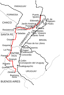
National Route 12 (RN12) is a road in Argentina, connecting the northeast section to the rest of the country. It runs through the provinces of Misiones, Corrientes, Entre Ríos and Buenos Aires.
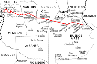
National Route 7 is a road in Argentina. It crosses the country from east to west, from the capital to the border with Chile, thus linking the Atlantic coast with the Andes, crossing the provinces of Buenos Aires, Santa Fe, Córdoba, San Luis and Mendoza. It has a total length of 1,224 km (761 mi), of which 367 km (228 mi) (30%) are freeways.
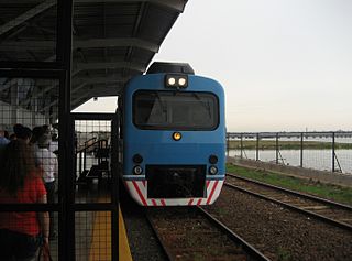
The General Urquiza Railway (FCGU), named after the Argentine general and politician Justo José de Urquiza, is a standard gauge railway of Argentina which runs approximately northwards from Buenos Aires to Posadas, with several branches in between. It was also one of the six state-owned Argentine railway companies formed after President Juan Perón's nationalisation of the railway network in 1948. The six companies were managed by Ferrocarriles Argentinos which was later broken up during the process of railway privatisation beginning in 1991 during Carlos Menem's presidency.

National Route 119 is a national road in Argentina, running north in the Center-South of Corrientes Province. It starts at the crossing with national routes 14 and 127 running for 109 kilometres (68 mi) until it crosses National Route 123 in Mercedes. The road is marked in red in the map. The whole length of the road is within Corrientes Province, crossing through Monte Caseros Department, Curuzú Cuatiá Department, and Mercedes Department.

National Route 118 is a national road in Argentina, in the northwest of Corrientes Province. It starts at the junction with National Route 12 until reaching the rural area of Paraje Vallejos Cué for a total length of 196 kilometres (122 mi). The road is marked in red in the map.
National Route 105 is a national road in the SW of Misiones Province, Argentina. From its start National Route 12 in Villalonga outside of the capital city of Posadas until its end at National Route 14, it has a total length of 35 kilometres (22 mi). The road is marked in red in the map.
National Route A009 is a highway in the northeast of Santa Fe Province, Argentina. It has a length of 12 km (7 mi) joining Puerto Reconquista on the east side of the Paraná River with National Route 11 at km marker 787, in the city of Reconquista, in General Obligado Department.

National Route 1, also known as Buenos Aires–La Plata Highway and officially called Autopista Doctor Ricardo Balbín since 2004, is a highway that connects the 25 de Mayo Highway and Paseo del Bajo in the city of Buenos Aires with the Provincial Route 11, near the city of La Plata. It has a length of 50 km (31 mi) with two or four lanes on each direction in different areas, and is indicated in red in the map.

Autovía 2 Juan Manuel Fangio is an Argentine dual carriageway, which runs from Buenos Aires to Mar del Plata. The road was a National Route until 1990 when it was transferred to the Government of Buenos Aires Province. The Autovía 2 extends from the junction of Provincial Routes 1 and 36 and National Route A004, just on the traffic circle "Juan María Gutiérrez", which is the limit of Berazategui and Florencio Varela districts.

Paso de los Libres Airport is an international airport serving Paso de los Libres, a town on the Uruguay River in Corrientes Province, Argentina. The airport is 6 kilometres (4 mi) west of the city, and 8 kilometres (5 mi) from the river, which is locally the border between Argentina and Brazil.

The Ruta Nacional 14 General José Gervasio Artigas is a major road in Argentina. It has its starting point in the small city of Ceibas, in the Entre Ríos province. Route 14 diverges from Ruta Nacional 12, following the río Uruguay coast and ending in the city of Bernardo de Irigoyen, Misiones. It is one of the most transited roads of the country, mainly because of tourists going to Brazil and Uruguay, and because it receives most of the former's trade.


