National road 98 (Poland)

Last updated
DK98-PL.svg
National Road 98
Droga krajowa nr 98
DK98 Wroclaw.svg
Wroclaw - droga krajowa nr 98 2015-12-26 14-39-11.JPG
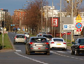
National road 98 as Ślężna Street in Wrocław. Picture taken in December 2015
Route information
History1985-2000: Renumbered to DK 28
2011-2019: A8 motorway junction Wrocław Psie Pole–Długołęka downgraded to DW 372 and section in Wrocław downgraded to a gmina road
Time period1985–2000, 2011–2019
Location
Country Poland
Regions Lower Silesian Voivodeship
Major cities Wrocław
Highway system
DK97-PL.svg DK 97 DK1-PL.svg DK 1

Droga krajowa nr 98 (translates from Polish as national road 98) was a route belonging to Polish national roads network.

Contents

History

1985–2000

The first time route 98 was introduced in 1985, as a part of road network reform. [1] It ran from Wadowice through Maków Podhalański, Jordanów, Rabka, Limanowa, Nowy Sącz, Gorlice, Jasło, Krosno, Sanok, Kuźmina and Bircza to Przemyśl [2] until the year 2000, when as a result of another reform the route 98 was decommissioned and replaced with road 28 existing to present day.

2011–2019

In 2011, after the Wrocław motorway bypass opened, road 98 was commissioned a second time. It ran entirely through Lower Silesian Voivodeship, leading from expressway S8 at junction Kobierzyce to Długołęka. In 2012 [3] road 98 was rerouted – it began on a crossing with national road 5 in Wrocław and finished at the Wrocław Psie Pole junction at motorway A8 and expressway S8 near the city, following mostly the old route of national road 8. Road 98 was treated as an alternative route for the bypass, despite the fact that A8 is not a toll road. [4]

Since January 1, 2020 road 98 is no longer a part of the national roads network. [5] The stretch connecting motorway junction Wrocław Psie Pole with village Długołęka was downgraded to voivodeship road 372 (DW 372), [6] with the further section through Wrocław downgraded to a gmina road. [7]

Related Research Articles

<span class="mw-page-title-main">Ministry of the Interior and Administration</span>

Ministry of the Interior and Administration is an administration structure controlling main administration and security branches of the Polish government. After Parliamentary Election on 9 October 2011 was transformed for two ministries: Ministry of Interior and Ministry of Administration and Digitization. It was recreated in late 2015.

<span class="mw-page-title-main">National roads in Poland</span> Category of public roads in Poland

According to classes and categories of public roads in Poland, a national road is a public trunk road controlled by the Polish central government authority, the General Directorship of National Roads and Motorways. All motorways and expressways in Poland are classified as part of the national roads network.

<span class="mw-page-title-main">Recław</span> Village in West Pomeranian Voivodeship, Poland

Recław is a village in the West Pomeranian Voivodeship, Poland, located within Gmina Wolin, Kamień County.

<span class="mw-page-title-main">National road 2 (Poland)</span> National road in Poland

National road 2 is an A-class, S-class and GP-class Polish national road, being part of the European route E30 from Cork (Ireland) to Omsk (Russia). The highway traverses through the Lubusz, Greater Poland, Łódź. Masovian and Lublin voivodeships. It runs latitudinally.
<span class="mw-page-title-main">National road 81 (Poland)</span> National road in Poland

National road 81 is a route belonging to the Polish national road network. The highway connects Katowice with Skoczów, the whole stretch lies within Silesian Voivodeship.

<span class="mw-page-title-main">Expressway S52 (Poland)</span> Polish highway under construction

Expressway S52 is a Polish highway under construction with a planned length of 116 km (72 mi), located in the Silesian and Lesser Poland voivodeships. Upon completion it will connect the border of the Czech Republic in Cieszyn with Kraków.

<span class="mw-page-title-main">National road 41 (Poland)</span> Road in Poland

National Road 41 is a route belonging to the Polish national roads network. The route runs from Nysa to Prudnik, in the Opole Voivodeship, then on to the border with the Czech Republic.

<span class="mw-page-title-main">National road 54 (Poland)</span> National road in Poland

National road 54 is a route belonging to the Polish national road network. The highway is a GP-class road, 18 km (11 mi) long, located in the Warmian-Masurian Voivodeship. This route connects the Expressway S22 at the Braniewo-Południe junction near Chruściel with the Gronowo-Mamonovo border crossing near Russia.

<span class="mw-page-title-main">National road 53 (Poland)</span> Road in Poland

National road 53 is a route belonging to the Polish national road network. The highway is a GP-class and G-class road, 123 km (76 mi) long and is located in the Masovian and Warmian-Masurian Voivodeship. This route connects Olsztyn with Ostrołęka. The winding section between Olsztyn and Szczytno is the most difficult for drivers.

<span class="mw-page-title-main">National road 52 (Poland)</span> Road in Poland

National road 52 is a route belonging to the Polish national road network. The highway is a GP-class and S-class road, 72 km (45 mi) long and is located in the Lesser Poland and Silesian Voivodeship. This route consists of two fragments that are not connected with each other. The first one connects Cieszyn through Bielsko-Biała with Głogoczów. The second is the north-west bypass of Kraków.

<span class="mw-page-title-main">National road 69 (Poland)</span> Former national road in Poland connecting Bielsko-Biała to Poland–Slovakia border in Zwardoń

National road 69 was a route belonging to the Polish national road network. The highway connected Bielsko-Biała with Poland–Slovakia border in Zwardoń.

<span class="mw-page-title-main">National road 68 (Poland)</span> National road in Poland

National road 68 is a main road of accelerated traffic belonging to the Polish national road network. The length of the route is 11.4 kilometres (7.1 mi), of which 5.197 kilometres (3.229 mi) is maintained by General Directorate for National Roads and Highways. The highway connects the Kukuryki border crossing on Belarus–Poland border with national road 2 in Wólka Dobryńska. It runs entirely in Lublin Voivodeship, in Biała County. According to signage, national road 68 is a component of European highway E30.

<span class="mw-page-title-main">National road 37 (Poland)</span> National road in Poland

National road 37 is a main road (Polish: droga główna, droga klasy G) route belonging to Polish national roads network, located in West Pomeranian Voivodeship. With its length of 14.6 kilometres (9.1 mi), the route connects the town of Darłowo with national road 6 near Karwice. In the future a new junction will be constructed, linking road 37 with expressway S6.

<span class="mw-page-title-main">National road 96 (Poland)</span> National road in Poland

National road 96 is a main road of accelerated traffic, belonging to Polish national roads network, with length of 1.5 kilometres (0.93 mi) and located in Toruń County. It connects motorway A1 with national road 15. With its length, the route is the shortest one of all national roads in Poland.A

<span class="mw-page-title-main">Lipa Piotrowska</span> District in Wrocław, Poland

Lipa Piotrowska is a district in Wrocław, Poland, located in the northern part of the city. It was established in the territory of the former Psie Pole district.

<span class="mw-page-title-main">Osobowice-Rędzin</span> District in Wrocław, Poland

Osobowice-Rędzin is a district in Wrocław, Poland, located in the northern part of the city. It was established in the territory of the former Psie Pole district. It consists of Osobowice, incorporated into the city in 1928, and Rędzin, incorporated in 1973. Much of the district's area is occupied by the former septic drain fields of the Wrocław sewage treatment plant.
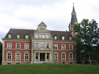
<span class="mw-page-title-main">Pawłowice, Wrocław</span> District in Wrocław, Poland

Pawłowice is a district in Wrocław located in the north-eastern part of the city. It was established in the territory of the former Psie Pole district.

<span class="mw-page-title-main">Psie Pole-Zawidawie</span> District in Wrocław, Poland

Psie Pole-Zawidawie is a district in Wrocław, Poland, located in the north-eastern part of the city. It was established in the territory of the former Psie Pole district. It consists of the neighborhoods of Psie Pole, Zakrzów, Zgorzelisko, and Kłokoczyce.

<span class="mw-page-title-main">Strachocin-Swojczyce-Wojnów</span> District in Wrocław, Poland

Strachocin-Swojczyce-Wojnów is a district in Wrocław, Poland, located in the eastern part of the city. It was established in the territory of the former Psie Pole district.

<span class="mw-page-title-main">Świniary, Wrocław</span> District in Wrocław, Poland

Świniary is a district in Wrocław, Poland, located in the northern part of the city. It was established in the territory of the former Psie Pole district.

References

  1. Uchwała nr 192 Rady Ministrów z dnia 2 grudnia 1985 r. w sprawie zaliczenia dróg do kategorii dróg krajowych  [Resolution No. 192 of the Council of Ministers of December 2, 1985 on including roads in the category of national roads], M.P., 1986, vol. 3, No. 16
  2. Rozporządzenie Rady Ministrów z dnia 15 grudnia 1998 r. w sprawie ustalenia wykazu dróg krajowych i wojewódzkich  [Regulation of the Council of Ministers of December 15, 1998 on establishing the list of national and voivodship roads], Dz. U., 1998, vol. 160, No. 1071
  3. "Zarządzenie nr 30 Generalnego Dyrektora Dróg Krajowych i Autostrad z dnia 11 września 2012" [Decree No. 30 of the General Director of National Roads and Motorways of September 11, 2012](PDF). www.gddkia.gov.pl (in Polish). GDDKiA. 2012-09-11. Retrieved 2020-01-21.
  4. "N4 Toll Route". www.gihub.org. Retrieved 2024-12-26.
  5. Rozporządzenie Ministra Infrastruktury z dnia 23 września 2019 r. w sprawie pozbawienia dróg kategorii dróg krajowych  [Regulation of the Minister of Infrastructure of 23 September 2019 on depriving roads of the category of national roads], Dz. U., 2019, No. 1850
  6. "Uchwała nr VII/153/19 Sejmiku Województwa Dolnośląskiego z dnia 25 kwietnia 2019 r. w sprawie zaliczenia odcinka drogi krajowej nr 98 do kategorii dróg wojewódzkich" [Resolution No. VII/153/19 of the Lower Silesian Voivodeship Parliament of April 25, 2019 regarding the inclusion of a section of national road No. 98 into the category of voivodeship roads.] (in Polish). Dziennik Urzędowy Województwa Dolnośląskiego. Retrieved 2020-01-21.
  7. "Uchwała nr LVI/1319/18 Rady Miejskiej Wrocławia z dnia 24 maja 2018 r. w sprawie opinii o pozbawieniu kategorii drogi krajowej odcinków drogi krajowej nr 98" [Resolution No. LVI/1319/18 of the Wrocław City Council of May 24, 2018 regarding the opinion on the deprivation of the national road category of the sections of national road No. 98.] (in Polish). Biuletyn Informacji Publicznej Urzędu Miasta Wrocławia. 2018-05-24. Retrieved 2020-01-21.

51°06′34″N17°03′10″E / 51.109502°N 17.052649°E / 51.109502; 17.052649