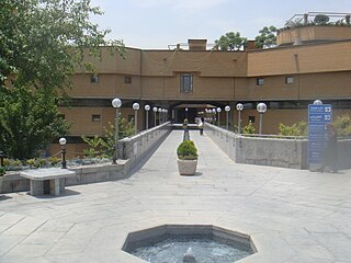
The National Library of Iran (NLI) is located in Tehran, Iran, with several branches scattered throughout the city.

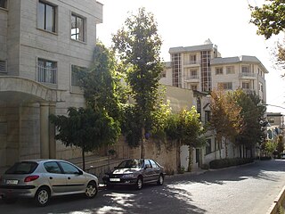
Elahieh is an affluent and upper-class district in northern Tehran.
The area is a residential and commercial locale and is filled with the homes and businesses of many politicians, diplomats, expatriates, and artists.
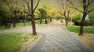
Laleh Park, is a large recreation area of the Iranian capital Tehran.

Shahrak-e Gharb or Qarb Town, also known as Qods Town, is a planned town built as a massive project of modern and Luxuries apartment buildings and villas in the north-western part of Tehran, Iran.
Sadeghiyeh is a heavily populated district in the West of Tehran, Iran. Also called by its pre-revolutionary name Ariashahr, it is one of Tehran's busiest commercial and residential centers. The Sadighiyeh metro station is one of the busiest stations in Tehran where Teheran Metro lines 2 and 5 intersect.

Abbās Ābād is a large north-central neighborhood of Tehran, Iran, designated within the Seventh Municipal District of the capital.

Farmanieh is a district located in Shemiran, Tehran, Iran centered on Farmanieh Street. Farmanieh neighborhood extends south all the way to Sadr Expressway, where it becomes Dibaji, and as far north as Niavaran Expressway. It has one of, if not the highest household income rates in Tehran, being home to many embassies, nobles and notables of Iran.
Zafaraniyeh is an affluent neighbourhood in the north of Tehran, Iran. The name's origin lies in the fact that it was the residence of many saffron traders long ago, thus the name Zafaraniyeh. The Islamic Azad University of Tehran, Languages branch is located at the beginning of Zafaraniyeh that teaches English, German, French, Spanish, and other foreign languages. The museum of Sa'dabad Palace is situated at the end of this street, which also contains a culture house. There are plans to build a shopping center in Asef crossroad. The Moghaddas Ardebili Street connects Zafaraniyeh to Velenjak from east and to Valiasr Street and Elahieh from west. Zafaraniyeh is one of Teheran´s safest and most heavily guarded neighborhood due to the many Embassies, Ambassadorial residences and Iranian’s head of state who reside here. There is also a synagogue in this neighbourhood. The area is classed as being the best and most expensive area of Tehran, with many wealthy Iranians and non-Iranians living here. The area has many Billionaires and Millionaires and many of the residents also live abroad. The area consists of nearly all apartment blocks with only a few houses. It is near the longest city road in Asia, Vali-asr Street. This area of Vali-asr street has many boutiques that has shops such as Gucci, Rolex and Armani, Louis Vuitton etc. boutiques. Some of the great Zafaraniyeh Shopping Malls and Centers are listed below:

Park e Shahr, literally the City Park, with its 26 hectares, is a major park located in the region 12th, central Tehran, Iran. It is surrounded by Fayaz Bakhsh Street from the north, Hafez Street from the west, Behesht Street from the south and Khayyam Street from the east.
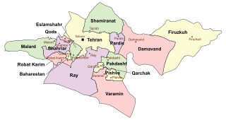
Shahriar County is a county in Tehran Province in Iran. The capital of the county is Shahriar. At the 2006 census, the county's population was 1,044,707, in 273,826 families; excluding those portions, the population was 516,022, in 134,378 families. The county has one district: the Central District. The county has seven cities: Shahriar, Sabashahr, Vahidieh, Shahedshahr, Ferdowsieh, Baghestan, and Andisheh.
Davoodiyeh is a large district of northern Tehran, Iran.
ToopKhāneh, also spelt as Tūpkhāneh, is a major town square and a neighborhood in the south of the central district of the city of Tehran, Iran. It was built in 1867 by an order of Amir Kabir and Commissioned in 1867. After the Iranian Revolution, it was renamed Imam Khomeini Square. Cheragh Bargh street ends-up to this square, and Naserie street, Bob Homayoun street, Sepah street, Ferdowsi street and Lalezar street find ways to other directions.
The Chaldean Catholic Metropolitan Archeparchy of Tehran is an Archeparchy of the Chaldean Catholic church in Iran, with its archiepiscopal see, St. Joseph's Cathedral, in the national capital Tehran. Despite its Metropolitan rank, it has no suffragan.
Qods County is a county in Tehran Province in Iran. The capital of the county is Qods. At the 2006 census, the county's population was 237,077, in 62,355 families. The county has one district: the Central District. The county has one city: Qods.
Javadabad District is a district (bakhsh) in Varamin County, Tehran Province, Iran. At the 2006 census, its population was 26,105, in 6,430 families. The District has one city: Javadabad. The District has two rural districts (dehestan): Behnamarab-e Jonubi Rural District and Behnamvasat-e Jonubi Rural District.
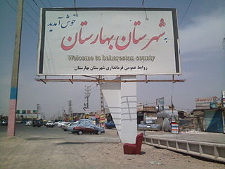
Baharestan County is a county in Tehran Province in Iran. The capital of the county is Nasim Shahr. The county has one district: the Central District. The county has three cities: Nasimshahr, Golestan and Salehieh. The county was formed in 2011 from the Baharestan District and parts of Golestan District, from Robat Karim County.
Razakan Rural District is a rural district (dehestan) in the Central District of Shahriar County, Tehran Province, Iran. At the 2006 census, its population was 25,395, in 6,293 families. The rural district has 9 villages.
Lavasan-e Bozorg Rural District is a rural district (dehestan) in Lavasanat District, Shemiranat County, Tehran Province, Iran. At the 2006 census, its population was 3,873, in 1,111 families. The rural district has 14 villages.
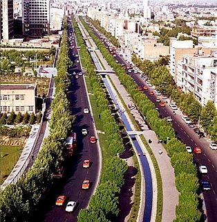
Keshavarz Boulevard (Blvd.) or simply Bolvār is a central Boulevard in Tehran, Iran. It is a 2.2 km long, East-West boulevard which connects Valiasr Street and Valiasr Sq. to Imam Khomeini Hospital Complex and is located in District 6 of Tehran. This boulevard was named "Elizabeth Boulevard" after Queen Elizabeth II visit to Iran during the former regime of Iran, Pahlavi dynasty. However, after the 1979 Revolution, it was renamed Keshavarz Boulevard, as the main building of the Ministry of Agriculture of Iran was located close to this boulevard.
Imam Ali Officers' University, formerly known as Officers' School is the military academy of Ground Forces of Islamic Republic of Iran Army, located in Tehran, Iran. Cadets of the academy achieve the second Lieutenant rank upon graduation and join one of Islamic Republic of Iran Army branches.