Punak

Last updated
Punak
پونک
Neighborhood
Punak winter.jpg
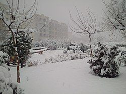
Punak in 2020 winter
Tehran arr jms.gif
Reddot.svg
Punak
Location in Tehran and Iran
Iran location map.svg
Red pog.svg
Punak
Punak (Iran)
Coordinates: 35°45′48″N51°20′12″E / 35.76333°N 51.33667°E / 35.76333; 51.33667
Country Flag of Iran.svg  Iran
Province Tehran
City Tehran
DistrictDistricts 5 and 2
Elevation
1,480 m (4,860 ft)
Population
  Total29,000
Time zone UTC+3:30 (IRST)
  Summer (DST) UTC+4:30 (IRDT)
Area code (+98)021444
Website https://region5.tehran.ir/
Punak within map of Tehran (colored in black) Poonak in Tehran map.JPG
Punak within map of Tehran (colored in black)

Punak is a high-class and luxurious neighborhood in north Tehran, the capital city of Iran. The name of one of the most expensive and promising neighborhoods in the city of Tehran, located in the northwest. Part of it is in Region 2 and another part is in District 5. According to the latest census, around 22,000 people reside in Punak. Boostan Shopping Center is near Punak.

Related Research Articles

<span class="mw-page-title-main">Tehran</span> Capital and largest city in Iran

Tehran is the capital and largest city of Iran. It also serves as the capital of the province, county and the Central District. With a population of around 9.4 million in the city and around 15.8 million in the larger metropolitan area of Greater Tehran, Tehran is the most populous city in Iran and Western Asia, and has the second-largest metropolitan area in the Middle East, after Cairo. It is ranked 24th in the world by metropolitan area population. Archaeological remains from the ancient city of Ray suggest that settlement in Tehran dates back over 6,000 years.

<span class="mw-page-title-main">Namakab Rud</span> Town in Mazandaran, Iran

Namakâb Rud is a town in Kelarestaq-e Gharbi Rural District, in the Central District of Chalus County, Mazandaran Province, Iran.

<span class="mw-page-title-main">Jannat Abad</span> District in Iran

Jannat Abad is a large neighbourhood in Tehran, Iran. It is an area around the Jannat Abad Street located in North West Tehran. Jannat Abad street starts from Ayatollah Kashani Freeway. It has several squares. The most famous one is Chahar Bagh. Jannat Abad Blvd has a South segment that is below the cross with Hemmat Freeway and North part that is located upon Hemmat and links to the Marzdaran Freeway.

<span class="mw-page-title-main">Pasdaran (district)</span>

Pasdaran is a neighborhood of northern Tehran centered on Pasdaran Avenue. This avenue connects Niavaran avenue to Shariati avenue. It is about 8–9 km long and is a major commercial thoroughfare for northern Tehran together with northern parts of two other long streets: Valiasr Street and Shariati Street.

<span class="mw-page-title-main">Ahmad Tafazzoli</span>

Ahmad Tafazzoli was an Iranian Iranist and professor of ancient Iranian languages and culture at Tehran University.

Velenjak is an affluent neighbourhood in the northwest of Tehran, Iran. Velenjak is located in the Shemiran area in the northernmost part of Tehran, on the slopes of the Alborz mountain range. It is known for its landscapes, mild climate, mountain air, springs, and wildlife.

<span class="mw-page-title-main">Sa'adat Abad</span> Neighborhood in Tehran

Sa'adat Abad is a wealthy district located in northern Tehran. The texture of the neighborhood is modern. Most of the main and secondary streets are wide and have been designed and implemented based on urban standard principles and in a modern style. The number of private and government companies in this region is not significant. Sa'adat Abad district is known to have better air quality and lower levels of air pollution. Another attractive feature that encourages people to buy a property in Sa'adat Abad is the lack of traffic restrictions in Tehran.

<span class="mw-page-title-main">Tajrish</span> Neighborhood in Tehran province, Iran

Tajrish, also Romanized as Tajrīš, is a neighbourhood of Tehran, capital of Iran. Administratively it is in Shemiranat County, Tehran province and serves as the capital of the county. At one time a village, it was later absorbed into the city of Tehran.

<span class="mw-page-title-main">Architecture of Tehran</span>

Tehran has grown dramatically since Mohammad Khan Qajar chose it as the capital of the Qajar dynasty in 1796. Despite the occurrence of earthquakes during the Qajar period and before, some buildings still remain from Tehran's era of antiquity. However, most of Tehran's historic architecture has been obliterated by the wave of hasty modernization that swept through the capital over the last 40 to 50 years. Of the eight city gates of old Tehran, none remain today. The Qajar culture flowered into a mature form of vernacular architecture, and many relics today remain of this tradition. Most, however, are government offices and residences of the royal elite. The "Kushak" of Ahmad Shah in the Niavaran Palace Complex is an example of this tradition.

<span class="mw-page-title-main">Greater Tehran</span> Place in Tehran, Iran

Greater Tehran Metropolitan Area is the urban agglomeration around Tehran that covers the central part of the Tehran Province and eastern part of the Alborz Province, that covers the contiguous cities of Tehran, Ray, Shemirānāt, and other areas.

<span class="mw-page-title-main">Yusef Abad</span> Neighbourhood in Tehran, Iran

Yusef Abad is an old neighborhood of Tehran, consisting of an area developed through nearly parallel streets including; Sayed Jamaleddin Asad Abadi, Ibn-e-sina, Jahan Ara, Mahram (Modabber), and Akbari (Mostowfi). The latter is the most beautiful, and seemingly the most expensive part of it. The area was first built by Mirza Yusef Ashtiani Mostowfi ul-Mamalek in north-west of Dar-ol Xelafe Naseri, so was named after his name as Yusef Abad locality.

Ekhtiyariyeh is a neighborhood in the district of Shemiran in northern Tehran, Iran.

<span class="mw-page-title-main">Shahran, Tehran</span> Neighborhood of Tehran in Tehran Province, Iran

Shahran is a neighbourhood in north-west Tehran, Iran.

<span class="mw-page-title-main">Baharestan (district)</span>

Baharestan is a locality east of the central part of Tehran in Iran. The historical Baharestan building is located in this neighborhood.

<span class="mw-page-title-main">Tehransar</span> Neighbourhood in western Tehran

Tehransar is the name of a neighborhood in the west of Tehran, which is connected to Shahid Lashkari highway and Shahrak Azadi neighborhood from the north, Fatah highway from the south, Mehrabad airport and Asman neighborhood from the east, and Ayatollah Mahdavi Keni highway and Esteghlal neighborhood and Darya neighborhood from the west. is limited. Tehransar neighborhood used to be in the 9th district of Tehran municipality, but since 2004 it is located in the 21st district of Tehran municipality. Girl schools in Tehranser have been the subject of gas poisonings in 2023, with dozens of students taken to hospital.

<span class="mw-page-title-main">Ashrafi Esfahani Expressway</span>

Ashrafi Esfahani Expressway (Highway) is an expressway in Tehran which runs North-South from Hesarak Road to Second Sadeghiye Square. It passes Punak, Hemmat, Qasem Soleimani and Jalale Ale Ahmad.

<span class="mw-page-title-main">Chizar</span> Neighbourhood in Tehran, Iran

Chizar is a neighborhood in Shemiran, north of Tehran, Iran. Chizar used to be a village which was gradually annexed to the capital with the expansion of Tehran city. Chizar neighborhood has a long religious history indicated by the presence of Imamzadeh Ali Akbar.

<span class="mw-page-title-main">Oudlajan</span> Historic neighborhood in Tehran, Iran

Oudlajan is a historic neighborhood in Tehran, Iran. The neighborhood is surrounded by Pamenar Street, Cyrus Street, Cheragh Bargh and BozarJomehr Street. Oudlajan, in addition to Arg, Dolat, Sangelaj, Bazar and Chalmeidan, constituted Old Tehran during the reign of Naser al-Din Shah Qajar. Old Oudlajan consisted of 2619 houses and 1146 shops and was one of the biggest and wealthiest neighborhoods in Tehran.

<span class="mw-page-title-main">Urbanism in Iran: Tehran</span>

Modern urbanist ideas were first conceived and applied in Iran beginning in 1952. During the British boycott of Iranian oil of 1952, the Iranian government looked inward for income by investing in infrastructural and agricultural projects. It is during this period that the Bank Sakhtemani was established to create capital and funding for infrastructure projects throughout Iran, including urban development. In 1952, the Iranian parliament approved the purchase of lands outside the Tehran city limits by Sakhtemani Bank for development into towns. Bank Sakhtemani collaborated with The Association of Iranian Architect Diploma (AIAD) to prepare master plans for these projects. The first of these projects were Kuy-e-Narmak, TehranPars, and Nazi-Abad. The AIAD attempted to integrate ideas from modernist conferences such as the Union Internationale Des Architectes (UIA) and Congrès Internationaux D'architecture Modern (CIAM), with vernacular Persian architecture, hence practicing a vernacular modernism. Decades onward, these neighborhoods still maintain their underlying structure which organized them and makes them identifiable even though social and economic factors of the society have changed.

<span class="mw-page-title-main">Kūh-Zibad</span>

Kūh-Zibad its peak also called Tir Mahi is a mountain in the province of Razavi Khorasan, city of Gonabad District Zibad in the eastern part of the country, 700 km east of the capital Tehran. The Peak of the Moantain is called Qole -e Tir Mahi is 2,557 metres (8,389 ft) above sea level, or 431 m (1,414 ft) above the surrounding terrain. The width at the base is 5.5 km. The terrain around the Qole-e Tir Mahi and Kuh-e zibad is mainly hilly. The highest point in the vicinity is 2775 meters above sea level, 17.7 km southeast of Qole-e Tir mahi. Around Kuh-e Zibad is very sparsely populated, with 5 inhabitants per square kilometer. Nearest society zibad, 8.5 km north of Kuh-e Zibad. The neighborhood around Kuh-e Zibad is barren with little or vegetation. In the neighborhood around the Kuh-e Zibad are unusually many named mountains and valleys. A cold steppe climate prevailing in the region. The average annual temperature in the area is 17 °C. The warmest month is July when the average temperature is 30 °C, and the coldest is January, with 1 °C. Average annual rainfall is 211 mm (8 in). The rainiest month is February, with an average of 58 mm (2 in) of precipitation, and the driest is July, with 1 mm of precipitation. This mountain had been referred in some historical book such as shahnameh in Davazdah Rokhwar as the Zibad mountain and its eastern part is called black mountain or kuh Gonabad. The long mountain range is called Qohestan and it extends from Bajestan to Birjand near the border with Afghanistan. This mountain range separates south khorasan from Razavi Khorasan, part of this mountain range near Kakhk is called black mountain or kuh e gonabad.

References