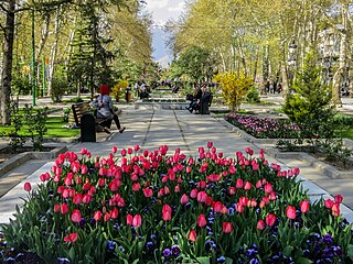
Mellat Park, literally the Nation Park, is an urban park in northern Tehran, Iran.

Vanak is a neighbourhood in the northern part of Tehran, capital of Iran and there is a square and a street named after it. The word Vanak means "Small (ash) Tree" in Persian.

Pardisan Park is a complex covering more than 270 hectares, located in the northwest of Tehran. It is connected to Hemmat Expressway in the north, and to Sheikh Nouri Expressway in the east.
Tehranpars or Tehran Pars (تهرانپارس) is an absorbed city inside the Greater Tehran Area and is located in the north east area of the city. It is considered a neighbourhood of Tehran City and lies in Tehran's eastern flank inside the area of the 4th and 8th municipalities of Tehran.

Shahrak-e Gharb or Qarb Town, also known as Qods Town, is a planned town built as a massive project of modern apartment buildings and villas in the north-western part of Tehran, Iran.

Abbās Ābād is a large north-central neighborhood of Tehran, Iran, designated within the Seventh Municipal District of the capital.

Farmanieh is a district located in Shemiran, Tehran, Iran centered on Farmanieh Street. Farmanieh neighborhood extends south all the way to Sadr Expressway, where it becomes Dibaji, and as far north as Niavaran Expressway. It has one of, if not the highest household income rates in Tehran, being home to many embassies, nobles and notables of Iran.

Narmak is a neighbourhood in north-east Tehran, the capital of Iran.

Park e Shahr, literally the City Park, with its 26 hectares, is a major park located in the region 12th, central Tehran, Iran. It is surrounded by Fayaz Bakhsh Street from the north, Hafez Street from the west, Behesht Street from the south and Khayyam Street from the east.
Ekhtiyariyeh is a neighborhood in the district of Shemiran in northern Tehran, Iran.

Mirdamad Boulevard is the center of Davoodiyeh district in the north of Tehran. The boulevard starts from Valiasr Street in its west and continues eastward passing Mother Square up to Shariati street. Central Bank of the Islamic Republic of Iran is located in this boulevard.

Mehran district is a neighborhood of northern Tehran. The area is named after the Mehran garden. It is located east of Shariati Avenue, west of Niavaran Expressway, north of Resalat Expressway, and southeast of Hemmat Expressway.

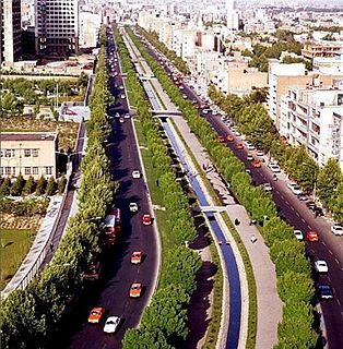
Hemmat Expressway is a route in Tehran, Iran. It starts from Pasdaran Avenue junction and goes west. It passes Haghani Expressway, Kordestan Expressway, Milad Tower, Ashrafi Esfahani Expressway and Ziba Shahr in Western Tehran and ends into a two-way road that goes south to Tehran–Karaj Freeway.

Shahid Haghani Metro Station is a station in Tehran Metro Line 1. It is located next to Shahid Haghani Expressway Between the junctions with Hemmat Expressway and Modares Expressway. It is between Shahid Hemmat Metro Station and Mirdamad Metro Station. This station also has a great parking.

The Tower of Bank Markazi is a high-rise building located in Davoodiyeh neighborhood of Tehran, between Shahid Haghani Expressway and Mirdamad Boulevard. Its facade is made of dark blue reflective glasses, making it a reverse panopticon. The building belongs to the Central Bank of Iran.
Kan Creek is a stream of water flowing through Western Tehran.

Tehranno is one of the eastern neighborhoods in Tehran. It is located in region 13 of Tehran. It has 4 small squares, named Chaychi, Ettela'at, Ashtiani, and Lozi, respectively. However, Ashtiani Square has been torn down, because of the Bagheri highway's construction.
Before the Islamic Revolution, some of the streets were named by the words beginning with "Mehr," such as Mehrbar, Mehrafrooz, Mehrpoo, Mehravar, Mehrjoo, and Mehrayin. The previous name of Lozi Square was Mehr Square, but during the war between Iraq and Iran, some were renamed after people killed in the war.
Other streets are named after famous poets, such as Hafez, Sa'di, Roodaki, Sa'eb tabrizi, Bou'ali, Sanayi, Ferdosi, and Molavi.
Rahimabad District is a district (bakhsh) in Rudsar County, Gilan Province, Iran. The
sole city in Rahimabad District, also called Rahimabad, is located west of the Caspian Sea at 35° 22' 54" North, 45° 7' 28" East, and lies at an altitude of 4,268 feet according to Maplandia.com. At the 2006 census, its population was 27,653, in 7,820 families. The District has one city: Rahimabad. The District has four rural districts (dehestan): Eshkevar-e Sofla Rural District, Rahimabad Rural District, Shuil Rural District, and Siyarastaq Yeylaq Rural District.
Keshavarz Boulevard (Blvd.) or simply Bolvār is a central Boulevard in Tehran, Iran. It is a 2.2 km long, East-West boulevard which connects Valiasr Street and Valiasr Sq. to Imam Khomeini Hospital Complex and is located in District 6 of Tehran. This boulevard was named "Elizabeth Boulevard" after Queen Elizabeth II visit to Iran during the former regime of Iran, Pahlavi dynasty. However, after the 1979 Revolution, it was renamed Keshavarz Boulevard, as the main building of the Ministry of Agriculture of Iran was located close to this boulevard.