Nes, Ameland

Last updated
Nes
Village
Ameland-Nes-Aug-2006.JPG
Nes
LocatieNesAmeland.png
Location in Ameland municipality
2010-NL-P02-Fryslan-positiekaart-gemnamen.jpg
Red pog.svg
Nes
Location in the province of Friesland
Netherlands location map.svg
Red pog.svg
Nes
Nes (Netherlands)
Coordinates: 53°26′42″N5°46′23″E / 53.44500°N 5.77306°E / 53.44500; 5.77306
Country Flag of the Netherlands.svg Netherlands
Province Frisian flag.svg Friesland
Municipality Flag of Ameland.svg Ameland
Area
[1]
  Total12.66 km2 (4.89 sq mi)
Elevation
[2]
1.7 m (5.6 ft)
Population
 (2021) [1]
  Total1,235
  Density98/km2 (250/sq mi)
Time zone UTC+1 (CET)
  Summer (DST) UTC+2 (CEST)
Postal code
9163
Dialing code 0519

Nes is the second largest village on the island of Ameland, one of the West Frisian Islands in the northern Netherlands.

Contents

It constitutes the main village of the eastern, Roman Catholic part of Ameland and had a population of 1,155 as of January 2017. [3] In the past, the Catholic Amelanders were involved in many conflicts with the western, Protestant Amelanders living in Hollum and Ballum. Nes has since become a popular tourist destination, as the place where the ferry from the mainland arrives. The village has many small shops and restaurants, a microdistillery, [4] and a windmill, De Phenix. [5]

Harbour

At Nes, on the south side of Ameland, lie the spring dock and marina on the island, one of the 17 Wadden Sea ports. The rescue station KNRM has separate these facilities in the Ballumerbocht, about 4 km east of the causeway. The marina is managed by the Foundation Marina Leyegat and is open from April 1 until November 1. At low tide, the port only to sail on small boats because of the shallow depth of 0.60 to 0.80 m at the harbor entrance. Acceptances route through the Reegeul is straight and clearly marked out. The harbor entrance is on the east side of the ferry jetty, from the Reegeul should be considered separately and accepts ferries and excursion boats. Traps can dry in various places, such as the east of the marina. The port has floating docks with power, a port office with meteorological and tidal information and sanitation.

Related Research Articles

<span class="mw-page-title-main">Ameland</span> Municipality and island of the Netherlands

Ameland is a municipality and one of the West Frisian Islands off the north coast of the Netherlands. It consists mostly of sand dunes and is the third major island of the West Frisians. It neighbours islands Terschelling to the west and Schiermonnikoog to the east. This includes the small Engelsmanplaat and Rif sandbanks to the east.

<span class="mw-page-title-main">Schiermonnikoog</span> Municipality in Friesland, Netherlands

Schiermonnikoog is an island, a municipality and national park in the Northern Netherlands. Schiermonnikoog is one of the West Frisian Islands, and is part of the province of Friesland. It is situated between the islands of Ameland and Rottumerplaat.

<span class="mw-page-title-main">Hollum</span> Village in Friesland, Netherlands

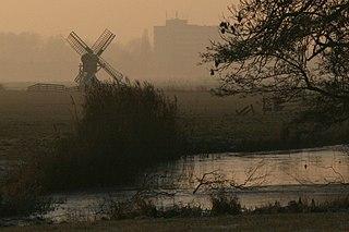
Hollum is the largest village on Ameland, Netherlands, one of the West Frisian Islands. It is situated on the westernmost part of the island and had, as of January 2017, a population of 1,165.

<span class="mw-page-title-main">Rijpwetering</span> Village in South Holland, Netherlands

Rijpwetering is a village in the Dutch province of South Holland. It is a part of the municipality of Kaag en Braassem, and lies about 8 kilometres (5.0 mi) east of Leiden.

<span class="mw-page-title-main">Akersloot</span> Village in North Holland, Netherlands

Akersloot is a village in the Dutch province of North Holland. It is a part of the municipality of Castricum, and lies about 9 km south of Alkmaar. Until 1 January 2002, Akersloot was a separate municipality.

<span class="mw-page-title-main">Fisherman's Village</span> Tourist attraction in Marina del Rey, California, USA

Fisherman's Village is a waterfront mall, commercial boat anchorage and tourist attraction located in the world's largest man-made small boat harbor in Los Angeles County at Marina del Rey, California. The Ballona Wetlands State Ecological Reserve is just east of Fisherman's Village and immediately to the south is the federally-owned riverine estuary of Ballona Creek. The historical Fisherman's Village, built in 1967, is nestled on the eastern bank of main harbor entrance channel between Whiskey Reds restaurant to the south and the Windward boatyard to the north.

<span class="mw-page-title-main">Buren, Friesland</span> Village in Friesland, Netherlands

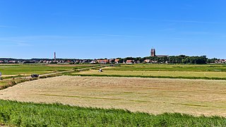
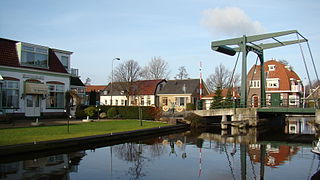
Buren is the easternmost village on the island of Ameland, one of the West Frisian Islands and part of the Netherlands. Buren had, as of January 2017, a population of 715.

<span class="mw-page-title-main">Bruinisse</span> Village in Zeeland, Netherlands

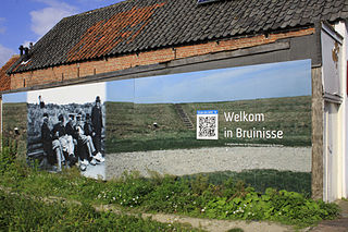
Bruinisse is a village in the south-west of the Netherlands. It is located in the municipality of Schouwen-Duiveland, Zeeland.

<span class="mw-page-title-main">Muiderberg</span> Village in North Holland, Netherlands

Muiderberg is a village in the municipality of Gooise Meren in the Netherlands. It lies about 6 km north of Bussum and 2 km west of Naarden, adjacent to the Naarderbos.

<span class="mw-page-title-main">Terheijden</span> Village in North Brabant, Netherlands

Terheijden is a village in the Dutch province of North Brabant. It is located in the municipality of Drimmelen, about 6 km north of Breda.

<span class="mw-page-title-main">Ballum</span> Village in Friesland, Netherlands

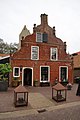
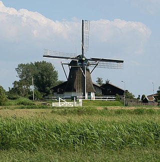
Ballum is a village on the western half of the island of Ameland and the smallest of the total of four villages on the island, one of the West Frisian Islands and part of the Netherlands.

<span class="mw-page-title-main">Goidschalxoord</span> Hamlet in South Holland, Netherlands

Goidschalxoord is a hamlet in the Dutch province of South Holland. It is located about 5 km east of Oud-Beijerland, in the municipality of Hoeksche Waard.

<span class="mw-page-title-main">Herkingen</span> Village in South Holland, Netherlands

Herkingen is a village in the Dutch province of South Holland. It is located on the south coast of the island Goeree-Overflakkee, in the municipality of Goeree-Overflakkee.

<span class="mw-page-title-main">Holwert</span> Village in Friesland, Netherlands

Holwert is a village in Noardeast-Fryslân municipality in the northern Netherlands, in the province of Friesland. It had a population of around 1,607 in January 2017. Before 2019, the village was part of the Dongeradeel municipality.

<span class="mw-page-title-main">Mildam</span> Village in Friesland, Netherlands

Mildam is a village in Heerenveen in the province of Friesland, the Netherlands. It had a population of around 685 in January 2017.

<span class="mw-page-title-main">Witmarsum, Netherlands</span> Village in Friesland, Netherlands

Witmarsum is a village in the northern Netherlands. It is located in Súdwest-Fryslân, Friesland. Witmarsum had a population of around 1,735 in January 2017. Witmarsum was birthplace of Menno Simons (1496–1561), the leader of what would become the Mennonites.

<span class="mw-page-title-main">Makkum, Súdwest-Fryslân</span> Village in Friesland, Netherlands

Makkum is a village of Súdwest-Fryslân municipality, west of Bolsward on the banks of the lake IJsselmeer in the province Friesland of the Netherlands. It had a population of around 3,460 in January 2017, making it the largest village of the former municipally Wûnseradiel. North and south of Makkum are nature reserves Noardwaard and Súdwaard. Belonging to Makkum is the hamlet Ingwier.

<span class="mw-page-title-main">Hartwerd</span> Village in Friesland, Netherlands

Hartwerd is a small village, near Bolsward, in the municipality of Súdwest-Fryslân in the Province of Friesland in the Netherlands. It had around 125 residents in January 2017.

<span class="mw-page-title-main">Woudsend</span> Village in Friesland, Netherlands

Woudsend is a village in Súdwest-Fryslân in the province of Friesland, the Netherlands. It had a population of around 1,380 in January 2017.

<span class="mw-page-title-main">Beugen</span> Village in North Brabant, Netherlands

Beugen is a village in the Dutch province of North Brabant. It is part of the municipality of Land van Cuijk. Beugen is located along the Maas and about 20 kilometres (12 mi) south of Nijmegen.

References

  1. 1 2 "Kerncijfers wijken en buurten 2021". Central Bureau of Statistics. Retrieved 26 April 2022. two entries
  2. "Postcodetool for 9163EA". Actueel Hoogtebestand Nederland (in Dutch). Het Waterschapshuis. Retrieved 26 April 2022.
  3. Kerncijfers wijken en buurten 2017 - CBS (in Dutch)
  4. Destilleerderij Nes
  5. Nes, Ameland - Nederlandse Molen Database

Commons-logo.svg Media related to Nes, Ameland at Wikimedia Commons