Heerenveen is a town and municipality in the province of Friesland (Fryslân), in the Northern Netherlands. In 2021, the town had a population of 29,790 while the municipality had a population 50,859.

Sneek is a city southwest of Leeuwarden and seat of the former municipality of Sneek in the province of Friesland, the Netherlands. As of 2011 it is part of the municipality Súdwest-Fryslân. The city had approximately 33,855 inhabitants in January 2017.

Drachten is a town in the northern Netherlands. It is located in the municipality of Smallingerland, Friesland. It had a population of around 45,186 in January 2017 and is the second largest town in the province of Friesland.
NES is commonly used as the abbreviation of Nintendo Entertainment System, a video game console

Joure is a town in the north of the Netherlands. It is the administrative center of De Fryske Marren, Friesland. With 13,090 inhabitants, it is also the most populous town in the municipality.

Akkrum is a village in the Dutch province of Friesland. It is located in the municipality Heerenveen, about 17 km south of the city of Leeuwarden.

Vis is a town on the eponymous island in the Adriatic Sea in southern Croatia. Its population was 1,934 as of 2011. The town is the seat of the eponymous Vis municipality, one of the island's two municipalities. Both belong administratively to Split-Dalmatia County.
Portmahomack is a small fishing village in Easter Ross, Scotland. It is situated in the Tarbat Peninsula in the parish of Tarbat. Tarbat Ness Lighthouse is about three miles from the village at the end of the Tarbat Peninsula. Ballone Castle lies about one mile from the village. There is evidence of early settlement, and the area seems to have been the site of significant activity during the time of the Picts, early Christianity and the Vikings. The village is situated on a sandy bay and has a small harbour designed by Thomas Telford: it shares with Hunstanton the unusual distinction of being on the east coast but facing west. Portmahomack lies inside the Moray Firth Special Area of Conservation with the associated dolphin and whale watching activity.

Churchstoke or Church Stoke is a village, community and electoral ward in Montgomeryshire, Powys, Wales. Located in the southeast of the Vale of Montgomery, it is overlooked by Todleth Hill, Roundton Hill and Corndon Hill. The rivers Caebitra and Camlad have their confluence just outside the village. The nearest town is Montgomery. In the 2011 census the village had a population of 708.

Bergues is a commune in the Nord department in northern France.

Triangle Region Denmark is a cooperation consisting of seven Danish municipalities on the Danish peninsula of Jutland and the island of Funen: Billund, Fredericia, Haderslev, Kolding, Middelfart, Vejen and Vejle.

The Middelzee, also called Bordine, was the estuary mouth of the River Boorne now in the Dutch province of Friesland. It ran from as far south as Sneek northward to the Wadden Sea and marked the border between main Frisian regions of Westergoa (Westergo) and Eastergoa (Oostergo). Other historical names for the Middelzee include Bordaa, Borndiep, Boerdiep, and Bordena. The names like Bordine, mean "border".

Brajčino is a village in the Resen Municipality of North Macedonia, situated 6 kilometres (3.7 mi) from Lake Prespa, on Baba Mountain in Pelister National Park. The village is also located near the border with Greece. Brajčino's nature and old architecture draws both domestic and foreign tourists.
Akmarijp is a village in the Dutch province of Friesland. It is in the municipality De Fryske Marren, about 5 km north of the town of Joure.

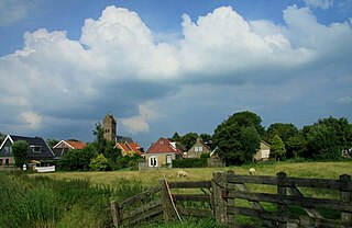
Aldeboarn is a village in Heerenveen in the province of Friesland, the Netherlands. It had a population of around 1545 in January 2017. Aldeboarn has an iconic church tower.
Dearsum is a small village in Súdwest-Fryslân municipality in the province of Friesland, the Netherlands. It has a population of around 130 as of January 2017.

Jirnsum is a village in Leeuwarden municipality in the province of Friesland, the Netherlands. It had a population of around 1,360 in January 2017.

Rinsumageast is a village in the Dantumadiel municipality of Friesland, the Netherlands. It had a population of around 965 in 2017.
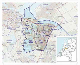
The Gooi is an area around Hilversum, in the centre of the Netherlands. It is a slightly hilly area characterised by its green landscape, its historical charm, the wealth of its inhabitants, and its villas. The Gooi is known in the Netherlands as the home of the rich and famous.

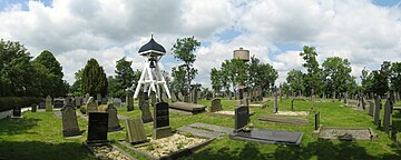
Nes is a narrow, old, street in central Amsterdam, Netherlands. It runs parallel to and to the east of Rokin, between Dam Square to the north and Grimburgwal to the south.