Nieuweschoot Nijskoat | |
|---|---|
Village | |
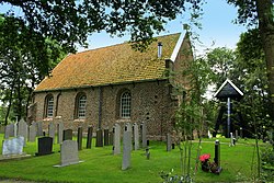 Nieuweschoot church | |
 Flag  Coat of arms | |
 Location in the Heerenveen municipality | |
 Nieuweschoot Location in the Netherlands  Nieuweschoot Nieuweschoot (Netherlands) | |
| Coordinates: 52°56′0″N5°55′30″E / 52.93333°N 5.92500°E | |
| Country | |
| Province | |
| Municipality | |
| Area | |
• Total | 3.47 km2 (1.34 sq mi) |
| Elevation | 0.5 m (1.6 ft) |
| Population (2021) [1] | |
• Total | 185 |
| • Density | 53.3/km2 (138/sq mi) |
| Postal code | 8445 [1] |
| Dialing code | 0513 |
Nieuweschoot (West Frisian : Nijskoat) is a village in Heerenveen in the province of Friesland, the Netherlands. It had a population of around 185 in January 2017. [3]