Katlijk

Last updated
Katlijk
Ketlik
Village
Thomaskerk, Katlijk.jpg
St Thomas' church
Map NL It Hearrenfean Ketlik.png
Location in the Heerenveen municipality
2010-NL-P02-Fryslan-positiekaart-gemnamen.jpg
Red pog.svg
Katlijk
Location in the Netherlands
Netherlands location map.svg
Red pog.svg
Katlijk
Katlijk (Netherlands)
Coordinates: 52°56′48″N6°0′46″E / 52.94667°N 6.01278°E / 52.94667; 6.01278
Country Flag of the Netherlands.svg Netherlands
Province Frisian flag.svg Friesland
Municipality Heerenveen flag.svg Heerenveen
Area
[1]
  Total
11.37 km2 (4.39 sq mi)
Elevation
[2]
2 m (7 ft)
Population
 (2021) [1]
  Total
585
  Density51/km2 (130/sq mi)
Postal code
8455 [1]
Dialing code 0513

Katlijk (West Frisian: Ketlik) is a village in Heerenveen in the province of Friesland, the Netherlands. It had a population of around 610 in 2017. [3]

Contents

History

The village was first mentioned in 1315 as Kathaleke. The etymology is unclear. [4] The village had a chapel as early as 1254. In 1525, a church without tower was built. The double bell tower has been restored in 1930. In 1840, Katlijk was home to 241 people. [5]

Before 1934, Katlijk was part of the Schoterland municipality. [5]

Related Research Articles

<span class="mw-page-title-main">Aldeboarn</span> Village in Friesland, Netherlands

Aldeboarn is a village in Heerenveen in the province of Friesland, the Netherlands. It had a population of around 1545 in January 2017. Aldeboarn has an iconic church tower.

<span class="mw-page-title-main">Friens</span> Village in Friesland, Netherlands

Friens is a village in the municipality Leeuwarden in the province of Friesland, the Netherlands. It had a population of around 80 in January 2017.

<span class="mw-page-title-main">Idaerd</span> Village in Friesland, Netherlands

Idaerd is a village in the municipality of Leeuwarden in the province of Friesland, Netherlands. It had a population of around 80 in January 2017.

<span class="mw-page-title-main">Ruigahuizen</span> Village in Friesland, Netherlands

Ruigahuizen is a small village in De Fryske Marren municipality in the province of Friesland, the Netherlands, south-west of Balk. It had a population of around 120 in 2017.
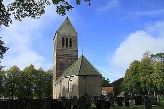
<span class="mw-page-title-main">Wijckel</span> Village in Friesland, Netherlands

Wijckel is a village in De Fryske Marren municipality in the province of Friesland, the Netherlands. It had a population of around 645 in 2017.

<span class="mw-page-title-main">De Knipe</span> Village in Friesland, Netherlands

De Knipe is a village in the municipality Heerenveen in the province of Friesland, the Netherlands. It had a population of around 1,455 in January 2017.

<span class="mw-page-title-main">Oudehorne</span> Village in Friesland, Netherlands

Oudehorne is a village in Heerenveen in the province of Friesland, the Netherlands. It had a population of around 835 in January 2017.
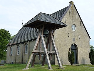
<span class="mw-page-title-main">Hoornsterzwaag</span> Village in Friesland, Netherlands

Hoornsterzwaag is a small village in Heerenveen in the province of Friesland, the Netherlands. It had a population of around 830 in January 2017.

<span class="mw-page-title-main">Mildam</span> Village in Friesland, Netherlands

Mildam is a village in Heerenveen in the province of Friesland, the Netherlands. It had a population of around 685 in January 2017.

<span class="mw-page-title-main">Luinjeberd</span> Village in Friesland, Netherlands

Luinjeberd is a village in the Heerenveen municipality in the province of Friesland, the Netherlands. It had a population of around 430 in January 2017.

<span class="mw-page-title-main">Hijum</span> Village in Friesland, Netherlands

Hijum is a village in Leeuwarden municipality in the province of Friesland, the Netherlands. It had a population of around 385 in January 2017.
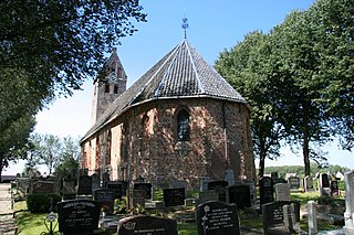
<span class="mw-page-title-main">Jelsum</span> Village in Friesland, Netherlands

Jelsum is a village in Leeuwarden municipality in the province of Friesland, the Netherlands. It had a population of around 195 in January 2017. The stins Dekemastate is located in Jelsum.

<span class="mw-page-title-main">Wirdum, Friesland</span> Village in Friesland, Netherlands

Wirdum is a village in Leeuwarden municipality in the province of Friesland, the Netherlands. It had a population of around 1,060 in January 2017.

<span class="mw-page-title-main">Olterterp</span> Village in Friesland, Netherlands

Olterterp is a village in the municipality of Opsterland in the east of Friesland, the Netherlands. It had a population of around 75 in January 2017.

<span class="mw-page-title-main">Rottum, Friesland</span> Village in Friesland, Netherlands

Rottum is a village in De Fryske Marren in the province of Friesland, the Netherlands. It had a population of around 675 in 2017.

<span class="mw-page-title-main">Snikzwaag</span> Village in Friesland, Netherlands

Snikzwaag is a village in De Fryske Marren in the province of Friesland, the Netherlands. It had a population of around 65 in 2017.

<span class="mw-page-title-main">Teroele</span> Village in Friesland, Netherlands

Teroele is a village in De Fryske Marren in the province of Friesland, the Netherlands. It had a population of around 20 in 2017.

<span class="mw-page-title-main">Schettens</span> Village in Friesland, Netherlands

Schettens is a village in Súdwest-Fryslân in the province of Friesland, the Netherlands. It had a population of around 285 in January 2017.
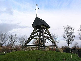
<span class="mw-page-title-main">Idzega</span> Village in Friesland, Netherlands

Idzega is a small village in Súdwest-Fryslân municipality in the province Friesland of the Netherlands. It had a population of around 30 in January 2017.

<span class="mw-page-title-main">Smallebrugge</span> Village in Friesland, Netherlands

Smallebrugge is a village in Súdwest-Fryslân in the province of Friesland, the Netherlands. It had a population of around 20 in January 2017.

References

  1. 1 2 3 "Kerncijfers wijken en buurten 2021". Central Bureau of Statistics. Retrieved 30 March 2022.
  2. "Postcodetool for 8455JA". Actueel Hoogtebestand Nederland (in Dutch). Het Waterschapshuis. Retrieved 30 March 2022.
  3. Kerncijfers wijken en buurten 2017 - CBS Statline
  4. "Katlijk - (geografische naam)". Etymologiebank (in Dutch). Retrieved 30 March 2022.
  5. 1 2 "Katlijk". Plaatsengids (in Dutch). Retrieved 30 March 2022.

Commons-logo.svg Media related to Katlijk at Wikimedia Commons