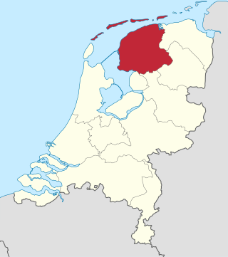
Friesland, historically and traditionally known as Frisia, named after the Frisians, is a province of the Netherlands located in the country's northern part. It is situated west of Groningen, northwest of Drenthe and Overijssel, north of Flevoland, northeast of North Holland, and south of the Wadden Sea. As of January 2023, the province had a population of about 660,000, and a total area of 5,753 km2 (2,221 sq mi).
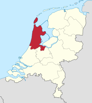
North Holland is a province of the Netherlands in the northwestern part of the country. It is located on the North Sea, north of South Holland and Utrecht, and west of Friesland and Flevoland. As of January 2023, it had a population of about 2,952,000 and a total area of 4,092 km2 (1,580 sq mi), of which 1,429 km2 (552 sq mi) is water.

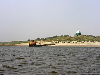
Ameland is a municipality and one of the West Frisian Islands off the north coast of the Netherlands. It consists mostly of sand dunes and is the third major island of the West Frisians. It neighbours islands Terschelling to the west and Schiermonnikoog to the east. This includes the small Engelsmanplaat and Rif sandbanks to the east.

Frisia is a cross-border cultural region in Northwestern Europe. Stretching along the Wadden Sea, it encompasses the north of the Netherlands and parts of northwestern Germany. Wider definitions of "Frisia" may include the island of Rem and the other Danish Wadden Sea Islands. The region is traditionally inhabited by the Frisians, a West Germanic ethnic group.
Eemsmond is a former municipality with a population of 15,864 in the north of the province of Groningen in the northeast of the Netherlands. On 1 January 2019 it merged with the municipalities of Bedum, De Marne and Winsum to form the new municipality Het Hogeland.
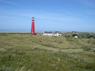
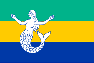
Schiermonnikoog is an island, a municipality and national park in the Northern Netherlands. Schiermonnikoog is one of the West Frisian Islands, and is part of the province of Friesland. It is situated between the islands of Ameland and Rottumerplaat.

Terschelling is a municipality and an island in the northern Netherlands, one of the West Frisian Islands. It is situated between the islands of Vlieland and Ameland.

Vlieland is a municipality and island in the northern Netherlands. The municipality of Vlieland is the second most sparsely populated municipality in the Netherlands, after Schiermonnikoog.

Texel is a municipality and an island with a population of 13,643 in North Holland, Netherlands. It is the largest and most populated island of the West Frisian Islands in the Wadden Sea. The island is situated north of Den Helder, northeast of Noorderhaaks, and southwest of Vlieland.

The Frisian Islands, also known as the Wadden Islands or the Wadden Sea Islands, form an archipelago at the eastern edge of the North Sea in northwestern Europe, stretching from the northwest of the Netherlands through Germany to the west of Denmark. The islands shield the mudflat region of the Wadden Sea from the North Sea.

Rottumeroog is an uninhabited island in the Wadden Sea and is part of the Netherlands. The island is one of three West Frisian Islands in the province of Groningen. It is situated between the islands of Rottumerplaat and Borkum.
Rottumerplaat is one of the three islands that make up Rottum in the West Frisian Islands. The island is located in the North Sea off the Dutch coast. It is situated between the shoal Simonszand and the island Rottumeroog. Rottumerplaat started as a shoal in the 1830. It continued to grow into an island after 1950, when a stuifdijk, a wind-blown dike, was constructed by Rijkswaterstaat, because there were plans to use Rottumerplaat as a work island for the reclamation of the Wadden Sea.

Mudflat hiking is a recreation enjoyed in the Netherlands, northwest Germany, Denmark, England and France. Mudflat hikers are people who, with the aid of a tide table, use a period of low water to walk and wade on the watershed of the mudflats, especially from the Frisian mainland coast to the Frisian islands.

Rottum is a nature reserve in the Wadden Sea in the Netherlands. It consists of the three West Frisian Islands Rottumerplaat, Rottumeroog, and Zuiderduintjes. As a nature reserve, Rottum receives highest protection status under Dutch law; admission to the islands is restricted. The Dutch Ministry of Agriculture, Nature and Food Quality and the government organisations Rijkswaterstaat and Staatsbosbeheer share responsibility for the nature reserve.

Rif is a sandbank in the Dutch Wadden Sea, lying between Ameland and Schiermonnikoog, north of Engelsmanplaat. The sandbank has an area of 0.9 square kilometres (0.35 sq mi) at high tide and is popular as a high-tide resting area for birds as well as for seals. Additionally, the sandbank is a breeding place for birds and seals use it to give birth on.

Bosch was a West Frisian island in the Wadden Sea. It was situated off the coast of present-day Groningen in the Netherlands, between the islands of Schiermonnikoog and Rottumeroog.

Noardeast-Fryslân is a municipality of Friesland in the northern Netherlands. It was established 1 January 2019 and consists of the former municipalities of Dongeradeel, Ferwerderadiel and Kollumerland en Nieuwkruisland, all three of which dissolved on the same day.

