Ballum

Last updated
Ballum
Village
Hervormde kerk Ballum.jpg
Ballum Church
LocatieBallum.png
Location in Ameland municipality
2010-NL-P02-Fryslan-positiekaart-gemnamen.jpg
Red pog.svg
Ballum
Location in the province of Friesland
Netherlands location map.svg
Red pog.svg
Ballum
Ballum (Netherlands)
Coordinates: Coordinates: 53°26′39″N5°41′20″E / 53.44417°N 5.68889°E / 53.44417; 5.68889
Country Flag of the Netherlands.svg Netherlands
Province Frisian flag.svg Friesland
Municipality Flag of Ameland.svg Ameland
Area
[1]
  Total17.19 km2 (6.64 sq mi)
Elevation
[2]
2.3 m (7.5 ft)
Population
 (2021) [1]
  Total480
  Density28/km2 (72/sq mi)
Time zone UTC+1 (CET)
  Summer (DST) UTC+2 (CEST)
Postal code
9162
Dialing code 0519

Ballum is a village on the western half of the island of Ameland and the smallest of the total of four villages on the island, one of the West Frisian Islands and part of the Netherlands.

Contents

History

The village was first mentioned in 1473 as "jn balnera lees: balmera buren", and means "settlement of Balle (person)". [3] Ballum is an esdorp with a triangular village square which developed in the Late Middle Ages. [4]

In the early 15th century, the castle Jelmera State was built in Ballum which later became known as Camminghaslot after the Cammingha family became owners of the island. The castle started to deteriorate and transporting stones to the island was too expensive, therefore, the island was sold to John William Friso, the Prince of Orange. Willem-Alexander of the Netherlands, the current King, still uses the title "Vrijheer of Ameland" as one of his titles. In 1795, the island was confiscated, and the castle became the residence of the grietman of Ameland. In 1829, the castle was condemned and demolished. The municipal hall of Ameland was built in its place. In 1961, a new municipal hall was built. [5] [6]

The bell tower was built in 1755 as a replacement of the wooden tower. It was enlarged in 1870. The Dutch Reformed church is an aisleless church which was built in 1832 to replace the medieval church which was located at a distance. [4]

Ballum was home to 289 people in 1840. [5]

The small Ameland Airport is located northwest of Ballum. [5]

People from Ballum

Related Research Articles

Ameland Municipality in Friesland, Netherlands

Ameland is a municipality and one of the West Frisian Islands off the north coast of the Netherlands. It consists mostly of sand dunes. It is the third major island of the West Frisians. It neighbours islands Terschelling to the west and Schiermonnikoog to the east. This includes the small Engelsmanplaat and Rif sandbanks to the east.

Elsloo, Limburg Village in Limburg, Netherlands

Elsloo is a village in the Dutch province of Limburg. It is located in the municipality of Stein, about 2 km south of the town of Stein itself. Beek-Elsloo railway station serves Elsloo.

Lobith Village in Gelderland, Netherlands

Lobith is a village in the Dutch province of Gelderland. It is located in the municipality of Zevenaar. Traditionally, it is said that the Rhine enters the Netherlands at Lobith, although in reality, this happens about 4 km further upstream, near Spijk.

Aarle-Rixtel Village and former municipality in North Brabant, Netherlands

Aarle-Rixtel is a village in the Dutch municipality of Laarbeek in North Brabant. It lies about 4 km north of Helmond. Since the municipal reorganization of 1968 the castle Croy is part of Aarle-Rixtel.

s-Heer Arendskerke Village in Zeeland, Netherlands

's-Heer Arendskerke is a village in the municipality of Goes in the south-western Netherlands.

Broekhuizen, Limburg Village in Limburg, Netherlands

Broekhuizen is a village in the Dutch province of Limburg. It is a part of the municipality of Horst aan de Maas, and lies about 14 km north of Venlo

Horn, Netherlands Village in Limburg, Netherlands

Horn is a village in the Dutch province of Limburg. It is a part of the municipality of Leudal, and lies about 5 km northwest of Roermond.

Oosterland, Zeeland Village in Zeeland, Netherlands

Oosterland is a village in the south-west Netherlands. It is located in the municipality of Schouwen-Duiveland, Zeeland, about 22 km south of Hellevoetsluis.

Haamstede Village in Zeeland, Netherlands

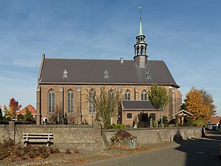
Haamstede is a village in the Dutch province of Zeeland. It is a part of the municipality of Schouwen-Duiveland. The village is known for Haamstede Castle.

Gieten Village in Drenthe, Netherlands

Gieten is a village in the Dutch province of Drenthe. It is a part of the municipality of Aa en Hunze, and lies about 14 km east of Assen.

s-Heerenhoek Village in Zeeland, Netherlands

's-Heerenhoek is a village in the Dutch province of Zeeland. It is a part of the municipality of Borsele, and lies about 12 km east of Middelburg.

Meeden Village in Groningen, Netherlands

Meeden is a village in the municipality of Midden-Groningen in the province of Groningen, Netherlands.

Helvoirt Village in North Brabant, Netherlands

Helvoirt is a village and part of the municipality of Vught, Netherlands.

Kloetinge Village in Zeeland, Netherlands

Kloetinge is a village in the Dutch province of Zeeland. It is located in the municipality of Goes, on the eastern side of the city.

Grubbenvorst Village in Limburg, Netherlands

Grubbenvorst is a village in the Dutch province of Limburg. It is located in the municipality of Horst aan de Maas, about 6 km northwest of Venlo.

Neeritter Village in Limburg, Netherlands

Neeritter is a village in the Dutch province of Limburg. It is located in the municipality of Leudal.

Posterholt Village in Limburg, Netherlands

Posterholt is a village in the Dutch province of Limburg. It is located in the municipality of Roerdalen.

Schaesberg Neighbourhood and former village in Landgraaf, Limburg, Netherlands

Schaesberg is a neighbourhoofd of Landgraaf and former village in the Dutch province of Limburg.

Ulestraten Village in Limburg, Netherlands

Ulestraten is a village in the Dutch province of Limburg. It is located in the municipality of Meerssen. It is surrounded by several forests.

Holwerd Village in Friesland, Netherlands

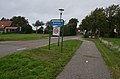
Holwerd is a village in Noardeast-Fryslân municipality in the northern Netherlands, in the province of Friesland. It had a population of around 1,607 in January 2017. Before 2019, the village was part of the Dongeradeel municipality.

References

  1. 1 2 "Kerncijfers wijken en buurten 2021". Central Bureau of Statistics. Retrieved 26 April 2022. two entries
  2. "Postcodetool for 9162AA". Actueel Hoogtebestand Nederland (in Dutch). Het Waterschapshuis. Retrieved 26 April 2022.
  3. "Ballum". Etymologiebank (in Dutch). Retrieved 26 April 2022.
  4. 1 2 Ronald Stenvert & Sabine Broekhoven (2000). "Ballum" (in Dutch). Zwolle: Waanders. ISBN   90 400 9476 4 . Retrieved 26 April 2022.
  5. 1 2 3 "Ballum". Plaatsengids (in Dutch). Retrieved 26 April 2022.
  6. Abraham Jacob van der Aa , "Aardrijkskundig woordenboek der Nederlanden", vol. 2 (B), 1840, p. 66. "Ballum" .
  7. "De voorouders van de oudste man van Nederland: Eelke Bakker (1910)". Amelanders Historie (in Dutch). Retrieved 26 April 2022.

Commons-logo.svg Media related to Ballum, Ameland at Wikimedia Commons